TopoQuest Logo
Do you find TopoQuest useful?
Help keep TopoQuest running and adding new maps/features by donating!
Bitcoin:  19c7KJd3qBynnjoSw5npx9KScwjBe4ifkT
Litecoin:  LXs6TkuXGGXo1vDsWCkWVdjQX94eUKd6ui
Home View Maps Find Maps Find Places Resources & Links


Spruce, Missouri Topographic Map

USGS Map Title: Spruce, MO
USGS Map MRC: 38094C2
DRG (GeoTIFF) Download: o38094c2.tif


Neighboring USGS Topographic Map Quads:


  Adrian, MO  
38094D3
 

  Dayton, MO  
38094D2
 

  Creighton, MO  
38094D1
 

  Butler, MO  
38094C3
 

  Spruce, MO  
38094C2
 

  Johnstown, MO  
38094C1
 

  Butler South, MO  
38094B3
 

  Pleasant Gap, MO  
38094B2
 

  Appleton City, MO  
38094B1


Map MRC Location:

N39°
W95°
N39°
W94°
H8 H7 H6 H5 H4 H3 H2 H1
G8 G7 G6 G5 G4 G3 G2 G1
F8 F7 F6 F5 F4 F3 F2 F1
E8 E7 E6 E5 E4 E3 E2 E1
D8 D7 D6 D5 D4 D3 D2 D1
C8 C7 C6 C5 C4 C3 C2 C1
B8 B7 B6 B5 B4 B3 B2 B1
A8 A7 A6 A5 A4 A3 A2 A1
N38°
W95°
N38°
W94°

Spruce, MO USGS 1:24K Topographic Map Preview:
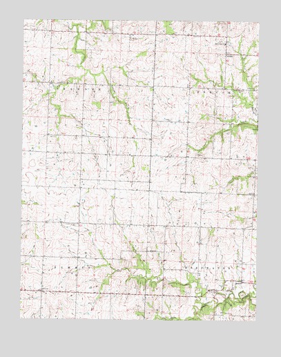
Spruce, MO USGS Topographic Map
Click on map above to begin viewing in our Map Viewer.

This topographic map contains these locations and features:
Feature Name Type Latitude Longitude GNIS ID View Map
Antioch CemeteryCemeteryN38.3100°W94.1260°713312View Map
BallardPopulated PlaceN38.3614°W94.1433°713605View Map
Ballard Elementary SchoolSchoolN38.3655°W94.1435°2743790View Map
Ballard High SchoolSchoolN38.3655°W94.1429°713606View Map
Bethel ChurchChurchN38.3334°W94.1730°714055View Map
Cherry Grove School (historical)SchoolN38.2961°W94.1377°746027View Map
Culver (historical)LocaleN38.3261°W94.2047°745640View Map
Elizabeth Chapel CemeteryCemeteryN38.2897°W94.2208°717447View Map
Fairview ChurchChurchN38.3686°W94.1611°717785View Map
Fishing BranchStreamN38.3539°W94.2161°717955View Map
Griggs School (historical)SchoolN38.3697°W94.2033°746023View Map
Harmony School (historical)SchoolN38.3259°W94.2097°746025View Map
Olive School (historical)SchoolN38.3703°W94.2372°746024View Map
Radford CemeteryCemeteryN38.2625°W94.1491°725054View Map
Redmond School (historical)SchoolN38.2839°W94.2102°746026View Map
SprucePopulated PlaceN38.2664°W94.1333°726968View Map
Straight BranchStreamN38.2503°W94.1663°739487View Map
Summit School (historical)SchoolN38.2620°W94.2386°727295View Map
Township of DeepwaterCivilN38.2593°W94.1286°766290View Map
Township of ShawneeCivilN38.3487°W94.2357°766307View Map
Township of SpruceCivilN38.3462°W94.1253°766308View Map
Township of SummitCivilN38.2617°W94.2387°766309View Map
Valley School (historical)SchoolN38.2800°W94.1747°746028View Map
Walnut Grove CemeteryCemeteryN38.3461°W94.1338°728303View Map
Walnut Grove ChurchChurchN38.3459°W94.1277°728308View Map
White CemeteryCemeteryN38.2789°W94.1830°728721View Map

Note: Coordinates in the location and feature list above are referenced to NAD83 datum.


Copyright (C) 2008-2025 Ryan Niemi / Sunset Dynamics ... All Rights Reserved