TopoQuest Logo
Do you find TopoQuest useful?
Help keep TopoQuest running and adding new maps/features by donating!
Bitcoin:  19c7KJd3qBynnjoSw5npx9KScwjBe4ifkT
Litecoin:  LXs6TkuXGGXo1vDsWCkWVdjQX94eUKd6ui
Home View Maps Find Maps Find Places Resources & Links


Pleasant Gap, Missouri Topographic Map

USGS Map Title: Pleasant Gap, MO
USGS Map MRC: 38094B2
DRG (GeoTIFF) Download: o38094b2.tif


Neighboring USGS Topographic Map Quads:


  Butler, MO  
38094C3
 

  Spruce, MO  
38094C2
 

  Johnstown, MO  
38094C1
 

  Butler South, MO  
38094B3
 

  Pleasant Gap, MO  
38094B2
 

  Appleton City, MO  
38094B1
 

  Rich Hill, MO  
38094A3
 

  Papinville, MO  
38094A2
 

  Rockville, MO  
38094A1


Map MRC Location:

N39°
W95°
N39°
W94°
H8 H7 H6 H5 H4 H3 H2 H1
G8 G7 G6 G5 G4 G3 G2 G1
F8 F7 F6 F5 F4 F3 F2 F1
E8 E7 E6 E5 E4 E3 E2 E1
D8 D7 D6 D5 D4 D3 D2 D1
C8 C7 C6 C5 C4 C3 C2 C1
B8 B7 B6 B5 B4 B3 B2 B1
A8 A7 A6 A5 A4 A3 A2 A1
N38°
W95°
N38°
W94°

Pleasant Gap, MO USGS 1:24K Topographic Map Preview:
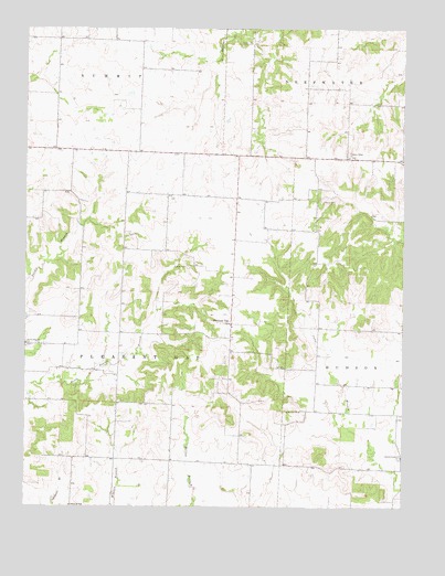
Pleasant Gap, MO USGS Topographic Map
Click on map above to begin viewing in our Map Viewer.

This topographic map contains these locations and features:
Feature Name Type Latitude Longitude GNIS ID View Map
Bauer PGI Airport (historical)AirportN38.1367°W94.1738°758888View Map
Bever School (historical)SchoolN38.1295°W94.1747°746042View Map
Church of GodChurchN38.1250°W94.2352°729860View Map
Cumpton School (historical)SchoolN38.2381°W94.1569°746038View Map
Fry School (historical)SchoolN38.2392°W94.2124°746034View Map
Marshall School (historical)SchoolN38.1997°W94.2336°746035View Map
Myers CemeteryCemeteryN38.2050°W94.1522°723098View Map
Orchard Grove School (historical)SchoolN38.1997°W94.2038°746039View Map
Pentecostal ChurchChurchN38.1500°W94.1594°724213View Map
Pleasant GapPopulated PlaceN38.1728°W94.1822°724473View Map
Pleasant Gap School (historical)SchoolN38.1705°W94.1961°746036View Map
Pleasant Ridge ChurchChurchN38.2164°W94.1433°724587View Map
Pleasant Ridge School (historical)SchoolN38.1970°W94.1544°746040View Map
Reynard (historical)Populated PlaceN38.1636°W94.1363°755622View Map
Reynard School (historical)SchoolN38.1575°W94.1355°746041View Map
Rogers CemeteryCemeteryN38.1878°W94.1966°725534View Map
Round Prairie ChurchChurchN38.1381°W94.1255°725616View Map
Scifers School (historical)SchoolN38.1375°W94.2066°746037View Map
Smith CemeteryCemeteryN38.2459°W94.1788°726594View Map
Township of Pleasant GapCivilN38.1630°W94.2192°766304View Map

Note: Coordinates in the location and feature list above are referenced to NAD83 datum.


Copyright (C) 2008-2025 Ryan Niemi / Sunset Dynamics ... All Rights Reserved