TopoQuest Logo
Do you find TopoQuest useful?
Help keep TopoQuest running and adding new maps/features by donating!
Bitcoin:  19c7KJd3qBynnjoSw5npx9KScwjBe4ifkT
Litecoin:  LXs6TkuXGGXo1vDsWCkWVdjQX94eUKd6ui
Home View Maps Find Maps Find Places Resources & Links


The Geysers, California Topographic Map

USGS Map Title: The Geysers, CA
USGS Map MRC: 38122G7
DRG (GeoTIFF) Download: o38122g7.tif


Neighboring USGS Topographic Map Quads:


  Highland Springs, CA  
38122H8
 

  Kelseyville, CA  
38122H7
 

  Clearlake Highlands, CA  
38122H6
 

  Asti, CA  
38122G8
 

  The Geysers, CA  
38122G7
 

  Whispering Pines, CA  
38122G6
 

  Geyserville, CA  
38122F8
 

  Jimtown, CA  
38122F7
 

  Mount Saint Helena, CA  
38122F6


Map MRC Location:

N39°
W123°
N39°
W122°
H8 H7 H6 H5 H4 H3 H2 H1
G8 G7 G6 G5 G4 G3 G2 G1
F8 F7 F6 F5 F4 F3 F2 F1
E8 E7 E6 E5 E4 E3 E2 E1
D8 D7 D6 D5 D4 D3 D2 D1
C8 C7 C6 C5 C4 C3 C2 C1
B8 B7 B6 B5 B4 B3 B2 B1
A8 A7 A6 A5 A4 A3 A2 A1
N38°
W123°
N38°
W122°

The Geysers, CA USGS 1:24K Topographic Map Preview:
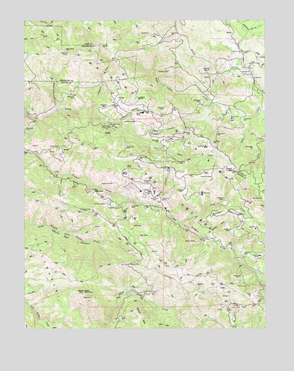
The Geysers, CA USGS Topographic Map
Click on map above to begin viewing in our Map Viewer.

This topographic map contains these locations and features:
Feature Name Type Latitude Longitude GNIS ID View Map
Adit Number OneMineN38.8049°W122.8414°253649View Map
Adit Number One-One Hundred TwentyMineN38.8063°W122.8428°217983View Map
Adit Number ThreeMineN38.7810°W122.8219°253651View Map
Adit Number TwoMineN38.8030°W122.8319°253650View Map
Alder CreekStreamN38.8518°W122.7572°218088View Map
Alder CreekStreamN38.8343°W122.8681°218097View Map
Bear CanyonValleyN38.8282°W122.8150°218788View Map
Binkley RanchLocaleN38.8541°W122.7822°219303View Map
Black OaksPopulated PlaceN38.8307°W122.8325°1658070View Map
Buckeye MineMineN38.8232°W122.8581°220037View Map
Buckman Mines HeadquartersLocaleN38.7999°W122.8314°254670View Map
Buckman Mines Housing Unit Number TwoLocaleN38.7877°W122.8255°254671View Map
Burned MountainSummitN38.7966°W122.7730°1658176View Map
Cadd Fire TrailTrailN38.7716°W122.7922°220360View Map
Caldwell PinesPopulated PlaceN38.8455°W122.8080°1658193View Map
Caldwell RanchLocaleN38.8427°W122.8261°220388View Map
Cloverdale Mine HeadquartersMineN38.8224°W122.8719°221257View Map
Cobb CreekStreamN38.7927°W122.7942°221279View Map
Cobb DivisionCivilN38.8717°W122.7708°2583193View Map
Cold SpringsSpringN38.7531°W122.8241°221343View Map
Coldwater CanyonValleyN38.8310°W122.8258°221350View Map
Contact MineMineN38.7588°W122.7647°221472View Map
Crystal MineMineN38.7571°W122.7758°221887View Map
Culver-Bear MineMineN38.7807°W122.8183°221906View Map
Dianna RockPillarN38.7846°W122.7905°222358View Map
Eagle RockPillarN38.8057°W122.8397°1657228View Map
Eureka MineMineN38.7671°W122.7653°223276View Map
Farleys RanchLocaleN38.8568°W122.7653°1724026View Map
Geyser CanyonValleyN38.7999°W122.8069°224139View Map
Geyser PeakSummitN38.7646°W122.8450°224140View Map
Geyser RockPillarN38.8138°W122.7669°224141View Map
Geysers ResortLocaleN38.7988°W122.8078°224142View Map
GlenbrookPopulated PlaceN38.8516°W122.7586°1658617View Map
Glenbrook ResortLocaleN38.8510°W122.7572°1724028View Map
Harness CampLocaleN38.7971°W122.8428°224948View Map
High Valley CreekStreamN38.8688°W122.7933°225284View Map
Hot Springs CreekStreamN38.7880°W122.7822°225675View Map
Hummingbird CreekStreamN38.8388°W122.8583°225758View Map
KHTT-FM (Healdsburg)TowerN38.7624°W122.8411°1665041View Map
KLVR-FM (Santa Rosa)TowerN38.7624°W122.8411°1665121View Map
Lee CreekStreamN38.8307°W122.7592°226991View Map
Mahnke PeakSummitN38.8627°W122.8555°1657229View Map
MercuryvillePopulated PlaceN38.7760°W122.8219°252738View Map
Rabbit ValleyValleyN38.8727°W122.7967°231155View Map
Rattlesnake Fire TrailTrailN38.7685°W122.7922°231262View Map
Smudgeo Number 1 HeliportAirportN38.7849°W122.7533°1653218View Map
Socrates MineMineN38.7630°W122.7592°234816View Map
Sulphur CreekStreamN38.8560°W122.7625°235710View Map
The GeysersSpringN38.7749°W122.7553°252363View Map
Truitt CreekStreamN38.8124°W122.8558°236580View Map
Truitt RanchLocaleN38.8077°W122.8581°1724058View Map
Wildhorse CreekStreamN38.8391°W122.8419°237815View Map

Note: Coordinates in the location and feature list above are referenced to NAD83 datum.


Copyright (C) 2008-2024 Ryan Niemi / Sunset Dynamics ... All Rights Reserved