TopoQuest Logo
Do you find TopoQuest useful?
Help keep TopoQuest running and adding new maps/features by donating!
Bitcoin:  19c7KJd3qBynnjoSw5npx9KScwjBe4ifkT
Litecoin:  LXs6TkuXGGXo1vDsWCkWVdjQX94eUKd6ui
Home View Maps Find Maps Find Places Resources & Links


Geyserville, California Topographic Map

USGS Map Title: Geyserville, CA
USGS Map MRC: 38122F8
DRG (GeoTIFF) Download: o38122f8.tif


Neighboring USGS Topographic Map Quads:


  Cloverdale, CA  
38123G1
 

  Asti, CA  
38122G8
 

  The Geysers, CA  
38122G7
 

  Warm Springs Dam, CA  
38123F1
 

  Geyserville, CA  
38122F8
 

  Jimtown, CA  
38122F7
 

  Cazadero, CA  
38123E1
 

  Guerneville, CA  
38122E8
 

  Healdsburg, CA  
38122E7


Map MRC Location:

N39°
W123°
N39°
W122°
H8 H7 H6 H5 H4 H3 H2 H1
G8 G7 G6 G5 G4 G3 G2 G1
F8 F7 F6 F5 F4 F3 F2 F1
E8 E7 E6 E5 E4 E3 E2 E1
D8 D7 D6 D5 D4 D3 D2 D1
C8 C7 C6 C5 C4 C3 C2 C1
B8 B7 B6 B5 B4 B3 B2 B1
A8 A7 A6 A5 A4 A3 A2 A1
N38°
W123°
N38°
W122°

Geyserville, CA USGS 1:24K Topographic Map Preview:
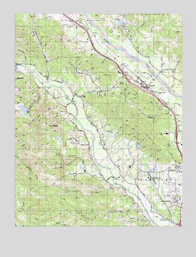
Geyserville, CA USGS Topographic Map
Click on map above to begin viewing in our Map Viewer.

This topographic map contains these locations and features:
Feature Name Type Latitude Longitude GNIS ID View Map
Asti 1428 DamDamN38.7482°W122.9728°1664322View Map
Big RidgeRidgeN38.6282°W122.9453°266451View Map
Bradford MountainSummitN38.6841°W122.9733°219761View Map
Buena Vista High SchoolSchoolN38.7209°W122.8907°2517955View Map
Chapman BranchStreamN38.6630°W122.9975°220914View Map
Chateau Diana WineryLocaleN38.6891°W122.9453°1799134View Map
Chateau Souverain WineryLocaleN38.6796°W122.8881°1799135View Map
ChiantiPopulated PlaceN38.7371°W122.9422°1658267View Map
Cloverdale-Geyserville DivisionCivilN38.7447°W122.8948°1935055View Map
Cook Number 2 3420 DamDamN38.6532°W122.9011°1664380View Map
Cozzens CornerPopulated PlaceN38.7010°W122.9519°1657223View Map
Crane CreekStreamN38.6494°W122.9256°221794View Map
Dorman CanyonValleyN38.6438°W122.9503°222525View Map
Dry Creek VineyardsLocaleN38.6527°W122.9250°1799138View Map
Dutcher CreekStreamN38.7074°W122.9742°222780View Map
Fall CreekStreamN38.7074°W122.9800°223368View Map
Geyser Peak WineryLocaleN38.7155°W122.9233°1799145View Map
GeyservillePopulated PlaceN38.7077°W122.9025°224138View Map
Geyserville Census Designated PlaceCensusN38.7173°W122.9034°2583024View Map
Geyserville Christian ChurchChurchN38.7099°W122.9256°1799147View Map
Geyserville Community Childrens CenterBuildingN38.7082°W122.9236°1799149View Map
Geyserville Elementary SchoolSchoolN38.7103°W122.9121°1799148View Map
Geyserville Fire Protection District Station 1 HeadquartersBuildingN38.7056°W122.9034°2624176View Map
Geyserville Fire Protection District Station 3BuildingN38.6577°W122.9229°2624179View Map
Geyserville High SchoolSchoolN38.7202°W122.8906°1799151View Map
Geyserville New Tech Academy High SchoolSchoolN38.7202°W122.8908°1799150View Map
Geyserville New Tech Academy Middle SchoolSchoolN38.7209°W122.8902°1799152View Map
Geyserville Post OfficePost OfficeN38.7081°W122.9075°1799153View Map
Gill CreekStreamN38.7285°W122.9186°224167View Map
Grape CreekStreamN38.6596°W122.9353°224441View Map
Grass ValleyBasinN38.6936°W122.9950°224464View Map
Healdsburg Municipal AirportAirportN38.6562°W122.9006°1657242View Map
Kelley CreekStreamN38.6316°W122.9019°226456View Map
Lambert Bridge WineryLocaleN38.6513°W122.9308°1799159View Map
Lambert Post Office (historical)Post OfficeN38.6491°W122.9106°1799160View Map
Long Ranch Family CemeteryCemeteryN38.6726°W122.8816°1989445View Map
Lytton Industrial Home (historical)BuildingN38.6594°W122.8814°227876View Map
Lytton LakeLakeN38.6507°W122.8753°1657220View Map
Lytton Springs WineryLocaleN38.6594°W122.8856°1799162View Map
Manzanita SchoolSchoolN38.6294°W122.8864°228050View Map
Mazzocco VineyardsLocaleN38.6546°W122.8961°1799163View Map
Merlo LakeLakeN38.6935°W122.9946°1657222View Map
Miller CreekStreamN38.7027°W122.8811°228731View Map
NervoPopulated PlaceN38.6877°W122.8803°1659210View Map
Nervo WineryLocaleN38.7044°W122.8989°1799166View Map
Norton Number 2 2423-002 DamDamN38.6482°W122.8978°1664366View Map
Olive Hill CemeteryCemeteryN38.7082°W122.9242°230005View Map
OmusPopulated PlaceN38.7196°W122.9197°1659306View Map
Pastori WineryLocaleN38.7260°W122.9350°1799167View Map
Pedroncelli WineryLocaleN38.7046°W122.9369°1799168View Map
Peņa CreekStreamN38.7010°W122.9622°230478View Map
Peterson CreekStreamN38.6994°W122.8772°230569View Map
Robert Stemmler WineryLocaleN38.6538°W122.9261°1799172View Map
Salvation Army Adult Rehabilitation CenterLocaleN38.6596°W122.8808°1799173View Map
Schoolhouse CreekStreamN38.7188°W122.9933°232676View Map
Sonoma County Sheriff's Office - Lake Sonoma Boating Safety UnitBuildingN38.7161°W122.9974°2755793View Map
Trentadue WineryLocaleN38.6960°W122.8872°1799186View Map
TzabacoCivilN38.7005°W122.9308°236750View Map
Vineyard LakeLakeN38.7448°W122.9218°1657224View Map
Vineyard Subdivision 3422 DamDamN38.7432°W122.9244°1664382View Map
Wine CreekStreamN38.6555°W122.9467°238037View Map
Wood CreekStreamN38.7088°W122.8942°238109View Map

Note: Coordinates in the location and feature list above are referenced to NAD83 datum.


Copyright (C) 2008-2025 Ryan Niemi / Sunset Dynamics ... All Rights Reserved