TopoQuest Logo
Do you find TopoQuest useful?
Help keep TopoQuest running and adding new maps/features by donating!
Bitcoin:  19c7KJd3qBynnjoSw5npx9KScwjBe4ifkT
Litecoin:  LXs6TkuXGGXo1vDsWCkWVdjQX94eUKd6ui
Home View Maps Find Maps Find Places Resources & Links


Carpenterville, Oregon Topographic Map

USGS Map Title: Carpenterville, OR
USGS Map MRC: 42124B3
DRG (GeoTIFF) Download: o42124b3.tif


Neighboring USGS Topographic Map Quads:


  Cape Sebastian, OR  
42124C4
 

  Sundown Mountain, OR  
42124C3
 

  Collier Butte, OR  
42124C2
 

  Mack Point, OR  
42124B4
 

  Carpenterville, OR  
42124B3
 

  Bosley Butte, OR  
42124B2


  Brookings, OR  
42124A3
 

  Mount Emily, OR  
42124A2


Map MRC Location:

N43°
W125°
N43°
W124°
H8 H7 H6 H5 H4 H3 H2 H1
G8 G7 G6 G5 G4 G3 G2 G1
F8 F7 F6 F5 F4 F3 F2 F1
E8 E7 E6 E5 E4 E3 E2 E1
D8 D7 D6 D5 D4 D3 D2 D1
C8 C7 C6 C5 C4 C3 C2 C1
B8 B7 B6 B5 B4 B3 B2 B1
A8 A7 A6 A5 A4 A3 A2 A1
N42°
W125°
N42°
W124°

Carpenterville, OR USGS 1:24K Topographic Map Preview:
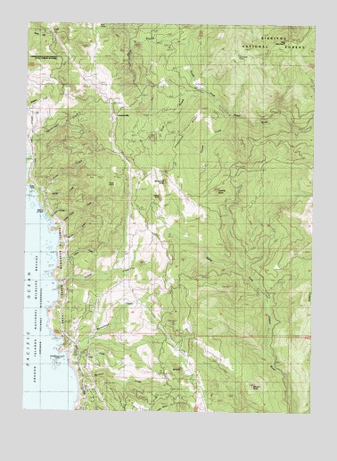
Carpenterville, OR USGS Topographic Map
Click on map above to begin viewing in our Map Viewer.

This topographic map contains these locations and features:
Feature Name Type Latitude Longitude GNIS ID View Map
Alder SpringSpringN42.1512°W124.3026°1154460View Map
Big Alder SpringSpringN42.1554°W124.3040°1154461View Map
Bowman CreekStreamN42.1371°W124.3543°1138519View Map
Bruces Bones CreekStreamN42.1604°W124.3615°1851914View Map
Bull GulchValleyN42.2437°W124.3101°1138906View Map
Burnt Hill SummitGapN42.2123°W124.3373°1638136View Map
Bush MoundSummitN42.1540°W124.3112°1638135View Map
Cape Ferrelo Rural Fire Protection DistrictBuildingN42.1258°W124.3229°2576887View Map
CarpentervillePopulated PlaceN42.2201°W124.3395°1139388View Map
Carpenterville Brookings Wayside (historical)ParkN42.2401°W124.3609°1154467View Map
Carpenterville Post Office (historical)Post OfficeN42.2201°W124.3395°1165014View Map
Cassiday ButteSummitN42.1961°W124.2929°1139435View Map
China CreekStreamN42.1743°W124.3629°1139662View Map
Colegrove ButteSummitN42.1991°W124.3158°1139981View Map
Coon CreekStreamN42.1409°W124.3562°1140066View Map
Deer PointCapeN42.1979°W124.3744°1140859View Map
Farmer CreekStreamN42.2204°W124.2882°1142022View Map
Fitzpatrick RidgeRidgeN42.2143°W124.3112°1142187View Map
GreenhillSummitN42.1415°W124.3429°1154459View Map
Hog MountainSummitN42.2446°W124.2640°1143644View Map
Horse Prairie CreekStreamN42.1854°W124.3648°1143783View Map
Indian RockSummitN42.1945°W124.3179°1133960View Map
Irma Post Office (historical)Post OfficeN42.2248°W124.3582°1165440View Map
Joe Hostler CampLocaleN42.2404°W124.2845°1133959View Map
Miner CreekStreamN42.1949°W124.3717°1133961View Map
Miner GulchValleyN42.1940°W124.3715°1146311View Map
Morton ButteSummitN42.1333°W124.2767°1146480View Map
Mount ItalySummitN42.1384°W124.3076°1144144View Map
Natural BridgesArchN42.1887°W124.3684°1159204View Map
Patrick CreekStreamN42.1887°W124.3665°1154449View Map
Ridge KnobSummitN42.2313°W124.3706°1154468View Map
Rocky PrairieFlatN42.1993°W124.3382°1148674View Map
Scott CreekStreamN42.2284°W124.3004°1149167View Map
Seal CoveBayN42.1915°W124.3679°1154450View Map
Seal PointCapeN42.1887°W124.3693°1154452View Map
Smith HillSummitN42.1536°W124.3540°1135915View Map
South Fork Pistol RiverStreamN42.2498°W124.3015°1150000View Map
South Fork Whalehead CreekStreamN42.1484°W124.3457°1154462View Map
Spruce CreekStreamN42.1793°W124.3629°1150204View Map
Thomas CreekStreamN42.1659°W124.3632°1151074View Map
Thomas Creek BridgeBridgeN42.1659°W124.3590°1955563View Map
Thomas Creek Rest AreaLocaleN42.1630°W124.3582°1154471View Map
Thomas HillSummitN42.1741°W124.3470°1154463View Map
Thomas PointCliffN42.1693°W124.3637°1154472View Map
WhaleheadCapeN42.1443°W124.3595°1158982View Map
Whalehead CreekStreamN42.1434°W124.3568°1158550View Map
Whalehead IslandIslandN42.1387°W124.3643°1158551View Map
Wridge CreekStreamN42.1943°W124.3709°1154464View Map

Note: Coordinates in the location and feature list above are referenced to NAD83 datum.


Copyright (C) 2008-2024 Ryan Niemi / Sunset Dynamics ... All Rights Reserved