TopoQuest Logo
Do you find TopoQuest useful?
Help keep TopoQuest running and adding new maps/features by donating!
Bitcoin:  19c7KJd3qBynnjoSw5npx9KScwjBe4ifkT
Litecoin:  LXs6TkuXGGXo1vDsWCkWVdjQX94eUKd6ui
Home View Maps Find Maps Find Places Resources & Links


Virden North, Illinois Topographic Map

USGS Map Title: Virden North, IL
USGS Map MRC: 39089E7
DRG (GeoTIFF) Download: o39089e7.tif


Neighboring USGS Topographic Map Quads:


  New Berlin, IL  
39089F8
 

  Loami, IL  
39089F7
 

  Chatham, IL  
39089F6
 

  Waverly, IL  
39089E8
 

  Virden North, IL  
39089E7
 

  Divernon, IL  
39089E6
 

  Palmyra, IL  
39089D8
 

  Virden South, IL  
39089D7
 

  Farmersville, IL  
39089D6


Map MRC Location:

N40°
W90°
N40°
W89°
H8 H7 H6 H5 H4 H3 H2 H1
G8 G7 G6 G5 G4 G3 G2 G1
F8 F7 F6 F5 F4 F3 F2 F1
E8 E7 E6 E5 E4 E3 E2 E1
D8 D7 D6 D5 D4 D3 D2 D1
C8 C7 C6 C5 C4 C3 C2 C1
B8 B7 B6 B5 B4 B3 B2 B1
A8 A7 A6 A5 A4 A3 A2 A1
N39°
W90°
N39°
W89°

Virden North, IL USGS 1:24K Topographic Map Preview:
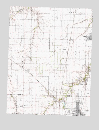
Virden North, IL USGS Topographic Map
Click on map above to begin viewing in our Map Viewer.

This topographic map contains these locations and features:
Feature Name Type Latitude Longitude GNIS ID View Map
Auburn Fire Protection District - Auburn Emergency SquadBuildingN39.5919°W89.7578°2640774View Map
Bumgarner School (historical)SchoolN39.5887°W89.8137°405187View Map
Central School (historical)SchoolN39.5020°W89.7690°1962256View Map
Christian Church of AuburnChurchN39.5906°W89.7582°1962307View Map
Church of the BrethrenChurchN39.5006°W89.7723°1962257View Map
Church of the NazareneChurchN39.5031°W89.7679°1962258View Map
City of VirdenCivilN39.5059°W89.7711°2397150View Map
ComproPopulated PlaceN39.5898°W89.7826°422573View Map
Coultas School (historical)SchoolN39.5120°W89.8045°406645View Map
Countyline School (historical)SchoolN39.5231°W89.8393°406669View Map
First Baptist ChurchChurchN39.5020°W89.7687°1962260View Map
First Christian ChurchChurchN39.5009°W89.7698°1962262View Map
First Presbyterian ChurchChurchN39.5006°W89.7698°1962264View Map
Fletcher School (historical)SchoolN39.5595°W89.7732°408458View Map
Full Gospel TabernacleChurchN39.5009°W89.7632°1962265View Map
Grand Prairie of the West Public LibraryBuildingN39.5017°W89.7693°1962266View Map
Holzwarth Flying ServiceAirportN39.5158°W89.8704°427891View Map
Johns Creek School (historical)SchoolN39.5951°W89.8418°411142View Map
Kingdom Hall of Jehovahs WitnessesChurchN39.5953°W89.7543°1962312View Map
Larabee School (historical)SchoolN39.5476°W89.8132°411828View Map
Lemmon (historical)Populated PlaceN39.5314°W89.7943°422907View Map
Little Panther CreekStreamN39.6145°W89.7515°412386View Map
LowderPopulated PlaceN39.5509°W89.8459°412703View Map
McDonald Landing Strip (historical)AirportN39.5264°W89.7557°1736877View Map
McNaught Landing Strip (historical)AirportN39.5764°W89.7937°1736879View Map
Prosperity School (historical)SchoolN39.6242°W89.8712°416245View Map
Pullhall School (historical)SchoolN39.5884°W89.7873°416284View Map
Sacred Heart ChurchChurchN39.5081°W89.7668°1962267View Map
Saint Catherines Roman Catholic Church (historical)ChurchN39.5006°W89.7618°1962268View Map
ThayerPopulated PlaceN39.5381°W89.7632°419624View Map
Thayer Police DepartmentBuildingN39.5375°W89.7604°2758937View Map
Thayer Post OfficePost OfficeN39.5374°W89.7607°2788253View Map
Tower HeightsPopulated PlaceN39.5248°W89.7693°1821116View Map
Township of AuburnCivilN39.5668°W89.7581°428619View Map
Township of TalkingtonCivilN39.5673°W89.8719°429822View Map
Township of VirdenCivilN39.5012°W89.7572°429875View Map
Trinity Lutheran ChurchChurchN39.5887°W89.7554°1962315View Map
Victory School (historical)SchoolN39.5662°W89.8412°420301View Map
Village of ThayerCivilN39.5404°W89.7579°2399964View Map
VirdenPopulated PlaceN39.5009°W89.7679°420328View Map
Virden City CemeteryCemeteryN39.5164°W89.7904°1764717View Map
Virden City HallBuildingN39.5009°W89.7668°1962270View Map
Virden Fire Protection DistrictBuildingN39.5034°W89.7678°2640496View Map
Virden Fire Protection District Thayer StationBuildingN39.5379°W89.7607°2640749View Map
Virden High SchoolSchoolN39.5073°W89.7701°1764718View Map
Virden Police DepartmentBuildingN39.5009°W89.7667°2758864View Map
Virden Post OfficePost OfficeN39.5022°W89.7679°1764719View Map
Virden Recreation Club LakeReservoirN39.5138°W89.7885°1691925View Map
Virden Recreation Club Lake DamDamN39.5151°W89.7884°1691924View Map
West CemeteryCemeteryN39.5373°W89.7812°1736913View Map

Note: Coordinates in the location and feature list above are referenced to NAD83 datum.


Copyright (C) 2008-2024 Ryan Niemi / Sunset Dynamics ... All Rights Reserved