TopoQuest Logo
Do you find TopoQuest useful?
Help keep TopoQuest running and adding new maps/features by donating!
Bitcoin:  19c7KJd3qBynnjoSw5npx9KScwjBe4ifkT
Litecoin:  LXs6TkuXGGXo1vDsWCkWVdjQX94eUKd6ui
Home View Maps Find Maps Find Places Resources & Links


Wagoner, Arizona Topographic Map

USGS Map Title: Wagoner, AZ
USGS Map MRC: 34112B5
DRG (GeoTIFF) Download: o34112b5.tif


Neighboring USGS Topographic Map Quads:


  Peeples Valley, AZ  
34112C6
 

  Walnut Grove, AZ  
34112C5
 

  Battleship Butte, AZ  
34112C4
 

  Yarnell, AZ  
34112B6
 

  Wagoner, AZ  
34112B5
 

  Minnehaha, AZ  
34112B4
 

  Sam Powell Peak, AZ  
34112A6
 

  Morgan Butte, AZ  
34112A5
 

  Copperopolis, AZ  
34112A4


Map MRC Location:

N35°
W113°
N35°
W112°
H8 H7 H6 H5 H4 H3 H2 H1
G8 G7 G6 G5 G4 G3 G2 G1
F8 F7 F6 F5 F4 F3 F2 F1
E8 E7 E6 E5 E4 E3 E2 E1
D8 D7 D6 D5 D4 D3 D2 D1
C8 C7 C6 C5 C4 C3 C2 C1
B8 B7 B6 B5 B4 B3 B2 B1
A8 A7 A6 A5 A4 A3 A2 A1
N34°
W113°
N34°
W112°

Wagoner, AZ USGS 1:24K Topographic Map Preview:
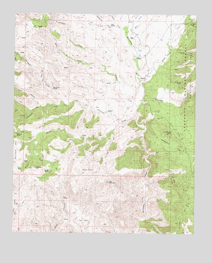
Wagoner, AZ USGS Topographic Map
Click on map above to begin viewing in our Map Viewer.

This topographic map contains these locations and features:
Feature Name Type Latitude Longitude GNIS ID View Map
Arrastre CreekStreamN34.1948°W112.5424°25767View Map
Ashe SpringsSpringN34.2115°W112.5597°41072View Map
Bain SpringSpringN34.2445°W112.5037°25894View Map
Blackwater CreekStreamN34.1961°W112.5774°26471View Map
Blind Indian CreekStreamN34.2111°W112.5385°26488View Map
Cameron SpringSpringN34.1948°W112.5612°27192View Map
Campbells FlatFlatN34.1750°W112.5160°27231View Map
Campbells Flat SpringSpringN34.1827°W112.5170°27232View Map
Cellar Springs CreekStreamN34.2456°W112.5052°27441View Map
Cherry CreekStreamN34.1856°W112.5360°27544View Map
Cooper Ranch Airport (historical)AirportN34.2153°W112.5368°45567View Map
Cottonwood CreekStreamN34.1886°W112.5413°28018View Map
Dead Mexican CreekStreamN34.1639°W112.5977°28328View Map
Diamond Two RanchLocaleN34.2250°W112.5388°28455View Map
French GulchValleyN34.2414°W112.5538°29188View Map
Hodgkins GulchValleyN34.2431°W112.5571°30007View Map
Jesus SpringSpringN34.1454°W112.5909°30531View Map
Lawrence SpringSpringN34.2289°W112.5088°30913View Map
Martin SpringSpringN34.1602°W112.6011°31543View Map
McAllister SpringSpringN34.2112°W112.5109°31618View Map
Milk CreekStreamN34.2395°W112.5491°31854View Map
Minnehaha CreekStreamN34.1984°W112.5407°31923View Map
Minoto RanchLocaleN34.2364°W112.5443°31927View Map
Mocho CanyonValleyN34.1970°W112.6068°31941View Map
Moonshiner SpringSpringN34.2073°W112.5989°32000View Map
Mud SpringSpringN34.2434°W112.5599°32116View Map
Oak CreekStreamN34.1545°W112.5332°32431View Map
Park CreekStreamN34.2186°W112.5638°32683View Map
Seal MountainSummitN34.1542°W112.5596°34177View Map
Seal Mountain TrailTrailN34.1756°W112.5591°38786View Map
South Fork Spring CreekStreamN34.1784°W112.5827°34667View Map
Spring CreekStreamN34.1889°W112.5521°34727View Map
Sugarloaf MountainSummitN34.1620°W112.6121°34920View Map
The HoleBendN34.1300°W112.5780°35225View Map
The ParkFlatN34.2403°W112.6146°35235View Map
Thousand SpringSpringN34.1814°W112.6237°35292View Map
Wades ButteSummitN34.1595°W112.5785°35798View Map
WagonerPopulated PlaceN34.2136°W112.5357°35806View Map

Note: Coordinates in the location and feature list above are referenced to NAD83 datum.


Copyright (C) 2008-2025 Ryan Niemi / Sunset Dynamics ... All Rights Reserved