TopoQuest Logo
Do you find TopoQuest useful?
Help keep TopoQuest running and adding new maps/features by donating!
Bitcoin:  19c7KJd3qBynnjoSw5npx9KScwjBe4ifkT
Litecoin:  LXs6TkuXGGXo1vDsWCkWVdjQX94eUKd6ui
Home View Maps Find Maps Find Places Resources & Links


West Lincoln, Mississippi Topographic Map

USGS Map Title: West Lincoln, MS
USGS Map MRC: 31090D5
DRG (GeoTIFF) Download: o31090d5.tif


Neighboring USGS Topographic Map Quads:


  McCall Creek, MS  
31090E6
 

  Zetus, MS  
31090E5
 

  Brookhaven, MS  
31090E4
 

  Little Springs, MS  
31090D6
 

  West Lincoln, MS  
31090D5
 

  Bogue Chitto, MS  
31090D4
 

  Smithdale, MS  
31090C6
 

  Auburn, MS  
31090C5
 

  McComb North, MS  
31090C4


Map MRC Location:

N32°
W91°
N32°
W90°
H8 H7 H6 H5 H4 H3 H2 H1
G8 G7 G6 G5 G4 G3 G2 G1
F8 F7 F6 F5 F4 F3 F2 F1
E8 E7 E6 E5 E4 E3 E2 E1
D8 D7 D6 D5 D4 D3 D2 D1
C8 C7 C6 C5 C4 C3 C2 C1
B8 B7 B6 B5 B4 B3 B2 B1
A8 A7 A6 A5 A4 A3 A2 A1
N31°
W91°
N31°
W90°

West Lincoln, MS USGS 1:24K Topographic Map Preview:
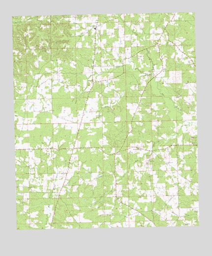
West Lincoln, MS USGS Topographic Map
Click on map above to begin viewing in our Map Viewer.

This topographic map contains these locations and features:
Feature Name Type Latitude Longitude GNIS ID View Map
Adams Grove Church (historical)ChurchN31.4705°W90.5020°686189View Map
ArlingtonPopulated PlaceN31.4185°W90.5568°691668View Map
Arlington Baptist ChurchChurchN31.4191°W90.5551°686190View Map
Arlington School (historical)SchoolN31.4185°W90.5545°686191View Map
Bethel ChurchChurchN31.4121°W90.5204°666901View Map
Butler CreekStreamN31.4699°W90.5295°667862View Map
Center PointPopulated PlaceN31.3996°W90.6159°691759View Map
Gum Grove ChurchChurchN31.4693°W90.5537°670790View Map
Gum Grove School (historical)SchoolN31.4693°W90.5515°686232View Map
Hoppy Field (historical)AirportN31.4085°W90.5251°680315View Map
Kings School (historical)SchoolN31.4118°W90.5201°686244View Map
Moak CemeteryCemeteryN31.4207°W90.5384°673715View Map
Mount Zion CemeteryCemeteryN31.4399°W90.5562°1805874View Map
Mount Zion ChurchChurchN31.4399°W90.5565°674332View Map
Palestine Church (historical)ChurchN31.4735°W90.5940°686263View Map
Panter CreekStreamN31.4677°W90.5462°675429View Map
R E Lee School (historical)SchoolN31.4668°W90.6068°686269View Map
Red CreekStreamN31.4643°W90.5318°676524View Map
Sassers Mill CreekStreamN31.4355°W90.5051°677426View Map
Supervisor District 4CivilN31.4486°W90.5480°711965View Map
West LincolnPopulated PlaceN31.4930°W90.5693°679507View Map
West Lincoln Attendance CenterSchoolN31.4918°W90.5687°707632View Map

Note: Coordinates in the location and feature list above are referenced to NAD83 datum.


Copyright (C) 2008-2025 Ryan Niemi / Sunset Dynamics ... All Rights Reserved