TopoQuest Logo
Do you find TopoQuest useful?
Help keep TopoQuest running and adding new maps/features by donating!
Bitcoin:  19c7KJd3qBynnjoSw5npx9KScwjBe4ifkT
Litecoin:  LXs6TkuXGGXo1vDsWCkWVdjQX94eUKd6ui
Home View Maps Find Maps Find Places Resources & Links


Auburn, Mississippi Topographic Map

USGS Map Title: Auburn, MS
USGS Map MRC: 31090C5
DRG (GeoTIFF) Download: o31090c5.tif


Neighboring USGS Topographic Map Quads:


  Little Springs, MS  
31090D6
 

  West Lincoln, MS  
31090D5
 

  Bogue Chitto, MS  
31090D4
 

  Smithdale, MS  
31090C6
 

  Auburn, MS  
31090C5
 

  McComb North, MS  
31090C4
 

  Peoria, MS  
31090B6
 

  Lake Tangipahoa, MS  
31090B5
 

  McComb South, MS  
31090B4


Map MRC Location:

N32°
W91°
N32°
W90°
H8 H7 H6 H5 H4 H3 H2 H1
G8 G7 G6 G5 G4 G3 G2 G1
F8 F7 F6 F5 F4 F3 F2 F1
E8 E7 E6 E5 E4 E3 E2 E1
D8 D7 D6 D5 D4 D3 D2 D1
C8 C7 C6 C5 C4 C3 C2 C1
B8 B7 B6 B5 B4 B3 B2 B1
A8 A7 A6 A5 A4 A3 A2 A1
N31°
W91°
N31°
W90°

Auburn, MS USGS 1:24K Topographic Map Preview:
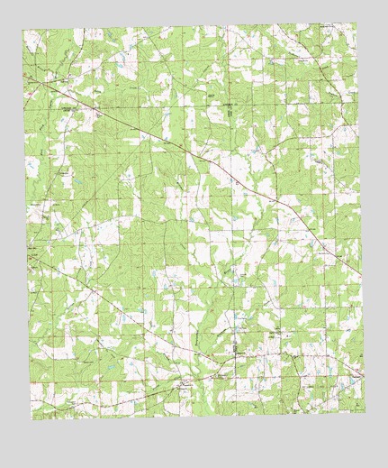
Auburn, MS USGS Topographic Map
Click on map above to begin viewing in our Map Viewer.

This topographic map contains these locations and features:
Feature Name Type Latitude Longitude GNIS ID View Map
Adam CreekStreamN31.3527°W90.6137°666145View Map
Adams ChurchChurchN31.3602°W90.6076°686188View Map
AuburnPopulated PlaceN31.3593°W90.6079°666423View Map
Chisholm MissionChurchN31.3524°W90.5559°668403View Map
Cobb BranchStreamN31.2627°W90.5637°668634View Map
Everett CemeteryCemeteryN31.2513°W90.5690°685258View Map
Fairfield Post Office (historical)Post OfficeN31.3168°W90.5682°712188View Map
Garner CemeteryCemeteryN31.2957°W90.6087°685270View Map
Hayman CemeteryCemeteryN31.2843°W90.5234°709918View Map
Haymans CreekStreamN31.2702°W90.5612°671025View Map
Hewitt Gordon CemeteryCemeteryN31.2574°W90.6243°685292View Map
Holmes CemeteryCemeteryN31.2949°W90.5459°671347View Map
Huett Store (historical)LocaleN31.2930°W90.6029°685297View Map
Johnson Chapel CemeteryCemeteryN31.3296°W90.5137°709946View Map
Johnston ChapelChurchN31.3302°W90.5140°671952View Map
Mars Hill Baptist ChurchChurchN31.3057°W90.6248°707327View Map
McGehee CreekStreamN31.2846°W90.5576°673354View Map
Meadville BranchStreamN31.3588°W90.6137°673456View Map
Montgomery CemeteryCemeteryN31.3749°W90.5095°673744View Map
Montgomery ChurchChurchN31.3741°W90.5090°673746View Map
Mount Canaan ChurchChurchN31.2582°W90.5707°673946View Map
OaklandPopulated PlaceN31.2616°W90.5007°675116View Map
Parsons CemeteryCemeteryN31.3160°W90.6193°685365View Map
Pevine CreekStreamN31.2618°W90.5623°675668View Map
Pine Grove ChurchChurchN31.3013°W90.5126°675822View Map
Pine Grove School (historical)SchoolN31.3127°W90.5732°685368View Map
Pine Hill School (historical)SchoolN31.3007°W90.5182°687669View Map
Pisgah ChurchChurchN31.2685°W90.5270°675938View Map
Pleasant Grove ChurchChurchN31.3585°W90.6237°675992View Map
Robertson CemeteryCemeteryN31.2552°W90.6079°685379View Map
Smithdale FieldLocaleN31.3010°W90.6048°677940View Map
Smithdale Oil FieldOilfieldN31.2721°W90.5951°677941View Map
TangipahoaPopulated PlaceN31.2599°W90.5695°685404View Map
Tangipahoa Baptist ChurchChurchN31.2607°W90.5682°678555View Map
Tangipahoa CemeteryCemeteryN31.2618°W90.5679°685405View Map
Tangipahoa ChurchChurchN31.2696°W90.5479°678556View Map
Terrell CemeteryCemeteryN31.3291°W90.6126°678638View Map
Turner CemeteryCemeteryN31.3313°W90.5445°710010View Map
Whittington CemeteryCemeteryN31.2629°W90.5554°679656View Map
Wilson CemeteryCemeteryN31.2682°W90.6051°679756View Map

Note: Coordinates in the location and feature list above are referenced to NAD83 datum.


Copyright (C) 2008-2024 Ryan Niemi / Sunset Dynamics ... All Rights Reserved