TopoQuest Logo
Do you find TopoQuest useful?
Help keep TopoQuest running and adding new maps/features by donating!
Bitcoin:  19c7KJd3qBynnjoSw5npx9KScwjBe4ifkT
Litecoin:  LXs6TkuXGGXo1vDsWCkWVdjQX94eUKd6ui
Home View Maps Find Maps Find Places Resources & Links


Little Springs, Mississippi Topographic Map

USGS Map Title: Little Springs, MS
USGS Map MRC: 31090D6
DRG (GeoTIFF) Download: o31090d6.tif


Neighboring USGS Topographic Map Quads:


  Eddiceton, MS  
31090E7
 

  McCall Creek, MS  
31090E6
 

  Zetus, MS  
31090E5
 

  Bude, MS  
31090D7
 

  Little Springs, MS  
31090D6
 

  West Lincoln, MS  
31090D5
 

  Busy Corner, MS  
31090C7
 

  Smithdale, MS  
31090C6
 

  Auburn, MS  
31090C5


Map MRC Location:

N32°
W91°
N32°
W90°
H8 H7 H6 H5 H4 H3 H2 H1
G8 G7 G6 G5 G4 G3 G2 G1
F8 F7 F6 F5 F4 F3 F2 F1
E8 E7 E6 E5 E4 E3 E2 E1
D8 D7 D6 D5 D4 D3 D2 D1
C8 C7 C6 C5 C4 C3 C2 C1
B8 B7 B6 B5 B4 B3 B2 B1
A8 A7 A6 A5 A4 A3 A2 A1
N31°
W91°
N31°
W90°

Little Springs, MS USGS 1:24K Topographic Map Preview:
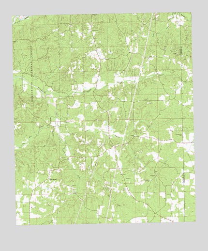
Little Springs, MS USGS Topographic Map
Click on map above to begin viewing in our Map Viewer.

This topographic map contains these locations and features:
Feature Name Type Latitude Longitude GNIS ID View Map
Beam CemeteryCemeteryN31.4213°W90.6820°692486View Map
Beams Store (historical)LocaleN31.4149°W90.6968°705196View Map
Bowlin CemeteryCemeteryN31.4221°W90.6787°707558View Map
Cain CemeteryCemeteryN31.3813°W90.6926°707563View Map
Cane Mill BranchStreamN31.4402°W90.7209°692831View Map
Center Point CemeteryCemeteryN31.4274°W90.6337°692869View Map
Concord Baptist ChurchChurchN31.4268°W90.6670°692956View Map
Concord CemeteryCemeteryN31.4271°W90.6656°707565View Map
Cotton CemeteryCemeteryN31.4091°W90.7198°692983View Map
Cowart Lake DamDamN31.4085°W90.6651°695379View Map
Davis CemeteryCemeteryN31.3993°W90.6815°693058View Map
Ebenezer CemeteryCemeteryN31.4238°W90.7018°707567View Map
Ebenezer ChurchChurchN31.4241°W90.7023°693160View Map
Goober CreekStreamN31.4391°W90.7204°693312View Map
Horse CreekStreamN31.4549°W90.7309°693536View Map
Jones Lake DamDamN31.4318°W90.6801°695385View Map
Leon Burris Lake DamDamN31.4785°W90.6884°695393View Map
Little CreekStreamN31.4996°W90.6382°693755View Map
Little SpringsPopulated PlaceN31.4024°W90.7268°693784View Map
Magee Lake DamDamN31.3968°W90.7268°695376View Map
McCall CemeteryCemeteryN31.4732°W90.6862°707583View Map
McCall ChurchChurchN31.4735°W90.6873°673287View Map
McGehee CemeteryCemeteryN31.4904°W90.6965°693916View Map
Mount Gilead CemeteryCemeteryN31.4035°W90.6523°707587View Map
Mount Gilead Primitive Baptist ChurchChurchN31.4032°W90.6526°694057View Map
Ramah Baptist ChurchChurchN31.4785°W90.6445°694505View Map
Ramah CemeteryCemeteryN31.4785°W90.6448°707603View Map
Wactor Mill CreekStreamN31.4024°W90.7057°695074View Map

Note: Coordinates in the location and feature list above are referenced to NAD83 datum.


Copyright (C) 2008-2025 Ryan Niemi / Sunset Dynamics ... All Rights Reserved