TopoQuest Logo
Do you find TopoQuest useful?
Help keep TopoQuest running and adding new maps/features by donating!
Bitcoin:  19c7KJd3qBynnjoSw5npx9KScwjBe4ifkT
Litecoin:  LXs6TkuXGGXo1vDsWCkWVdjQX94eUKd6ui
Home View Maps Find Maps Find Places Resources & Links


Eight Dollar Mountain, Oregon Topographic Map

USGS Map Title: Eight Dollar Mountain, OR
USGS Map MRC: 42123C6
DRG (GeoTIFF) Download: o42123c6.tif


Neighboring USGS Topographic Map Quads:


  York Butte, OR  
42123D7
 

  Chrome Ridge, OR  
42123D6
 

  Onion Mountain, OR  
42123D5
 

  Pearsoll Peak, OR  
42123C7
 

  Eight Dollar Mountain, OR  
42123C6
 

  Selma, OR  
42123C5
 

  Josephine Mountain, OR  
42123B7
 

  Cave Junction, OR  
42123B6
 

  Holland, OR  
42123B5


Map MRC Location:

N43°
W124°
N43°
W123°
H8 H7 H6 H5 H4 H3 H2 H1
G8 G7 G6 G5 G4 G3 G2 G1
F8 F7 F6 F5 F4 F3 F2 F1
E8 E7 E6 E5 E4 E3 E2 E1
D8 D7 D6 D5 D4 D3 D2 D1
C8 C7 C6 C5 C4 C3 C2 C1
B8 B7 B6 B5 B4 B3 B2 B1
A8 A7 A6 A5 A4 A3 A2 A1
N42°
W124°
N42°
W123°

Eight Dollar Mountain, OR USGS 1:24K Topographic Map Preview:
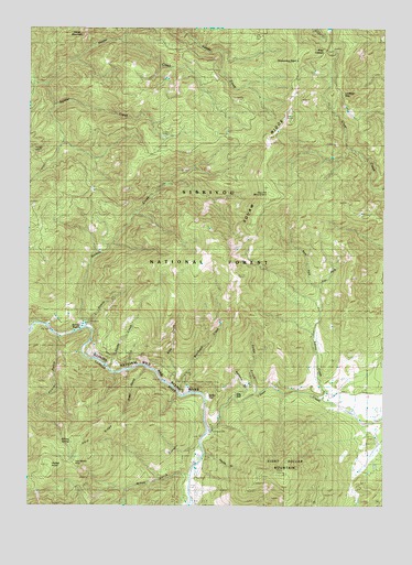
Eight Dollar Mountain, OR USGS Topographic Map
Click on map above to begin viewing in our Map Viewer.

This topographic map contains these locations and features:
Feature Name Type Latitude Longitude GNIS ID View Map
Alder GulchValleyN42.2851°W123.7103°1137089View Map
Anderson MineMineN42.2682°W123.6906°1155923View Map
Baldwin GulchValleyN42.2776°W123.6762°1154342View Map
Bour Post Office (historical)Post OfficeN42.2526°W123.6928°1164944View Map
Cedar GulchValleyN42.2812°W123.6715°1139521View Map
Clear CreekStreamN42.2732°W123.6259°1139781View Map
CoonskinAreaN42.2651°W123.6990°1155684View Map
Deer CreekStreamN42.2696°W123.6881°1140838View Map
East Fork Squaw CreekStreamN42.3068°W123.6484°1154345View Map
Eight Dollar MountainSummitN42.2583°W123.6619°1141700View Map
Eight Dollar Mountain CreekStreamN42.2707°W123.6317°1154529View Map
Ellis CreekStreamN42.2818°W123.7015°1141836View Map
Fayes GulchValleyN42.2634°W123.6878°1142052View Map
Gold Blanket MineMineN42.2615°W123.7348°2754355View Map
Hoover GulchValleyN42.2929°W123.7406°1143720View Map
Horse CreekStreamN42.3607°W123.7451°1143744View Map
Kerby FlatFlatN42.2787°W123.6881°1144566View Map
Little Sixmile CreekStreamN42.2962°W123.7301°1145257View Map
Lookout GapGapN42.3576°W123.6423°1145464View Map
Mikes GulchValleyN42.2579°W123.6965°1146197View Map
Pockett KnollSummitN42.2693°W123.7331°1154343View Map
Serpentine PointSummitN42.3660°W123.6573°1149244View Map
Shade CreekStreamN42.2865°W123.7231°1149268View Map
Sixmile CreekStreamN42.2968°W123.7317°1149569View Map
Snailback CreekStreamN42.2790°W123.6967°1149786View Map
Spalding Pond Recreation SiteLocaleN42.3465°W123.7037°1155912View Map
Spaulding MillLocaleN42.3451°W123.7037°1150106View Map
Spring CreekStreamN42.2857°W123.7162°1150160View Map
Squaw CreekStreamN42.2779°W123.6478°1150229View Map
Squaw MountainSummitN42.3314°W123.6667°1150288View Map
Squaw RidgeRidgeN42.3377°W123.6688°2507567View Map
Star FlatFlatN42.2787°W123.6770°1150342View Map
West Fork Squaw CreekStreamN42.3068°W123.6484°1154344View Map
Wheeler City (historical)LocaleN42.2971°W123.7317°1154341View Map
Zigzag CreekStreamN42.3596°W123.7484°1159031View Map

Note: Coordinates in the location and feature list above are referenced to NAD83 datum.


Copyright (C) 2008-2024 Ryan Niemi / Sunset Dynamics ... All Rights Reserved