TopoQuest Logo
Do you find TopoQuest useful?
Help keep TopoQuest running and adding new maps/features by donating!
Bitcoin:  19c7KJd3qBynnjoSw5npx9KScwjBe4ifkT
Litecoin:  LXs6TkuXGGXo1vDsWCkWVdjQX94eUKd6ui
Home View Maps Find Maps Find Places Resources & Links


Hayfork Bally, California Topographic Map

USGS Map Title: Hayfork Bally, CA
USGS Map MRC: 40123F2
DRG (GeoTIFF) Download: o40123f2.tif


Neighboring USGS Topographic Map Quads:


  Del Loma, CA  
40123G3
 

  Helena, CA  
40123G2
 

  Dedrick, CA  
40123G1
 

  Big Bar, CA  
40123F3
 

  Hayfork Bally, CA  
40123F2
 

  Junction City, CA  
40123F1
 

  Halfway Ridge, CA  
40123E3
 

  Hayfork, CA  
40123E2
 

  Hayfork Summit, CA  
40123E1


Map MRC Location:

N41°
W124°
N41°
W123°
H8 H7 H6 H5 H4 H3 H2 H1
G8 G7 G6 G5 G4 G3 G2 G1
F8 F7 F6 F5 F4 F3 F2 F1
E8 E7 E6 E5 E4 E3 E2 E1
D8 D7 D6 D5 D4 D3 D2 D1
C8 C7 C6 C5 C4 C3 C2 C1
B8 B7 B6 B5 B4 B3 B2 B1
A8 A7 A6 A5 A4 A3 A2 A1
N40°
W124°
N40°
W123°

Hayfork Bally, CA USGS 1:24K Topographic Map Preview:
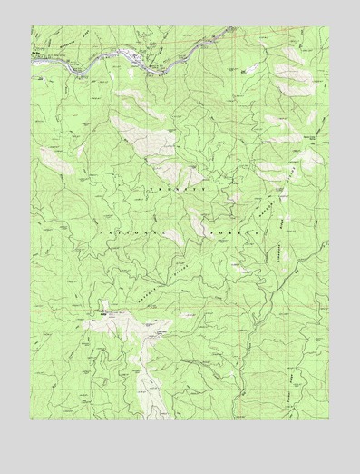
Hayfork Bally, CA USGS Topographic Map
Click on map above to begin viewing in our Map Viewer.

This topographic map contains these locations and features:
Feature Name Type Latitude Longitude GNIS ID View Map
Big Bar CreekStreamN40.7407°W123.2214°256876View Map
Big Bar Ranger StationLocaleN40.7396°W123.2448°276959View Map
Big Flat CampgroundLocaleN40.7393°W123.2059°256929View Map
Bordy CreekStreamN40.7351°W123.2336°257361View Map
Cottonwood TrailTrailN40.6629°W123.2317°258777View Map
Donaldson CreekStreamN40.6338°W123.1634°259469View Map
Downriver Volunteer Fire CompanyBuildingN40.7385°W123.2068°2622105View Map
Eagle RanchLocaleN40.7349°W123.1631°259673View Map
East Fork Big CreekStreamN40.6801°W123.1314°259711View Map
Farmer RidgeRidgeN40.6288°W123.1409°1665348View Map
Hayfork BallySummitN40.6588°W123.2192°261174View Map
Hayfork Bally LookoutLocaleN40.6588°W123.2186°276949View Map
Hocker MeadowFlatN40.7343°W123.1256°261385View Map
Kottmeter MineMineN40.6471°W123.2270°262240View Map
Limestone CreekStreamN40.6665°W123.1486°262479View Map
Limestone RidgeRidgeN40.6893°W123.1461°262482View Map
Love Letter SpringSpringN40.6524°W123.1986°262978View Map
Manzanita CreekStreamN40.7393°W123.2442°263159View Map
Packers CreekStreamN40.6529°W123.1592°264437View Map
Rose RanchLocaleN40.7329°W123.2453°265576View Map
Skunk Point Group CampgroundLocaleN40.7332°W123.2303°276948View Map
Skunk Point Picnic AreaLocaleN40.7360°W123.2339°1665428View Map
Squaw CampLocaleN40.7135°W123.1356°267619View Map
Squaw Camp SpringSpringN40.7146°W123.1317°1665432View Map
Trinity National ForestForestN40.6492°W123.1586°1851861View Map
Wheel GulchValleyN40.7376°W123.2023°268956View Map

Note: Coordinates in the location and feature list above are referenced to NAD83 datum.


Copyright (C) 2008-2025 Ryan Niemi / Sunset Dynamics ... All Rights Reserved