TopoQuest Logo
Do you find TopoQuest useful?
Help keep TopoQuest running and adding new maps/features by donating!
Bitcoin:  19c7KJd3qBynnjoSw5npx9KScwjBe4ifkT
Litecoin:  LXs6TkuXGGXo1vDsWCkWVdjQX94eUKd6ui
Home View Maps Find Maps Find Places Resources & Links


Cardwell Mountain, Tennessee Topographic Map

USGS Map Title: Cardwell Mountain, TN
USGS Map MRC: 35085F6
DRG (GeoTIFF) Download: o35085f6.tif


Neighboring USGS Topographic Map Quads:


  Dibrell, TN  
35085G7
 

  Campaign, TN  
35085G6
 

  Doyle, TN  
35085G5
 

  McMinnville, TN  
35085F7
 

  Cardwell Mountain, TN  
35085F6
 

  Welchland, TN  
35085F5
 

  Viola, TN  
35085E7
 

  Irving College, TN  
35085E6
 

  Curtistown, TN  
35085E5


Map MRC Location:

N36°
W86°
N36°
W85°
H8 H7 H6 H5 H4 H3 H2 H1
G8 G7 G6 G5 G4 G3 G2 G1
F8 F7 F6 F5 F4 F3 F2 F1
E8 E7 E6 E5 E4 E3 E2 E1
D8 D7 D6 D5 D4 D3 D2 D1
C8 C7 C6 C5 C4 C3 C2 C1
B8 B7 B6 B5 B4 B3 B2 B1
A8 A7 A6 A5 A4 A3 A2 A1
N35°
W86°
N35°
W85°

Cardwell Mountain, TN USGS 1:24K Topographic Map Preview:
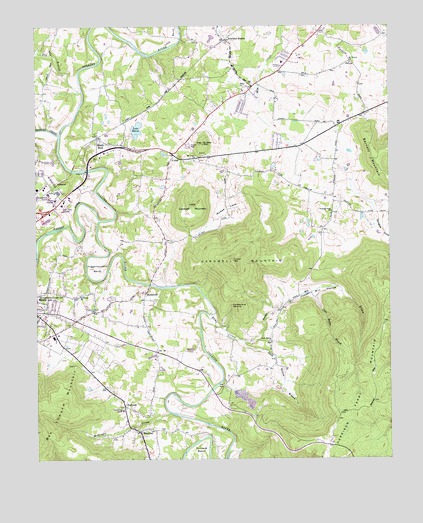
Cardwell Mountain, TN USGS Topographic Map
Click on map above to begin viewing in our Map Viewer.

This topographic map contains these locations and features:
Feature Name Type Latitude Longitude GNIS ID View Map
Barren ForkStreamN35.6942°W85.7272°1276379View Map
Bethlehem ChurchChurchN35.7290°W85.7097°1277170View Map
Blacks Ferry (historical)CrossingN35.7001°W85.7264°1311855View Map
Blue Spring CoveValleyN35.6528°W85.6819°1311857View Map
Cane Hollow BranchStreamN35.6728°W85.6525°1279536View Map
Cardwell MountainSummitN35.6823°W85.6803°1279669View Map
Charles CreekStreamN35.7190°W85.7419°1305863View Map
Collins River Volunteer Fire Department Station 1BuildingN35.6633°W85.7437°2654615View Map
Commissioner District 4CivilN35.7315°W85.7478°2464095View Map
Commissioner District 5CivilN35.6829°W85.7384°2464501View Map
Commissioner District 7CivilN35.7352°W85.6561°2464649View Map
Dark Hollow BranchStreamN35.6590°W85.6764°1282059View Map
Dark Hollow ChurchChurchN35.6587°W85.6669°1282061View Map
Douglas CoveValleyN35.7013°W85.6372°1269534View Map
Dry BranchStreamN35.7312°W85.7333°1282843View Map
East Elementary SchoolSchoolN35.7395°W85.6625°1320535View Map
FairviewPopulated PlaceN35.6406°W85.7189°1315038View Map
Grassy MountainSummitN35.7159°W85.6905°1285906View Map
Groves (historical)Populated PlaceN35.6709°W85.6605°1311867View Map
Higgenbottom BendBendN35.6787°W85.7289°1287683View Map
Higgenbottom CemeteryCemeteryN35.6678°W85.7286°1287684View Map
Lake KarenLakeN35.7202°W85.7138°1289907View Map
Leesburg ChurchChurchN35.6720°W85.7350°1290985View Map
Left Fork Dry BranchStreamN35.7428°W85.7489°1290990View Map
Little Cardwell MountainSummitN35.6962°W85.6961°1291417View Map
Lock BendBendN35.7467°W85.7000°1291754View Map
Martins Chapel United Methodist ChurchChurchN35.7256°W85.7097°1646740View Map
McGee CoveValleyN35.7021°W85.6822°1293302View Map
McGregor CreekStreamN35.6384°W85.7033°1293327View Map
McMinnville QuarryMineN35.6411°W85.6744°2633148View Map
Mount Vernon CemeteryCemeteryN35.7392°W85.6380°1646742View Map
Mount Vernon ChurchChurchN35.7395°W85.6383°1306791View Map
Mount View ChurchChurchN35.7123°W85.6936°1306795View Map
Mud CreekStreamN35.7498°W85.6625°1294993View Map
New Union United Methodist ChurchChurchN35.7106°W85.6953°1646744View Map
Pleasant Cove ChurchChurchN35.6965°W85.6453°1297785View Map
Pleasant Hill SchoolSchoolN35.7301°W85.7053°1297896View Map
Powder Mill BranchStreamN35.6590°W85.6764°1298379View Map
Powder Mill HollowValleyN35.6588°W85.6762°1298383View Map
Powder Mill SpringsSpringN35.6695°W85.6508°1311893View Map
Rams CreekStreamN35.6667°W85.6900°1298877View Map
Right Fork Dry BranchStreamN35.7428°W85.7489°1299431View Map
River Park HospitalHospitalN35.6984°W85.7408°1320568View Map
River Park HospitalHospitalN35.7001°W85.7429°1320579View Map
RowlandPopulated PlaceN35.7459°W85.6828°1315846View Map
Shady RestPopulated PlaceN35.7165°W85.7247°1301194View Map
ShellsfordPopulated PlaceN35.6728°W85.7116°1314275View Map
Shellsford Baptist ChurchChurchN35.6715°W85.7097°1320571View Map
Shiloh ChurchChurchN35.7326°W85.6750°1270089View Map
SmyrnaPopulated PlaceN35.6328°W85.7139°1270733View Map
Smyrna Church of ChristChurchN35.6328°W85.7047°1320572View Map
Three Star Mall Shopping CenterLocaleN35.6940°W85.7464°1320574View Map
Turners BendBendN35.6290°W85.6916°1273089View Map
UnionPopulated PlaceN35.7128°W85.7011°1314431View Map
Warren County Ambulance ServiceBuildingN35.6990°W85.7458°2697452View Map
Warren County Farm (historical)LocaleN35.6987°W85.7439°1320578View Map

Note: Coordinates in the location and feature list above are referenced to NAD83 datum.


Copyright (C) 2008-2025 Ryan Niemi / Sunset Dynamics ... All Rights Reserved