TopoQuest Logo
Do you find TopoQuest useful?
Help keep TopoQuest running and adding new maps/features by donating!
Bitcoin:  19c7KJd3qBynnjoSw5npx9KScwjBe4ifkT
Litecoin:  LXs6TkuXGGXo1vDsWCkWVdjQX94eUKd6ui
Home View Maps Find Maps Find Places Resources & Links


Carlinville East, Illinois Topographic Map

USGS Map Title: Carlinville East, IL
USGS Map MRC: 39089C7
DRG (GeoTIFF) Download: o39089c7.tif


Neighboring USGS Topographic Map Quads:


  Palmyra, IL  
39089D8
 

  Virden South, IL  
39089D7
 

  Farmersville, IL  
39089D6
 

  Carlinville West, IL  
39089C8
 

  Carlinville East, IL  
39089C7
 

  Atwater, IL  
39089C6
 

  Plainview, IL  
39089B8
 

  Gillespie North, IL  
39089B7
 

  Litchfield, IL  
39089B6


Map MRC Location:

N40°
W90°
N40°
W89°
H8 H7 H6 H5 H4 H3 H2 H1
G8 G7 G6 G5 G4 G3 G2 G1
F8 F7 F6 F5 F4 F3 F2 F1
E8 E7 E6 E5 E4 E3 E2 E1
D8 D7 D6 D5 D4 D3 D2 D1
C8 C7 C6 C5 C4 C3 C2 C1
B8 B7 B6 B5 B4 B3 B2 B1
A8 A7 A6 A5 A4 A3 A2 A1
N39°
W90°
N39°
W89°

Carlinville East, IL USGS 1:24K Topographic Map Preview:
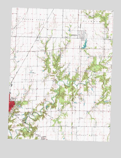
Carlinville East, IL USGS Topographic Map
Click on map above to begin viewing in our Map Viewer.

This topographic map contains these locations and features:
Feature Name Type Latitude Longitude GNIS ID View Map
AndersonPopulated PlaceN39.3439°W89.8451°422409View Map
Anderson BranchStreamN39.3106°W89.8193°403501View Map
Anderson CemeteryCemeteryN39.3339°W89.8443°403505View Map
Anderson School (historical)SchoolN39.3337°W89.8343°1764576View Map
Anderson Student CenterBuildingN39.2873°W89.8734°1821320View Map
Austiff PondReservoirN39.3184°W89.8668°1692325View Map
Austiff Pond DamDamN39.3184°W89.8668°1692324View Map
Blackburn UniversitySchoolN39.2887°W89.8707°404513View Map
Bothwell Conservatory of MusicSchoolN39.2895°W89.8712°1967511View Map
Brick School (historical)SchoolN39.3056°W89.8412°1764586View Map
Burridge D Butler HallBuildingN39.2864°W89.8734°1821328View Map
Burton School (historical)SchoolN39.2717°W89.8654°1764592View Map
Carlinville Area Hospital HeliportAirportN39.2812°W89.8695°427106View Map
Carlinville Country ClubLocaleN39.2731°W89.8645°424713View Map
Centerview School (historical)SchoolN39.3162°W89.7606°1764593View Map
Challacombe HallBuildingN39.2881°W89.8729°1967512View Map
Clegg ChapelChurchN39.2873°W89.8726°1967513View Map
Coops MoundSummitN39.3173°W89.7840°406562View Map
Cottonwood CreekStreamN39.2900°W89.7606°406634View Map
Davis CemeteryCemeteryN39.2542°W89.8365°1993889View Map
Dawes Physical Education CenterBuildingN39.2884°W89.8720°1821337View Map
Demuzio Campus CenterBuildingN39.2884°W89.8729°1967514View Map
Denbys PondReservoirN39.2815°W89.8283°1692281View Map
Denbys Pond DamDamN39.2834°W89.8318°1692280View Map
Gore School (historical)SchoolN39.3262°W89.8695°1764622View Map
Graham HallBuildingN39.2878°W89.8734°1821344View Map
Gray Family CemeteryCemeteryN39.2903°W89.7893°1994449View Map
Hudson HallBuildingN39.2873°W89.8723°1967515View Map
Jewell HallBuildingN39.2892°W89.8723°1967516View Map
Jones Allison HallBuildingN39.2862°W89.8723°1821346View Map
Kasten School (historical)SchoolN39.3612°W89.8682°1764637View Map
Klimut Landing Strip (historical)AirportN39.2792°W89.8504°1764639View Map
Lake Williamson Christian CenterLocaleN39.2512°W89.8304°411742View Map
Leefers Landing Strip (historical)AirportN39.3125°W89.8479°1764642View Map
Ludlum HallBuildingN39.2870°W89.8732°1967517View Map
Lumpkin LibraryBuildingN39.2881°W89.8704°1967518View Map
Lynn Grove BranchStreamN39.3709°W89.7662°412766View Map
Lynn Grove School (historical)SchoolN39.3701°W89.7862°1764649View Map
Macoupin County FairgroundLocaleN39.3084°W89.8745°1764651View Map
Mayfield Memorial ParkCemeteryN39.2656°W89.8565°413159View Map
Moore CemeteryCemeteryN39.3064°W89.8187°413779View Map
New Calvary CemeteryCemeteryN39.2681°W89.8587°414384View Map
Oakland School (historical)SchoolN39.2634°W89.8140°1764675View Map
Olin Science BuildingBuildingN39.2887°W89.8707°1967519View Map
Pleasant Point School (historical)SchoolN39.2645°W89.7695°1764681View Map
Prairie Chapel School (historical)SchoolN39.3698°W89.8307°1764683View Map
Rahme Learning CenterSchoolN39.2878°W89.8704°1967520View Map
Renner Art CenterBuildingN39.2870°W89.8704°1967521View Map
Richardson BranchStreamN39.3056°W89.8159°416593View Map
Robley School (historical)SchoolN39.3306°W89.7890°1764687View Map
Rural ChurchChurchN39.2900°W89.7893°417047View Map
Rural Methodist CemeteryCemeteryN39.2906°W89.7893°1997739View Map
Rural School (historical)SchoolN39.2898°W89.7882°1764689View Map
SchoperPopulated PlaceN39.3381°W89.7843°423164View Map
Schoper LakeReservoirN39.3416°W89.7841°418106View Map
Shaw Point BranchStreamN39.3125°W89.7743°418308View Map
Standard CityPopulated PlaceN39.3523°W89.7876°422381View Map
Standard City LakeReservoirN39.3416°W89.7841°1691927View Map
Standard City Lake DamDamN39.3384°W89.7851°1691926View Map
Stoddard HallBuildingN39.2867°W89.8712°1967523View Map
Sugar CreekStreamN39.3020°W89.7929°419282View Map
Township of CarlinvilleCivilN39.3043°W89.8694°428761View Map
Township of Shaws PointCivilN39.3060°W89.7586°429738View Map
Village of Standard CityCivilN39.3504°W89.7836°2399885View Map
WIBI-FM (Carlinville)TowerN39.3495°W89.8045°428130View Map
WomacPopulated PlaceN39.2714°W89.7882°423330View Map
Womac StationLocaleN39.2634°W89.7968°421407View Map
Yowell CemeteryCemeteryN39.3470°W89.7556°421607View Map
Zion CemeteryCemeteryN39.2737°W89.8745°2009710View Map

Note: Coordinates in the location and feature list above are referenced to NAD83 datum.


Copyright (C) 2008-2025 Ryan Niemi / Sunset Dynamics ... All Rights Reserved