TopoQuest Logo
Do you find TopoQuest useful?
Help keep TopoQuest running and adding new maps/features by donating!
Bitcoin:  19c7KJd3qBynnjoSw5npx9KScwjBe4ifkT
Litecoin:  LXs6TkuXGGXo1vDsWCkWVdjQX94eUKd6ui
Home View Maps Find Maps Find Places Resources & Links


Carrollton, Ohio Topographic Map

USGS Map Title: Carrollton, OH
USGS Map MRC: 40081E1
DRG (GeoTIFF) Download: o40081e1.tif


Neighboring USGS Topographic Map Quads:


  Malvern, OH  
40081F2
 

  Minerva, OH  
40081F1
 

  Kensington, OH  
40080F8
 

  Dellroy, OH  
40081E2
 

  Carrollton, OH  
40081E1
 

  Bergholz, OH  
40080E8
 

  Bowerston, OH  
40081D2
 

  Scio, OH  
40081D1
 

  Amsterdam, OH  
40080D8


Map MRC Location:

N41°
W82°
N41°
W81°
H8 H7 H6 H5 H4 H3 H2 H1
G8 G7 G6 G5 G4 G3 G2 G1
F8 F7 F6 F5 F4 F3 F2 F1
E8 E7 E6 E5 E4 E3 E2 E1
D8 D7 D6 D5 D4 D3 D2 D1
C8 C7 C6 C5 C4 C3 C2 C1
B8 B7 B6 B5 B4 B3 B2 B1
A8 A7 A6 A5 A4 A3 A2 A1
N40°
W82°
N40°
W81°

Carrollton, OH USGS 1:24K Topographic Map Preview:
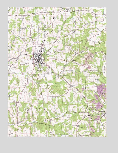
Carrollton, OH USGS Topographic Map
Click on map above to begin viewing in our Map Viewer.

This topographic map contains these locations and features:
Feature Name Type Latitude Longitude GNIS ID View Map
Algonquin Mill (historical)LocaleN40.5131°W81.1123°1071090View Map
Becki Lynn CourtPopulated PlaceN40.5814°W81.0894°2727495View Map
Bell-Heron Middle SchoolSchoolN40.5742°W81.0826°1052454View Map
Carroll CountyCivilN40.5796°W81.0897°1074022View Map
Carroll County CourthouseBuildingN40.5720°W81.0862°1052447View Map
Carroll County HomeBuildingN40.6145°W81.0673°1052458View Map
Carroll County Sheriff's OfficeBuildingN40.5719°W81.0859°2732708View Map
Carroll County Volunteer Fire DepartmentBuildingN40.5879°W81.0820°2549530View Map
Carroll County-Tolson AirportAirportN40.5627°W81.0792°1082550View Map
Carroll Hills SchoolSchoolN40.6142°W81.0684°1052457View Map
Carroll Hills Training CenterSchoolN40.5770°W81.0843°1052448View Map
Carroll Kemp Corporation DamDamN40.5834°W81.0982°1079461View Map
Carroll Kemp Corporation ReservoirReservoirN40.5841°W81.0979°1079462View Map
Carroll View TerracePopulated PlaceN40.5848°W81.1043°1052450View Map
CarrolltonPopulated PlaceN40.5728°W81.0857°1056769View Map
Carrollton Elementary SchoolSchoolN40.5731°W81.0832°1052449View Map
Carrollton High SchoolSchoolN40.5731°W81.0823°1052453View Map
Carrollton Post OfficePost OfficeN40.5723°W81.0859°1965227View Map
Carrollton Village Volunteer Fire DepartmentBuildingN40.5716°W81.0890°2550213View Map
Champers CemeteryCemeteryN40.5668°W81.1178°1070712View Map
Chestnut Grove School (historical)SchoolN40.5456°W81.0362°1052465View Map
County Home CemeteryCemeteryN40.6176°W81.0672°1052459View Map
Downing CemeteryCemeteryN40.5567°W81.0115°1052466View Map
Dutch CornersPopulated PlaceN40.5112°W81.0376°1048673View Map
EckleyPopulated PlaceN40.6212°W81.0231°1062745View Map
Eckley Post Office (historical)Post OfficeN40.6215°W81.0234°1083274View Map
Emergency Medical Transport Carrollton Station 3BuildingN40.5790°W81.0930°2550695View Map
EMT AmbulanceBuildingN40.5830°W81.0927°2550979View Map
Fawcett School (historical)SchoolN40.5476°W81.1043°1052445View Map
Friday CreekStreamN40.5526°W81.0676°1040681View Map
Gantz CreekStreamN40.5573°W81.0937°1070756View Map
Grandview CemeteryCemeteryN40.5695°W81.0826°1041035View Map
Green Hill CemeteryCemeteryN40.5308°W81.0242°1041103View Map
Harlem SpringsPopulated PlaceN40.5209°W81.0031°1064794View Map
Harlem Springs CemeteryCemeteryN40.5220°W81.0051°1052463View Map
Harlem Springs Elementary SchoolSchoolN40.5212°W81.0018°1052462View Map
Harlem Springs Post OfficePost OfficeN40.5209°W81.0026°1965231View Map
Heritage HillsPopulated PlaceN40.5426°W81.1090°1052444View Map
Hickory GrovePopulated PlaceN40.5109°W81.1226°1052442View Map
Hills Trailer CourtPopulated PlaceN40.5703°W81.0911°2727503View Map
Honey RunStreamN40.5573°W81.0934°1070779View Map
Lee CemeteryCemeteryN40.5392°W81.0312°1042472View Map
Minor's Mobile Home ParkPopulated PlaceN40.5906°W81.0828°2727500View Map
Moorehead CemeteryCemeteryN40.5454°W81.0035°1052464View Map
Mount Olivet CemeteryCemeteryN40.5906°W81.0079°1052467View Map
Mount Olivet ChurchChurchN40.5909°W81.0081°1043602View Map
Mount Pleasant CemeteryCemeteryN40.5245°W81.1002°1052443View Map
Mount Pleasant ChurchChurchN40.5251°W81.0993°1043616View Map
Mud School (historical)SchoolN40.5884°W81.0698°1052455View Map
Our Lady of Fatima SchoolSchoolN40.5759°W81.0943°1068999View Map
PetersburghPopulated PlaceN40.5140°W81.1123°1079586View Map
PigtownPopulated PlaceN40.5637°W81.0534°1049081View Map
Pleasant Hill ChurchChurchN40.5328°W81.1137°1044558View Map
Puskarich Brothers LakeReservoirN40.5501°W81.0015°1078421View Map
Puskarich Brothers Lake DamDamN40.5501°W81.0015°1078420View Map
Puskarich Limestone Quarry (historical)MineN40.5428°W81.0044°2674903View Map
Rolling Meadow AcresPopulated PlaceN40.5556°W81.0832°1052446View Map
Roudebush School (historical)SchoolN40.6042°W81.0337°1052468View Map
Smith PondReservoirN40.5516°W81.0999°1079430View Map
Smith Pond DamDamN40.5534°W81.0982°1079429View Map
Smith School (historical)SchoolN40.5109°W81.0740°1052451View Map
StemplePopulated PlaceN40.6181°W81.0895°1061206View Map
Toot School (historical)SchoolN40.5048°W81.0687°1052452View Map
Toots CrossroadsPopulated PlaceN40.5390°W81.0682°1049248View Map
Town CreekStreamN40.5645°W81.0829°1047103View Map
Township of CenterCivilN40.5784°W81.0735°1085826View Map
Township of UnionCivilN40.5282°W81.1044°1085836View Map
Township of WashingtonCivilN40.6113°W81.0243°1085837View Map
Trail Run LakesReservoirN40.5242°W81.0097°1079432View Map
Trail Run Lakes DamDamN40.5251°W81.0081°1079431View Map
Village of CarrolltonCivilN40.5804°W81.0900°2397564View Map
Washington HallPopulated PlaceN40.5734°W81.0445°1049293View Map
Washington Hall School (historical)SchoolN40.5731°W81.0445°1052461View Map
WaterlooPopulated PlaceN40.5153°W81.0707°1049297View Map
Waterworks ParkParkN40.6062°W81.0779°1052456View Map
Westview CemeteryCemeteryN40.5664°W81.0851°1047833View Map
Wherry CemeteryCemeteryN40.6154°W81.1067°1047853View Map
Wherrys CrossroadsPopulated PlaceN40.6170°W81.1032°1047854View Map
WyncrestPopulated PlaceN40.6187°W81.0818°1052460View Map

Note: Coordinates in the location and feature list above are referenced to NAD83 datum.


Copyright (C) 2008-2025 Ryan Niemi / Sunset Dynamics ... All Rights Reserved