TopoQuest Logo
Do you find TopoQuest useful?
Help keep TopoQuest running and adding new maps/features by donating!
Bitcoin:  19c7KJd3qBynnjoSw5npx9KScwjBe4ifkT
Litecoin:  LXs6TkuXGGXo1vDsWCkWVdjQX94eUKd6ui
Home View Maps Find Maps Find Places Resources & Links


Carrollton, Illinois Topographic Map

USGS Map Title: Carrollton, IL
USGS Map MRC: 39090C4
DRG (GeoTIFF) Download: o39090c4.tif


Neighboring USGS Topographic Map Quads:


  Pearl East, IL  
39090D5
 

  Roodhouse West, IL  
39090D4
 

  Roodhouse East, IL  
39090D3
 

  Kampsville, IL  
39090C5
 

  Carrollton, IL  
39090C4
 

  Daum, IL  
39090C3
 

  Hardin, IL  
39090B5
 

  Boyer Creek, IL  
39090B4
 

  Jerseyville North, IL  
39090B3


Map MRC Location:

N40°
W91°
N40°
W90°
H8 H7 H6 H5 H4 H3 H2 H1
G8 G7 G6 G5 G4 G3 G2 G1
F8 F7 F6 F5 F4 F3 F2 F1
E8 E7 E6 E5 E4 E3 E2 E1
D8 D7 D6 D5 D4 D3 D2 D1
C8 C7 C6 C5 C4 C3 C2 C1
B8 B7 B6 B5 B4 B3 B2 B1
A8 A7 A6 A5 A4 A3 A2 A1
N39°
W91°
N39°
W90°

Carrollton, IL USGS 1:24K Topographic Map Preview:
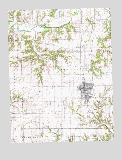
Carrollton, IL USGS Topographic Map
Click on map above to begin viewing in our Map Viewer.

This topographic map contains these locations and features:
Feature Name Type Latitude Longitude GNIS ID View Map
Believers ChurchChurchN39.2637°W90.4607°1748343View Map
BerdanPopulated PlaceN39.3650°W90.3954°404201View Map
Boyd Hospital HeliportAirportN39.2981°W90.4151°427111View Map
Brushy School (historical)SchoolN39.2545°W90.4010°405064View Map
CarrolltonPopulated PlaceN39.3023°W90.4071°405642View Map
Carrollton Courthouse Square Historic DistrictParkN39.3014°W90.4085°1811011View Map
Carrollton Elementary SchoolSchoolN39.2964°W90.4065°1811012View Map
Carrollton Fire Protection DistrictBuildingN39.3007°W90.4104°2640865View Map
Carrollton High SchoolSchoolN39.2939°W90.4026°1748350View Map
Carrollton Police DepartmentBuildingN39.3007°W90.4101°2759021View Map
Carrollton Post OfficePost OfficeN39.3020°W90.4065°1748351View Map
Carter CemeteryCemeteryN39.2650°W90.4029°1748352View Map
Centerville School (historical)SchoolN39.2881°W90.4471°405845View Map
City of CarrolltonCivilN39.2948°W90.4062°2393753View Map
Coates CreekStreamN39.3581°W90.4701°406311View Map
Elm Dale CemeteryCemeteryN39.3425°W90.4504°1748359View Map
Elmdale School (historical)SchoolN39.3428°W90.4507°407944View Map
Farm Service Agency Interest of IllinoisParkN39.3568°W90.4579°2765289View Map
Fry ParkParkN39.3048°W90.4010°1811015View Map
Greene CountyCivilN39.3562°W90.3905°424232View Map
Greene County CourthouseBuildingN39.3014°W90.4085°1748365View Map
Greene County Sheriff's OfficeBuildingN39.3006°W90.4110°2758909View Map
Hopewell CemeteryCemeteryN39.3387°W90.4123°1748376View Map
Hopewell School (historical)SchoolN39.3392°W90.4126°410525View Map
Horseshoe LakeLakeN39.3563°W90.4537°410573View Map
Hurricane (historical)Populated PlaceN39.2917°W90.4901°422832View Map
KaserPopulated PlaceN39.2995°W90.4643°422857View Map
Maberry CemeteryCemeteryN39.2517°W90.4990°1748387View Map
PegramPopulated PlaceN39.3464°W90.3971°423061View Map
Pinkerton Number 1 CemeteryCemeteryN39.3631°W90.3934°1748404View Map
Rainey ParkParkN39.3062°W90.4079°1748407View Map
Saint Johns Catholic CemeteryCemeteryN39.2912°W90.3982°1748417View Map
Saint Johns SchoolSchoolN39.3000°W90.4035°1748418View Map
Smith CemeteryCemeteryN39.3164°W90.4734°1748425View Map
Thomas H Boyd Memorial HospitalHospitalN39.2967°W90.4128°2662358View Map
Township of CarrolltonCivilN39.3159°W90.4257°428768View Map
Walnut Hill School (historical)SchoolN39.3120°W90.4740°420476View Map
WoodyPopulated PlaceN39.2637°W90.4851°423337View Map

Note: Coordinates in the location and feature list above are referenced to NAD83 datum.


Copyright (C) 2008-2025 Ryan Niemi / Sunset Dynamics ... All Rights Reserved