TopoQuest Logo
Do you find TopoQuest useful?
Help keep TopoQuest running and adding new maps/features by donating!
Bitcoin:  19c7KJd3qBynnjoSw5npx9KScwjBe4ifkT
Litecoin:  LXs6TkuXGGXo1vDsWCkWVdjQX94eUKd6ui
Home View Maps Find Maps Find Places Resources & Links


Kampsville, Illinois Topographic Map

USGS Map Title: Kampsville, IL
USGS Map MRC: 39090C5
DRG (GeoTIFF) Download: o39090c5.tif


Neighboring USGS Topographic Map Quads:


  Pearl West, IL  
39090D6
 

  Pearl East, IL  
39090D5
 

  Roodhouse West, IL  
39090D4
 

  Pleasant Dale Valley, IL  
39090C6
 

  Kampsville, IL  
39090C5
 

  Carrollton, IL  
39090C4
 

  Hamburg, IL  
39090B6
 

  Hardin, IL  
39090B5
 

  Boyer Creek, IL  
39090B4


Map MRC Location:

N40°
W91°
N40°
W90°
H8 H7 H6 H5 H4 H3 H2 H1
G8 G7 G6 G5 G4 G3 G2 G1
F8 F7 F6 F5 F4 F3 F2 F1
E8 E7 E6 E5 E4 E3 E2 E1
D8 D7 D6 D5 D4 D3 D2 D1
C8 C7 C6 C5 C4 C3 C2 C1
B8 B7 B6 B5 B4 B3 B2 B1
A8 A7 A6 A5 A4 A3 A2 A1
N39°
W91°
N39°
W90°

Kampsville, IL USGS 1:24K Topographic Map Preview:
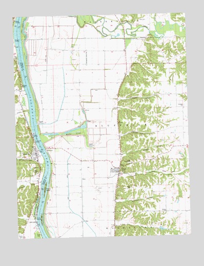
Kampsville, IL USGS Topographic Map
Click on map above to begin viewing in our Map Viewer.

This topographic map contains these locations and features:
Feature Name Type Latitude Longitude GNIS ID View Map
Apple CreekStreamN39.3620°W90.6198°403577View Map
Bests PondReservoirN39.2539°W90.5208°1692295View Map
Bests Pond DamDamN39.2534°W90.5235°1692294View Map
BoylePopulated PlaceN39.2834°W90.5773°422492View Map
Bushnell HollowValleyN39.2698°W90.5544°405286View Map
Calhoun Junior High SchoolSchoolN39.2937°W90.6098°1808828View Map
Campbell LandingLocaleN39.3333°W90.6167°2680988View Map
Christian Grove School (historical)SchoolN39.2709°W90.5173°406094View Map
ClarkPopulated PlaceN39.2598°W90.5779°422555View Map
Columbiana (historical)Populated PlaceN39.2973°W90.6004°1811013View Map
Columbiana School (historical)SchoolN39.3012°W90.6026°406413View Map
Cooke RanchFlatN39.2703°W90.5946°406507View Map
Crater IslandIslandN39.2617°W90.6076°406748View Map
Crater LandingLocaleN39.2587°W90.6112°1748286View Map
Crawford CreekStreamN39.2798°W90.6076°406757View Map
Crooked CreekStreamN39.3698°W90.5210°406811View Map
East Panther CreekStreamN39.3656°W90.6248°407680View Map
EldredPopulated PlaceN39.2875°W90.5523°407851View Map
Eldred CemeteryCemeteryN39.3139°W90.5515°1748357View Map
Eldred Fire DepartmentBuildingN39.2863°W90.5531°2640930View Map
Eldred HollowValleyN39.3071°W90.5501°407852View Map
Eldred Memorial GardensCemeteryN39.2914°W90.5432°1748358View Map
Eldred Post OfficePost OfficeN39.2860°W90.5525°2788401View Map
Fairbanks Pumping StationLocaleN39.3153°W90.6090°424881View Map
Fairbanks RanchFlatN39.3414°W90.5812°408157View Map
Farrow CemeteryCemeteryN39.3006°W90.6129°1748292View Map
HaypressBuildingN39.3614°W90.5348°422481View Map
Herschberger Landing Strip (historical)AirportN39.3514°W90.5726°1748372View Map
Hurricane CreekStreamN39.3042°W90.6062°410713View Map
KampsvillePopulated PlaceN39.2978°W90.6090°411293View Map
Kampsville HollowValleyN39.2946°W90.6098°411294View Map
Kampsville LandingLocaleN39.3042°W90.6112°1748300View Map
Kampsville Post OfficePost OfficeN39.2995°W90.6113°2788437View Map
Keach School (historical)SchoolN39.3562°W90.5787°411333View Map
Langes LandingLocaleN39.3081°W90.6123°1748303View Map
Mulberry CemeteryCemeteryN39.2642°W90.5176°1748392View Map
North Calhoun Fire Protection District Station 1BuildingN39.2950°W90.6091°2640261View Map
Pacific Union School (historical)SchoolN39.2998°W90.5076°415286View Map
Perrins LedgeCliffN39.3356°W90.6223°415556View Map
Potato Prairie Lake (historical)LakeN39.2792°W90.5879°1811020View Map
Retzers LandingLocaleN39.3614°W90.6240°1748320View Map
Richwoods School (historical)SchoolN39.3303°W90.5082°416624View Map
Richwoods West CemeteryCemeteryN39.3223°W90.5048°1748410View Map
Robley HollowValleyN39.3273°W90.5505°416780View Map
Robley School (historical)SchoolN39.3264°W90.5496°416781View Map
Rollins CemeteryCemeteryN39.3720°W90.5293°1748414View Map
Saint Anselm CemeteryCemeteryN39.2987°W90.6159°1748324View Map
Schumann CemeteryCemeteryN39.2873°W90.6098°1748326View Map
Shaffer HollowValleyN39.2962°W90.5491°418268View Map
Silver CreekStreamN39.3212°W90.6160°418501View Map
Sutter LakeSwampN39.2501°W90.6108°419438View Map
The Adwell Corporation Airport (historical)AirportN39.3473°W90.6026°427249View Map
Township of BluffdaleCivilN39.3137°W90.5487°428690View Map
Village of EldredCivilN39.2862°W90.5540°2398797View Map
Village of KampsvilleCivilN39.2971°W90.6127°2398323View Map
Webbs LandingLocaleN39.3723°W90.6232°1748335View Map
Willow IslandIslandN39.2789°W90.6043°421251View Map
Woods CreekStreamN39.3339°W90.6173°421477View Map

Note: Coordinates in the location and feature list above are referenced to NAD83 datum.


Copyright (C) 2008-2025 Ryan Niemi / Sunset Dynamics ... All Rights Reserved