TopoQuest Logo
Do you find TopoQuest useful?
Help keep TopoQuest running and adding new maps/features by donating!
Bitcoin:  19c7KJd3qBynnjoSw5npx9KScwjBe4ifkT
Litecoin:  LXs6TkuXGGXo1vDsWCkWVdjQX94eUKd6ui
Home View Maps Find Maps Find Places Resources & Links


Carrville, Alabama Topographic Map

USGS Map Title: Carrville, AL
USGS Map MRC: 32085E7
DRG (GeoTIFF) Download: o32085e7.tif


Neighboring USGS Topographic Map Quads:


  Red Hill, AL  
32085F8
 

  Ponders, AL  
32085F7
 

  Thornton, AL  
32085F6
 

  Tallassee, AL  
32085E8
 

  Carrville, AL  
32085E7
 

  Notasulga, AL  
32085E6
 

  Shorter, AL  
32085D8
 

  La Place, AL  
32085D7
 

  Tuskegee, AL  
32085D6


Map MRC Location:

N33°
W86°
N33°
W85°
H8 H7 H6 H5 H4 H3 H2 H1
G8 G7 G6 G5 G4 G3 G2 G1
F8 F7 F6 F5 F4 F3 F2 F1
E8 E7 E6 E5 E4 E3 E2 E1
D8 D7 D6 D5 D4 D3 D2 D1
C8 C7 C6 C5 C4 C3 C2 C1
B8 B7 B6 B5 B4 B3 B2 B1
A8 A7 A6 A5 A4 A3 A2 A1
N32°
W86°
N32°
W85°

Carrville, AL USGS 1:24K Topographic Map Preview:
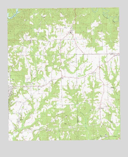
Carrville, AL USGS Topographic Map
Click on map above to begin viewing in our Map Viewer.

This topographic map contains these locations and features:
Feature Name Type Latitude Longitude GNIS ID View Map
Ashurot Mill (historical)LocaleN32.5107°W85.8616°137367View Map
Baxley HillSummitN32.5157°W85.8100°113580View Map
Broach MillPopulated PlaceN32.5487°W85.7566°156115View Map
BuckvillePopulated PlaceN32.5210°W85.8636°115149View Map
Calvary Baptist ChurchChurchN32.5549°W85.8480°158803View Map
CarrvillePopulated PlaceN32.5499°W85.8700°115652View Map
Elam ChurchChurchN32.5565°W85.8269°117904View Map
Gauntts Mill (historical)LocaleN32.5244°W85.8511°137431View Map
GolddustPopulated PlaceN32.5637°W85.7811°119091View Map
Golddust School (historical)SchoolN32.5624°W85.7802°134020View Map
Hicks Chapel School (historical)SchoolN32.5682°W85.8111°158695View Map
Jackson School (historical)SchoolN32.5699°W85.7719°134027View Map
Liberty CemeteryCemeteryN32.5793°W85.7561°137118View Map
Liberty United Methodist ChurchChurchN32.5787°W85.7558°137119View Map
Macedonia ChurchChurchN32.5835°W85.8594°158863View Map
Mount Heeren ChurchChurchN32.5732°W85.7652°163661View Map
Muck CreekStreamN32.5196°W85.7886°134042View Map
New Zion ChurchChurchN32.5107°W85.8333°137486View Map
Oak Heights ChurchChurchN32.5357°W85.8744°137489View Map
Old Hicks Chapel ChurchChurchN32.5682°W85.8111°137492View Map
ReeltownPopulated PlaceN32.6037°W85.8052°158909View Map
Reeltown - Macedonia Fire DepartmentBuildingN32.5799°W85.8621°2691193View Map
Reeltown CemeteryCemeteryN32.6010°W85.8055°137507View Map
Reeltown Census Designated PlaceCensusN32.5788°W85.8189°2582697View Map
Reeltown ChurchChurchN32.6010°W85.8050°137508View Map
Reeltown High SchoolSchoolN32.6021°W85.8050°137509View Map
Reeltown Volunteer Fire DepartmentBuildingN32.6028°W85.8039°2691224View Map
Sharon Primitive Baptist ChurchChurchN32.5946°W85.8500°158922View Map
Simmons School (historical)SchoolN32.5146°W85.7688°134058View Map
SmithPopulated PlaceN32.5262°W85.8147°158709View Map
Smith ChurchChurchN32.5226°W85.8108°127016View Map
Smith SchoolSchoolN32.5226°W85.8105°158710View Map
Sycamore CreekStreamN32.6174°W85.7502°153635View Map
Tallapoosa CityPopulated PlaceN32.5515°W85.8486°137540View Map
Tallassee DivisionCivilN32.6072°W85.8080°165969View Map
Tallassee Fire Department Station 2BuildingN32.5501°W85.8707°2691463View Map
The BarroomLocaleN32.5104°W85.8316°127792View Map
WACQ-AM (Carrville)TowerN32.5562°W85.8713°160976View Map
WoodlandPopulated PlaceN32.5299°W85.7727°129192View Map
Woodland CemeteryCemeteryN32.5301°W85.7730°137130View Map
Woodland ChurchChurchN32.5301°W85.7730°134072View Map

Note: Coordinates in the location and feature list above are referenced to NAD83 datum.


Copyright (C) 2008-2025 Ryan Niemi / Sunset Dynamics ... All Rights Reserved