TopoQuest Logo
Do you find TopoQuest useful?
Help keep TopoQuest running and adding new maps/features by donating!
Bitcoin:  19c7KJd3qBynnjoSw5npx9KScwjBe4ifkT
Litecoin:  LXs6TkuXGGXo1vDsWCkWVdjQX94eUKd6ui
Home View Maps Find Maps Find Places Resources & Links


Eden, Mississippi Topographic Map

USGS Map Title: Eden, MS
USGS Map MRC: 32090H3
DRG (GeoTIFF) Download: o32090h3.tif


Neighboring USGS Topographic Map Quads:


  Silver City, MS  
33090A4
 

  Thornton, MS  
33090A3
 

  Howard, MS  
33090A2
 

  Carter, MS  
32090H4
 

  Eden, MS  
32090H3
 

  Zeiglerville, MS  
32090H2
 

  Yazoo City, MS  
32090G4
 

  Benton, MS  
32090G3
 

  Linwood, MS  
32090G2


Map MRC Location:

N33°
W91°
N33°
W90°
H8 H7 H6 H5 H4 H3 H2 H1
G8 G7 G6 G5 G4 G3 G2 G1
F8 F7 F6 F5 F4 F3 F2 F1
E8 E7 E6 E5 E4 E3 E2 E1
D8 D7 D6 D5 D4 D3 D2 D1
C8 C7 C6 C5 C4 C3 C2 C1
B8 B7 B6 B5 B4 B3 B2 B1
A8 A7 A6 A5 A4 A3 A2 A1
N32°
W91°
N32°
W90°

Eden, MS USGS 1:24K Topographic Map Preview:
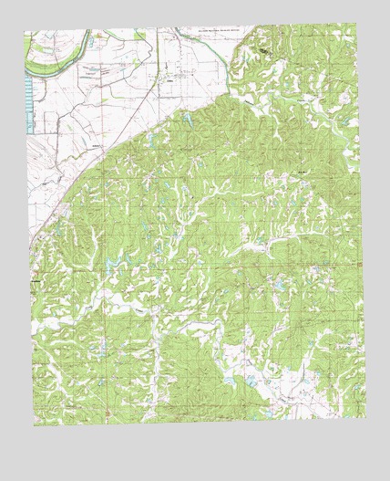
Eden, MS USGS Topographic Map
Click on map above to begin viewing in our Map Viewer.

This topographic map contains these locations and features:
Feature Name Type Latitude Longitude GNIS ID View Map
Coleman Ponds DamDamN32.9318°W90.3318°681743View Map
Dead Man BayouStreamN32.9857°W90.3712°669164View Map
Double Springs ChurchChurchN32.8807°W90.3215°669350View Map
Dover (historical)Populated PlaceN32.9876°W90.3709°707846View Map
Dover LandingLocaleN32.9851°W90.3693°707847View Map
EdenPopulated PlaceN32.9849°W90.3234°669664View Map
Eden Baptist ChurchChurchN32.9849°W90.3215°686664View Map
Eden Creek Watershed Number 10 DamDamN32.9668°W90.3168°681765View Map
Eden Creek Watershed Y-370-3 DamDamN32.9668°W90.3218°681766View Map
Eden Volunteer Fire DepartmentBuildingN32.9842°W90.3248°2665788View Map
Fouche Lake DamDamN32.8885°W90.2901°681728View Map
Free RunPopulated PlaceN32.9521°W90.2743°683134View Map
Hardshell CemeteryCemeteryN32.9198°W90.2870°670907View Map
Ingersoll LakeSwampN32.9857°W90.3470°671707View Map
Ingersols LandingLocaleN32.9854°W90.3643°707875View Map
Johnston Lake DamDamN32.9551°W90.3251°681759View Map
Morning Star ChurchChurchN32.9796°W90.3259°673834View Map
New Foundation ChurchChurchN32.9393°W90.3670°674620View Map
Old CreekStreamN32.9801°W90.3701°675176View Map
Pearce (historical)Populated PlaceN32.8912°W90.3445°686681View Map
Piney Creek Watershed Structure 23 DamDamN32.8801°W90.2851°681721View Map
Piney Creek Watershed Y-38-3 DamDamN32.9235°W90.3501°681740View Map
Piney Creek Watershed Y-38-35 DamDamN32.8901°W90.3001°681729View Map
Piney Watershed Y-38-33 DamDamN32.8868°W90.2718°681727View Map
Pleasant Hill ChurchChurchN32.9579°W90.3393°676071View Map
Rocky Springs ChurchChurchN32.9507°W90.2684°676806View Map
Sheppards LandingLocaleN32.9882°W90.3593°707908View Map
Strickland Lake DamDamN32.9468°W90.3101°681754View Map
Supervisor District 4CivilN32.9212°W90.2681°712155View Map
Tranquil ChurchChurchN32.9240°W90.2909°678854View Map
Van Land LandingLocaleN32.9890°W90.3598°707917View Map
Village of EdenCivilN32.9837°W90.3240°2407447View Map
ZelleriaPopulated PlaceN32.9637°W90.3495°692336View Map

Note: Coordinates in the location and feature list above are referenced to NAD83 datum.


Copyright (C) 2008-2024 Ryan Niemi / Sunset Dynamics ... All Rights Reserved