TopoQuest Logo
Do you find TopoQuest useful?
Help keep TopoQuest running and adding new maps/features by donating!
Bitcoin:  19c7KJd3qBynnjoSw5npx9KScwjBe4ifkT
Litecoin:  LXs6TkuXGGXo1vDsWCkWVdjQX94eUKd6ui
Home View Maps Find Maps Find Places Resources & Links


Carterville, Mississippi Topographic Map

USGS Map Title: Carterville, MS
USGS Map MRC: 31089C2
DRG (GeoTIFF) Download: o31089c2.tif


Neighboring USGS Topographic Map Quads:


  Eastabuchie, MS  
31089D3
 

  Barrontown, MS  
31089D2
 

  Ovett, MS  
31089D1
 

  Hattiesburg, MS  
31089C3
 

  Carterville, MS  
31089C2
 

  Ovett SE, MS  
31089C1
 

  Dixie, MS  
31089B3
 

  McLaurin, MS  
31089B2
 

  New Augusta, MS  
31089B1


Map MRC Location:

N32°
W90°
N32°
W89°
H8 H7 H6 H5 H4 H3 H2 H1
G8 G7 G6 G5 G4 G3 G2 G1
F8 F7 F6 F5 F4 F3 F2 F1
E8 E7 E6 E5 E4 E3 E2 E1
D8 D7 D6 D5 D4 D3 D2 D1
C8 C7 C6 C5 C4 C3 C2 C1
B8 B7 B6 B5 B4 B3 B2 B1
A8 A7 A6 A5 A4 A3 A2 A1
N31°
W90°
N31°
W89°

Carterville, MS USGS 1:24K Topographic Map Preview:
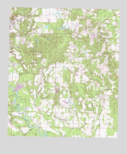
Carterville, MS USGS Topographic Map
Click on map above to begin viewing in our Map Viewer.

This topographic map contains these locations and features:
Feature Name Type Latitude Longitude GNIS ID View Map
Aldrich LakeLakeN31.2846°W89.2366°666182View Map
Annie Carter LakeLakeN31.2537°W89.2078°666276View Map
Asbury United Methodist ChurchChurchN31.3515°W89.1921°2596571View Map
BatsonPopulated PlaceN31.2691°W89.1959°691686View Map
Beach Church (historical)ChurchN31.3643°W89.1595°683880View Map
Betsy BranchStreamN31.2582°W89.1678°667034View Map
Buzzard BayLakeN31.3597°W89.1316°667870View Map
Calvary Baptist ChurchChurchN31.3510°W89.2075°2596573View Map
Carters CreekStreamN31.2582°W89.2151°668119View Map
CartervillePopulated PlaceN31.3199°W89.2462°668122View Map
Carterville Baptist ChurchChurchN31.3210°W89.2467°683889View Map
Church of Christ of PetalChurchN31.3519°W89.1726°2596329View Map
City of PetalCivilN31.3477°W89.2359°2404508View Map
CorinthPopulated PlaceN31.3438°W89.1398°691788View Map
Corinth ChurchChurchN31.3693°W89.1306°668831View Map
Crestview Baptist ChurchChurchN31.3488°W89.2398°668946View Map
Dry ProngStreamN31.3127°W89.2259°669457View Map
E C Simmons Lake DamDamN31.2818°W89.1751°680641View Map
E C Simmons Lake DamDamN31.2852°W89.1817°680643View Map
East Petal Baptist ChurchChurchN31.3517°W89.1741°2596744View Map
East Pine ChurchChurchN31.3505°W89.2248°669598View Map
EastsidePopulated PlaceN31.2821°W89.1937°706339View Map
Edwards Lake DamDamN31.2835°W89.1817°680642View Map
First Baptist Church of PetalChurchN31.3495°W89.2186°2596988View Map
First Pentecostal ChurchChurchN31.3564°W89.2485°2596330View Map
Forrest Memorial GardensCemeteryN31.3221°W89.2495°670105View Map
Four PointsPopulated PlaceN31.2513°W89.1862°691873View Map
Gay's Mobile Home ParkPopulated PlaceN31.3353°W89.1791°2596721View Map
GoodluckPopulated PlaceN31.3268°W89.1564°691894View Map
Grant CemeteryCemeteryN31.3721°W89.2348°670590View Map
Grantham BayFlatN31.3705°W89.1362°670592View Map
Greens Creek Baptist ChurchChurchN31.3574°W89.2492°670709View Map
H D and R Ranch DamDamN31.3652°W89.1917°680686View Map
H L Womack Lake DamDamN31.3485°W89.1984°680677View Map
Hillcrest CemeteryCemeteryN31.3424°W89.2470°671214View Map
Indian SpringsPopulated PlaceN31.2977°W89.1378°691956View Map
Indian Springs Baptist ChurchChurchN31.2968°W89.1373°683355View Map
Jacobs CreekStreamN31.2543°W89.2156°693596View Map
Jessie Bruce Pond DamDamN31.3685°W89.1701°680687View Map
Leo Turner Pond DamDamN31.3502°W89.1601°680678View Map
Lotts CreekStreamN31.2993°W89.2395°672892View Map
Lynn Ray Road Baptist ChurchChurchN31.3741°W89.2498°2596457View Map
Mount Vernon Baptist ChurchChurchN31.3507°W89.2292°674293View Map
Mount Zion ChurchChurchN31.2907°W89.1412°674330View Map
Myers CreekStreamN31.2585°W89.2209°694141View Map
Owens Bluff LakeLakeN31.2762°W89.2414°675345View Map
Penn BranchStreamN31.2996°W89.1426°675591View Map
Petal Fire Department Station 3BuildingN31.3508°W89.2010°2667840View Map
Petal Recreational ClubBuildingN31.3396°W89.2351°2596949View Map
Pine GrovePopulated PlaceN31.2782°W89.1806°692144View Map
Pine Grove CemeteryCemeteryN31.2646°W89.1767°675811View Map
Piney Grove Missionary Baptist ChurchChurchN31.2758°W89.1799°2596879View Map
Priests CreekStreamN31.2677°W89.2312°676340View Map
Rice Patch BranchStreamN31.2652°W89.1514°676626View Map
Rivers of Life ChurchChurchN31.3171°W89.2428°2596458View Map
Sims LakeLakeN31.2667°W89.2246°677836View Map
Smith Pond DamDamN31.3168°W89.2184°680655View Map
SunrisePopulated PlaceN31.3124°W89.2139°692251View Map
Sunrise Baptist ChurchChurchN31.3132°W89.2148°683956View Map
Sunrise SchoolSchoolN31.3168°W89.2073°678435View Map
Sunrise Volunteer Fire DepartmentBuildingN31.3077°W89.2131°2667918View Map
Supervisor District 3CivilN31.3460°W89.2044°711845View Map
Tom Ray Phillips Lake DamDamN31.3235°W89.1967°680663View Map
Tom Ray Phillips Lake DamDamN31.3285°W89.1934°680665View Map
Twin Pines Country ClubLocaleN31.3475°W89.1859°2596218View Map
Wedgeworth CreekStreamN31.2699°W89.2245°679419View Map
Wedgeworth LakeLakeN31.2785°W89.2320°679420View Map

Note: Coordinates in the location and feature list above are referenced to NAD83 datum.


Copyright (C) 2008-2025 Ryan Niemi / Sunset Dynamics ... All Rights Reserved