TopoQuest Logo
Do you find TopoQuest useful?
Help keep TopoQuest running and adding new maps/features by donating!
Bitcoin:  19c7KJd3qBynnjoSw5npx9KScwjBe4ifkT
Litecoin:  LXs6TkuXGGXo1vDsWCkWVdjQX94eUKd6ui
Home View Maps Find Maps Find Places Resources & Links


Carthage, Indiana Topographic Map

USGS Map Title: Carthage, IN
USGS Map MRC: 39085F5
DRG (GeoTIFF) Download: o39085f5.tif


Neighboring USGS Topographic Map Quads:


  Cleveland, IN  
39085G6
 

  Knightstown, IN  
39085G5
 

  Dunreith, IN  
39085G4
 

  Morristown, IN  
39085F6
 

  Carthage, IN  
39085F5
 

  Mays, IN  
39085F4
 

  Rays Crossing, IN  
39085E6
 

  Manilla, IN  
39085E5
 

  Rushville, IN  
39085E4


Map MRC Location:

N40°
W86°
N40°
W85°
H8 H7 H6 H5 H4 H3 H2 H1
G8 G7 G6 G5 G4 G3 G2 G1
F8 F7 F6 F5 F4 F3 F2 F1
E8 E7 E6 E5 E4 E3 E2 E1
D8 D7 D6 D5 D4 D3 D2 D1
C8 C7 C6 C5 C4 C3 C2 C1
B8 B7 B6 B5 B4 B3 B2 B1
A8 A7 A6 A5 A4 A3 A2 A1
N39°
W86°
N39°
W85°

Carthage, IN USGS 1:24K Topographic Map Preview:
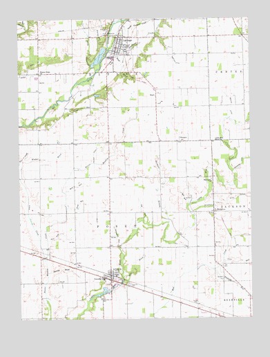
Carthage, IN USGS Topographic Map
Click on map above to begin viewing in our Map Viewer.

This topographic map contains these locations and features:
Feature Name Type Latitude Longitude GNIS ID View Map
ArlingtonPopulated PlaceN39.6425°W85.5764°430245View Map
Arlington Census Designated PlaceCensusN39.6458°W85.5796°2629872View Map
Arlington Elementary SchoolSchoolN39.6417°W85.5803°447131View Map
Arlington RunStreamN39.6542°W85.5714°430250View Map
Ball CemeteryCemeteryN39.6731°W85.5325°430457View Map
Ball RunStreamN39.6717°W85.5344°430462View Map
Bea RunStreamN39.6578°W85.6100°430597View Map
BoydPopulated PlaceN39.7187°W85.5511°431420View Map
Boyd BrookStreamN39.7362°W85.5722°431422View Map
Cap RunStreamN39.6659°W85.5580°432117View Map
CarthagePopulated PlaceN39.7384°W85.5719°432194View Map
Carthage CreekStreamN39.7373°W85.5758°432196View Map
Carthage Elementary SchoolSchoolN39.7387°W85.5655°447060View Map
Carthage Police DepartmentBuildingN39.7391°W85.5710°2758098View Map
Carthage Volunteer Fire DepartmentBuildingN39.7347°W85.5734°2625859View Map
Circle RunStreamN39.7187°W85.5955°432530View Map
Dill DitchCanalN39.6556°W85.5375°433549View Map
East Hill CemeteryCemeteryN39.6394°W85.5650°433911View Map
FarmersPopulated PlaceN39.6989°W85.5372°434397View Map
Farmers StreamStreamN39.6653°W85.5447°434405View Map
Fayette Central Elementary SchoolSchoolN39.6856°W85.6183°434423View Map
Frank Alexander LakeReservoirN39.7182°W85.5828°447673View Map
Frank Alexander Lake DamDamN39.7184°W85.5850°447674View Map
Goose CreekStreamN39.7484°W85.5730°435195View Map
Hannegan ChurchChurchN39.6820°W85.5214°435693View Map
HendersonPopulated PlaceN39.6695°W85.5203°436004View Map
Henderson DitchCanalN39.6734°W85.5161°436011View Map
Herkless DitchCanalN39.7314°W85.5397°436054View Map
Hill BrookStreamN39.6420°W85.5694°436183View Map
Linn CreekStreamN39.6495°W85.6114°437964View Map
Little Blue River ChurchChurchN39.6992°W85.5191°437997View Map
Miles CreekStreamN39.7481°W85.6214°439135View Map
Newhouse DitchCanalN39.6892°W85.5050°440140View Map
North Carthage CreekStreamN39.7439°W85.5675°440230View Map
Osco RunStreamN39.6489°W85.5153°440720View Map
Posey Township Volunteer Fire DepartmentBuildingN39.6445°W85.5865°2626407View Map
Pump RunStreamN39.6775°W85.5997°441641View Map
Reddick DitchCanalN39.7128°W85.5100°441828View Map
Ripley RunStreamN39.7389°W85.5766°442058View Map
Riverside BrookStreamN39.7242°W85.5930°442083View Map
Riverside CemeteryCemeteryN39.7446°W85.5765°442086View Map
Rushing RunStreamN39.6453°W85.5205°442409View Map
Stanley BrookStreamN39.6445°W85.6100°444061View Map
Stevens Farms AirportAirportN39.6588°W85.5493°2677085View Map
Town of CarthageCivilN39.7367°W85.5714°2396629View Map
Township of PoseyCivilN39.6548°W85.5764°453765View Map
Township of RipleyCivilN39.7425°W85.5775°453804View Map
Walker BrookStreamN39.6912°W85.6233°445370View Map
Walker DitchCanalN39.6931°W85.5844°445376View Map
Walnut Ridge ChurchChurchN39.7281°W85.6133°445441View Map
Well RunStreamN39.6775°W85.6000°445661View Map

Note: Coordinates in the location and feature list above are referenced to NAD83 datum.


Copyright (C) 2008-2024 Ryan Niemi / Sunset Dynamics ... All Rights Reserved