TopoQuest Logo
Do you find TopoQuest useful?
Help keep TopoQuest running and adding new maps/features by donating!
Bitcoin:  19c7KJd3qBynnjoSw5npx9KScwjBe4ifkT
Litecoin:  LXs6TkuXGGXo1vDsWCkWVdjQX94eUKd6ui
Home View Maps Find Maps Find Places Resources & Links


Cleveland, Indiana Topographic Map

USGS Map Title: Cleveland, IN
USGS Map MRC: 39085G6
DRG (GeoTIFF) Download: o39085g6.tif


Neighboring USGS Topographic Map Quads:


  Ingalls, IN  
39085H7
 

  Pendleton, IN  
39085H6
 

  Shirley, IN  
39085H5
 

  Greenfield, IN  
39085G7
 

  Cleveland, IN  
39085G6
 

  Knightstown, IN  
39085G5
 

  Fountaintown, IN  
39085F7
 

  Morristown, IN  
39085F6
 

  Carthage, IN  
39085F5


Map MRC Location:

N40°
W86°
N40°
W85°
H8 H7 H6 H5 H4 H3 H2 H1
G8 G7 G6 G5 G4 G3 G2 G1
F8 F7 F6 F5 F4 F3 F2 F1
E8 E7 E6 E5 E4 E3 E2 E1
D8 D7 D6 D5 D4 D3 D2 D1
C8 C7 C6 C5 C4 C3 C2 C1
B8 B7 B6 B5 B4 B3 B2 B1
A8 A7 A6 A5 A4 A3 A2 A1
N39°
W86°
N39°
W85°

Cleveland, IN USGS 1:24K Topographic Map Preview:
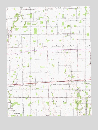
Cleveland, IN USGS Topographic Map
Click on map above to begin viewing in our Map Viewer.

This topographic map contains these locations and features:
Feature Name Type Latitude Longitude GNIS ID View Map
Baptist-Braddock CemeteryCemeteryN39.8631°W85.6956°2585702View Map
Barrett CemeteryCemeteryN39.8528°W85.7383°430533View Map
Browns ChapelChurchN39.7995°W85.6894°431639View Map
Caldwell CemeteryCemeteryN39.7872°W85.7173°431950View Map
ClevelandPopulated PlaceN39.7903°W85.6447°432645View Map
Curry ChapelChurchN39.8364°W85.7328°433255View Map
Gilboa CemeteryCemeteryN39.7755°W85.6528°435066View Map
Greenfield Country ClubLocaleN39.7795°W85.7472°452331View Map
Hinchman CemeteryCemeteryN39.7590°W85.7494°436229View Map
Lost Forty Tree FarmLocaleN39.8500°W85.7214°2635435View Map
Nameless Creek ChurchChurchN39.8417°W85.6550°439931View Map
Oakes FieldAirportN39.7883°W85.6358°2676959View Map
Pleasant HillPopulated PlaceN39.8662°W85.6872°452148View Map
Pleasant View CemeteryCemeteryN39.7570°W85.6328°441337View Map
Pope FieldAirportN39.7871°W85.7356°449185View Map
Pratt CemeteryCemeteryN39.8684°W85.7288°441570View Map
RileyPopulated PlaceN39.7870°W85.7305°442016View Map
Simmons CemeteryCemeteryN39.8614°W85.6642°443522View Map
StringtownPopulated PlaceN39.7881°W85.7080°444271View Map
Township of JacksonCivilN39.8295°W85.6528°453447View Map
WestlandPopulated PlaceN39.7503°W85.6878°447628View Map
Willow BranchStreamN39.8637°W85.6997°446096View Map

Note: Coordinates in the location and feature list above are referenced to NAD83 datum.


Copyright (C) 2008-2025 Ryan Niemi / Sunset Dynamics ... All Rights Reserved