TopoQuest Logo
Do you find TopoQuest useful?
Help keep TopoQuest running and adding new maps/features by donating!
Bitcoin:  19c7KJd3qBynnjoSw5npx9KScwjBe4ifkT
Litecoin:  LXs6TkuXGGXo1vDsWCkWVdjQX94eUKd6ui
Home View Maps Find Maps Find Places Resources & Links


Casa Salazar, New Mexico Topographic Map

USGS Map Title: Casa Salazar, NM
USGS Map MRC: 35107D1
DRG (GeoTIFF) Download: o35107d1.tif


Neighboring USGS Topographic Map Quads:


  Guadalupe, NM  
35107E2
 

  Cabezon Peak, NM  
35107E1
 

  Ojito Spring, NM  
35106E8
 

  Cerro Tinaja, NM  
35107D2
 

  Casa Salazar, NM  
35107D1
 

  Collier Draw, NM  
35106D8
 

  La Gotera, NM  
35107C2
 

  Puerco Dam, NM  
35107C1
 

  San Felipe Mesa, NM  
35106C8


Map MRC Location:

N36°
W108°
N36°
W107°
H8 H7 H6 H5 H4 H3 H2 H1
G8 G7 G6 G5 G4 G3 G2 G1
F8 F7 F6 F5 F4 F3 F2 F1
E8 E7 E6 E5 E4 E3 E2 E1
D8 D7 D6 D5 D4 D3 D2 D1
C8 C7 C6 C5 C4 C3 C2 C1
B8 B7 B6 B5 B4 B3 B2 B1
A8 A7 A6 A5 A4 A3 A2 A1
N35°
W108°
N35°
W107°

Casa Salazar, NM USGS 1:24K Topographic Map Preview:
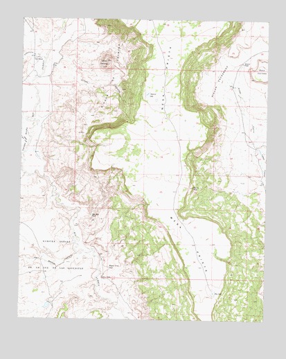
Casa Salazar, NM USGS Topographic Map
Click on map above to begin viewing in our Map Viewer.

This topographic map contains these locations and features:
Feature Name Type Latitude Longitude GNIS ID View Map
Big Bead MesaSummitN35.4833°W107.1156°935209View Map
Caņada AnchaValleyN35.4553°W107.1214°904434View Map
Caņada GonzalesStreamN35.4798°W107.1139°897729View Map
Caņon Jara LosoValleyN35.4481°W107.1220°904655View Map
CaņoncitoValleyN35.4834°W107.1139°904712View Map
Casa SalazarPopulated PlaceN35.4834°W107.1162°915806View Map
Casa Salazar Post Office (historical)Post OfficeN35.4834°W107.1162°938136View Map
Cerrito CochinoSummitN35.4828°W107.0820°897864View Map
Dry LakeLakeN35.3864°W107.0267°888535View Map
Hay Meadow CanyonValleyN35.4025°W107.0962°906885View Map
Mesa CortadaSummitN35.4767°W107.0012°898677View Map
Miguel Urrea TankReservoirN35.3968°W107.0799°892032View Map
Natural LakeLakeN35.4688°W107.0617°892381View Map
Rincon De CochinoAreaN35.4773°W107.0781°893931View Map
Rincon EntranosoAreaN35.4742°W107.0262°893934View Map
Rincon TankReservoirN35.4822°W107.0129°893955View Map
Sam Hill TankReservoirN35.4183°W107.0890°894384View Map
Squaw PeakSummitN35.4300°W107.0373°895285View Map

Note: Coordinates in the location and feature list above are referenced to NAD83 datum.


Copyright (C) 2008-2025 Ryan Niemi / Sunset Dynamics ... All Rights Reserved