TopoQuest Logo
Do you find TopoQuest useful?
Help keep TopoQuest running and adding new maps/features by donating!
Bitcoin:  19c7KJd3qBynnjoSw5npx9KScwjBe4ifkT
Litecoin:  LXs6TkuXGGXo1vDsWCkWVdjQX94eUKd6ui
Home View Maps Find Maps Find Places Resources & Links


Guadalupe, New Mexico Topographic Map

USGS Map Title: Guadalupe, NM
USGS Map MRC: 35107E2
DRG (GeoTIFF) Download: o35107e2.tif


Neighboring USGS Topographic Map Quads:


  Canada Calladita, NM  
35107F3
 

  Arroyo Empedrado, NM  
35107F2
 

  San Luis, NM  
35107F1
 

  Cerro Parido, NM  
35107E3
 

  Guadalupe, NM  
35107E2
 

  Cabezon Peak, NM  
35107E1
 

  Laguna Seca, NM  
35107D3
 

  Cerro Tinaja, NM  
35107D2
 

  Casa Salazar, NM  
35107D1


Map MRC Location:

N36°
W108°
N36°
W107°
H8 H7 H6 H5 H4 H3 H2 H1
G8 G7 G6 G5 G4 G3 G2 G1
F8 F7 F6 F5 F4 F3 F2 F1
E8 E7 E6 E5 E4 E3 E2 E1
D8 D7 D6 D5 D4 D3 D2 D1
C8 C7 C6 C5 C4 C3 C2 C1
B8 B7 B6 B5 B4 B3 B2 B1
A8 A7 A6 A5 A4 A3 A2 A1
N35°
W108°
N35°
W107°

Guadalupe, NM USGS 1:24K Topographic Map Preview:
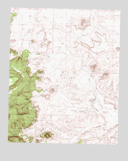
Guadalupe, NM USGS Topographic Map
Click on map above to begin viewing in our Map Viewer.

This topographic map contains these locations and features:
Feature Name Type Latitude Longitude GNIS ID View Map
Abra de los CerrosValleyN35.5586°W107.1584°885538View Map
Aranda TankReservoirN35.5795°W107.1368°903261View Map
Arroyo ChicoArroyoN35.5917°W107.1867°903366View Map
Canada de las LomitasArroyoN35.6078°W107.2123°904355View Map
Caņon Chamisa LosaValleyN35.5336°W107.2495°904637View Map
Caņon GuadalupeValleyN35.5328°W107.1448°906756View Map
Cerro ChafoSummitN35.5898°W107.1278°904956View Map
Cerro Chamisa LosaSummitN35.5492°W107.2014°904957View Map
Cerro CuateSummitN35.6142°W107.1673°918137View Map
Cerro de GuadalupeSummitN35.5650°W107.1398°904934View Map
Cerro de Santa ClaraSummitN35.5723°W107.1537°904937View Map
Cerro del Ojo de las YeguasSummitN35.5667°W107.2123°904941View Map
Cerro del Ojo FrioSummitN35.5934°W107.2248°904942View Map
Cerro SaladoSummitN35.5064°W107.2062°933071View Map
Chamisa Losa SpringSpringN35.5402°W107.2280°905019View Map
Chamisa Losa Water WellWellN35.5573°W107.1998°921918View Map
Chamisa Wilderness Study AreaParkN35.5492°W107.2014°935829View Map
Cirillio Garcia Detention DamDamN35.6234°W107.1823°923857View Map
GuadalupePopulated PlaceN35.5414°W107.1514°915832View Map
Guadalupe CemeteryCemeteryN35.5359°W107.1542°906759View Map
Guadalupe Historic DistrictLocaleN35.5414°W107.1514°933585View Map
Guadalupe Ruin Historic SiteLocaleN35.5414°W107.1514°933414View Map
Guadalupe SpringsSpringN35.5304°W107.1643°906769View Map
Ignacio Chavez Wilderness Study AreaParkN35.5575°W107.2284°935859View Map
La Caņada de la LenaValleyN35.6023°W107.1748°885488View Map
La Caņada SantiagoValleyN35.6236°W107.1375°885489View Map
Laguna CuatesReservoirN35.6170°W107.2261°907774View Map
LoddyLocaleN35.5420°W107.1414°927335View Map
Loma PadreRidgeN35.5628°W107.1909°908134View Map
Ojo AtascosoSpringN35.5808°W107.2079°909306View Map
Ojo de las YeguasSpringN35.5703°W107.2128°909290View Map
Ojo de los JaramillosSpringN35.5678°W107.1565°909294View Map
Ojo del PadreSpringN35.5397°W107.1526°909300View Map
Ojo FrioSpringN35.5920°W107.2278°909317View Map
Ojo Frio OBS Water WellWellN35.5828°W107.2234°921905View Map
Rinconada del CochinoValleyN35.5436°W107.1445°910210View Map

Note: Coordinates in the location and feature list above are referenced to NAD83 datum.


Copyright (C) 2008-2024 Ryan Niemi / Sunset Dynamics ... All Rights Reserved