TopoQuest Logo
Do you find TopoQuest useful?
Help keep TopoQuest running and adding new maps/features by donating!
Bitcoin:  19c7KJd3qBynnjoSw5npx9KScwjBe4ifkT
Litecoin:  LXs6TkuXGGXo1vDsWCkWVdjQX94eUKd6ui
Home View Maps Find Maps Find Places Resources & Links


Cerro Tinaja, New Mexico Topographic Map

USGS Map Title: Cerro Tinaja, NM
USGS Map MRC: 35107D2
DRG (GeoTIFF) Download: o35107d2.tif


Neighboring USGS Topographic Map Quads:


  Cerro Parido, NM  
35107E3
 

  Guadalupe, NM  
35107E2
 

  Cabezon Peak, NM  
35107E1
 

  Laguna Seca, NM  
35107D3
 

  Cerro Tinaja, NM  
35107D2
 

  Casa Salazar, NM  
35107D1
 

  Marquez, NM  
35107C3
 

  La Gotera, NM  
35107C2
 

  Puerco Dam, NM  
35107C1


Map MRC Location:

N36°
W108°
N36°
W107°
H8 H7 H6 H5 H4 H3 H2 H1
G8 G7 G6 G5 G4 G3 G2 G1
F8 F7 F6 F5 F4 F3 F2 F1
E8 E7 E6 E5 E4 E3 E2 E1
D8 D7 D6 D5 D4 D3 D2 D1
C8 C7 C6 C5 C4 C3 C2 C1
B8 B7 B6 B5 B4 B3 B2 B1
A8 A7 A6 A5 A4 A3 A2 A1
N35°
W108°
N35°
W107°

Cerro Tinaja, NM USGS 1:24K Topographic Map Preview:
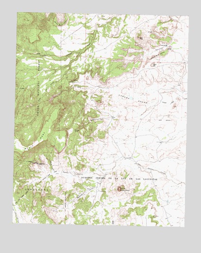
Cerro Tinaja, NM USGS Topographic Map
Click on map above to begin viewing in our Map Viewer.

This topographic map contains these locations and features:
Feature Name Type Latitude Longitude GNIS ID View Map
Badlands CanyonValleyN35.4048°W107.1848°903497View Map
Banco de la CasaSummitN35.4928°W107.2184°903527View Map
Caņon del PuenteValleyN35.4778°W107.2028°904596View Map
Cerro de Nuestra SeņoraSummitN35.3964°W107.1734°904935View Map
Cerro TinajaSummitN35.4861°W107.1612°905004View Map
Gonzales RanchLocaleN35.4825°W107.1412°906637View Map
Jara Loso SpringSpringN35.4313°W107.2071°907306View Map
Jaralosa SpringSpringN35.4278°W107.2056°924443View Map
Jaramosa CanyonValleyN35.4064°W107.2209°907318View Map
Juan Chullo WellWellN35.4156°W107.1703°907462View Map
Juan Jose RanchLocaleN35.4742°W107.2334°907467View Map
Lagunitas WellWellN35.3950°W107.1873°907821View Map
Mesita de la VentanaSummitN35.4770°W107.1453°908649View Map
Mesita LeonSummitN35.4703°W107.1514°908656View Map
North WindmillLocaleN35.4250°W107.1431°909209View Map
Ojo CanoaSpringN35.4546°W107.2443°909314View Map
Rancho Viejo SpringSpringN35.4753°W107.2341°914152View Map
Sanchez RanchLocaleN35.4592°W107.2078°910721View Map

Note: Coordinates in the location and feature list above are referenced to NAD83 datum.


Copyright (C) 2008-2025 Ryan Niemi / Sunset Dynamics ... All Rights Reserved