TopoQuest Logo
Do you find TopoQuest useful?
Help keep TopoQuest running and adding new maps/features by donating!
Bitcoin:  19c7KJd3qBynnjoSw5npx9KScwjBe4ifkT
Litecoin:  LXs6TkuXGGXo1vDsWCkWVdjQX94eUKd6ui
Home View Maps Find Maps Find Places Resources & Links


Edgewood, Texas Topographic Map

USGS Map Title: Edgewood, TX
USGS Map MRC: 32095F8
DRG (GeoTIFF) Download: o32095f8.tif


Neighboring USGS Topographic Map Quads:


  Ables Springs, TX  
32096G1
 

  Iron Bridge Dam, TX  
32095G8
 

  Emory South, TX  
32095G7
 

  Wills Point, TX  
32096F1
 

  Edgewood, TX  
32095F8
 

  Fruitvale, TX  
32095F7
 

  Cedarvale, TX  
32096E1
 

  Myrtle Springs, TX  
32095E8
 

  Canton, TX  
32095E7


Map MRC Location:

N33°
W96°
N33°
W95°
H8 H7 H6 H5 H4 H3 H2 H1
G8 G7 G6 G5 G4 G3 G2 G1
F8 F7 F6 F5 F4 F3 F2 F1
E8 E7 E6 E5 E4 E3 E2 E1
D8 D7 D6 D5 D4 D3 D2 D1
C8 C7 C6 C5 C4 C3 C2 C1
B8 B7 B6 B5 B4 B3 B2 B1
A8 A7 A6 A5 A4 A3 A2 A1
N32°
W96°
N32°
W95°

Edgewood, TX USGS 1:24K Topographic Map Preview:
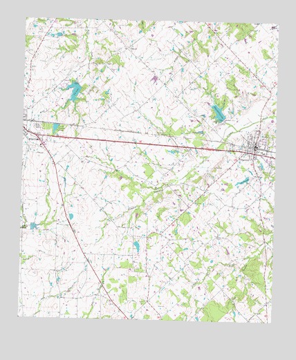
Edgewood, TX USGS Topographic Map
Click on map above to begin viewing in our Map Viewer.

This topographic map contains these locations and features:
Feature Name Type Latitude Longitude GNIS ID View Map
Callaway LakeReservoirN32.6585°W95.9436°1859874View Map
Callaway Lake DamDamN32.6585°W95.9436°1859873View Map
EdgewoodPopulated PlaceN32.6982°W95.8852°1335087View Map
Edgewood City HallBuildingN32.6984°W95.8858°2753517View Map
Edgewood City LakeReservoirN32.7120°W95.9037°1335090View Map
Edgewood City Lake DamDamN32.7085°W95.9019°1859869View Map
Edgewood Heritage Park MuseumBuildingN32.6990°W95.8852°2014415View Map
Edgewood Police DepartmentBuildingN32.6984°W95.8859°2751179View Map
Edgewood Post OfficePost OfficeN32.6991°W95.8867°2731686View Map
Edgewood Volunteer Fire DepartmentBuildingN32.6932°W95.8759°2655230View Map
Ellis Chapel CemeteryCemeteryN32.7337°W95.9177°1335329View Map
ElwoodPopulated PlaceN32.7385°W95.9497°1378259View Map
Fin and Feather Club Lake DamDamN32.7068°W95.9836°1859877View Map
Fin and Feathers Club LakeReservoirN32.7047°W95.9842°1335792View Map
Hamilton LakeReservoirN32.6668°W95.9752°1859876View Map
Hamilton Lake DamDamN32.6668°W95.9752°1859875View Map
Highland ChurchChurchN32.6290°W95.8830°1337730View Map
New Hope CemeteryCemeteryN32.6785°W95.9314°1342461View Map
Oak Hill CemeteryCemeteryN32.6976°W95.8911°1342988View Map
Old City LakeReservoirN32.6842°W95.8904°1343133View Map
Old City Lake DamDamN32.6851°W95.8886°1859871View Map
Raineys ChapelChurchN32.6601°W95.9036°1344716View Map
Reed Club LakeLakeN32.6901°W95.8816°1344994View Map
Rock BranchStreamN32.6521°W95.8864°1345357View Map
Rock Hill CemeteryCemeteryN32.6462°W95.9427°1345378View Map
Soil Conservation Service Site 104 DamDamN32.6635°W95.9969°1859867View Map
Soil Conservation Service Site 104 ReservoirReservoirN32.6635°W95.9969°1859868View Map
Sycamore BranchStreamN32.6624°W95.9983°1348160View Map
T P LakeReservoirN32.7203°W95.9751°1348187View Map
Town of EdgewoodCivilN32.6946°W95.8833°2412468View Map
Turner ChurchChurchN32.6446°W95.9816°1348909View Map
Van Zandt County Regional AirportAirportN32.6815°W95.9841°1387755View Map
White Rose CemeteryCemeteryN32.7046°W95.9930°1349988View Map
Willow LakeReservoirN32.7235°W95.9736°1859880View Map
Willow Lake DamDamN32.7235°W95.9736°1859879View Map
Woodall CemeteryCemeteryN32.7315°W95.9597°1350519View Map

Note: Coordinates in the location and feature list above are referenced to NAD83 datum.


Copyright (C) 2008-2025 Ryan Niemi / Sunset Dynamics ... All Rights Reserved