TopoQuest Logo
Do you find TopoQuest useful?
Help keep TopoQuest running and adding new maps/features by donating!
Bitcoin:  19c7KJd3qBynnjoSw5npx9KScwjBe4ifkT
Litecoin:  LXs6TkuXGGXo1vDsWCkWVdjQX94eUKd6ui
Home View Maps Find Maps Find Places Resources & Links


Ellistown, Mississippi Topographic Map

USGS Map Title: Ellistown, MS
USGS Map MRC: 34088D7
DRG (GeoTIFF) Download: o34088d7.tif


Neighboring USGS Topographic Map Quads:


  Keownville, MS  
34088E8
 

  Pleasant Ridge, MS  
34088E7
 

  Baldwyn, MS  
34088E6
 

  New Albany East, MS  
34088D8
 

  Ellistown, MS  
34088D7
 

  Guntown, MS  
34088D6
 

  Northeast Pontotoc, MS  
34088C8
 

  Sherman, MS  
34088C7
 

  Tupelo, MS  
34088C6


Map MRC Location:

N35°
W89°
N35°
W88°
H8 H7 H6 H5 H4 H3 H2 H1
G8 G7 G6 G5 G4 G3 G2 G1
F8 F7 F6 F5 F4 F3 F2 F1
E8 E7 E6 E5 E4 E3 E2 E1
D8 D7 D6 D5 D4 D3 D2 D1
C8 C7 C6 C5 C4 C3 C2 C1
B8 B7 B6 B5 B4 B3 B2 B1
A8 A7 A6 A5 A4 A3 A2 A1
N34°
W89°
N34°
W88°

Ellistown, MS USGS 1:24K Topographic Map Preview:
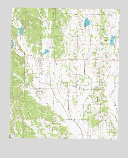
Ellistown, MS USGS Topographic Map
Click on map above to begin viewing in our Map Viewer.

This topographic map contains these locations and features:
Feature Name Type Latitude Longitude GNIS ID View Map
AlpinePopulated PlaceN34.4954°W88.7978°666235View Map
Alpine Volunteer Fire DepartmentBuildingN34.4945°W88.7979°2665966View Map
Antioch ChurchChurchN34.4254°W88.7987°683560View Map
Bart HillSummitN34.4326°W88.8517°666546View Map
Beech Springs ChurchChurchN34.4307°W88.7987°683562View Map
Big CreekStreamN34.4793°W88.8370°667104View Map
BirminghamPopulated PlaceN34.4084°W88.7692°667183View Map
Birmingham Baptist ChurchChurchN34.4084°W88.7703°686946View Map
Birmingham CemeteryCemeteryN34.4295°W88.7717°686948View Map
Birmingham RidgeRidgeN34.3807°W88.7578°667184View Map
Birmingham Ridge Volunteer Fire DepartmentBuildingN34.3789°W88.7704°2665980View Map
Birmingham SchoolSchoolN34.3912°W88.7623°667185View Map
Blue SpringsPopulated PlaceN34.4018°W88.8728°667322View Map
Blue Springs Post OfficePost OfficeN34.3971°W88.8743°2768673View Map
Boggan BendPopulated PlaceN34.4515°W88.7539°667363View Map
BranyanPopulated PlaceN34.4515°W88.8012°667528View Map
Branyan SchoolSchoolN34.4620°W88.7976°667529View Map
Bridge CreekStreamN34.3934°W88.8028°667564View Map
Brown CreekStreamN34.3937°W88.8028°667626View Map
Camp CemeteryCemeteryN34.4807°W88.7712°667970View Map
Camp Creek ChurchChurchN34.4668°W88.7712°686960View Map
Coker Lake DamDamN34.4584°W88.8551°682650View Map
CorronaPopulated PlaceN34.4701°W88.7673°668843View Map
Damascus CemeteryCemeteryN34.4958°W88.7958°709719View Map
Darling BranchStreamN34.4337°W88.8451°669114View Map
East Union SchoolSchoolN34.4423°W88.8401°683573View Map
East Union Volunteer Fire Department Station 1BuildingN34.4497°W88.8432°2665924View Map
East Union Volunteer Fire Department Station 2BuildingN34.4205°W88.8404°2665965View Map
EllistownPopulated PlaceN34.4448°W88.8409°669745View Map
Ellistown CemeteryCemeteryN34.4507°W88.8414°706096View Map
FairfieldPopulated PlaceN34.4220°W88.8417°669872View Map
Fairfield CemeteryCemeteryN34.4215°W88.8417°706097View Map
Franklin CreekStreamN34.4759°W88.8637°670164View Map
GravesPopulated PlaceN34.4515°W88.7770°691902View Map
Hall CreekStreamN34.4545°W88.8587°670840View Map
Jones ChapelChurchN34.4259°W88.8081°683583View Map
Jones Memorial CemeteryCemeteryN34.4257°W88.7956°683584View Map
Jug ForkPopulated PlaceN34.4265°W88.7892°672049View Map
Liberty ChurchChurchN34.4337°W88.7978°683589View Map
Little CreekStreamN34.4873°W88.8373°672594View Map
Little Dry CreekStreamN34.4159°W88.7581°672605View Map
McNeil CemeteryCemeteryN34.3826°W88.7787°706769View Map
McNeil ChapelChurchN34.3832°W88.7778°673416View Map
McWhorter CemeteryCemeteryN34.3885°W88.8309°706105View Map
McWhorter CreekStreamN34.4107°W88.8187°673447View Map
Mud Creek ChurchChurchN34.3823°W88.7556°674436View Map
New Hope CemeteryCemeteryN34.4732°W88.8239°674670View Map
Parnell CreekStreamN34.4848°W88.8748°675475View Map
Phil Marsin Lake DamDamN34.4634°W88.7701°682654View Map
Red Hill CemeteryCemeteryN34.3876°W88.8306°683607View Map
Red Hill ChurchChurchN34.3932°W88.8337°683608View Map
Red Hill SchoolSchoolN34.3857°W88.8292°676539View Map
Rowan Lake DamDamN34.4834°W88.7867°682664View Map
Roy Starnes Pond DamDamN34.4218°W88.7951°682635View Map
Sawmill CreekStreamN34.4265°W88.8284°677448View Map
Shell CreekStreamN34.4357°W88.7617°677639View Map
Smiths Store (historical)LocaleN34.3951°W88.7670°684590View Map
Spout Spring BranchStreamN34.4545°W88.8584°678063View Map
Supervisor District 4CivilN34.4364°W88.8715°712113View Map
Thompson CemeteryCemeteryN34.4984°W88.8073°678698View Map
Tishomingo CreekStreamN34.4159°W88.7584°678783View Map
Town Creek Structure 16 DamDamN34.4668°W88.7584°682656View Map
Town Creek Structure 19 DamDamN34.4551°W88.8367°682648View Map
Town Creek Structure 20 DamDamN34.4734°W88.8684°682660View Map
Town Creek Structure 22 DamDamN34.4768°W88.7834°682662View Map
Town Creek Structure 28 DamDamN34.4634°W88.8734°682655View Map
Village of Blue SpringsCivilN34.4014°W88.8721°2407421View Map
Wilkerson Pond DamDamN34.4884°W88.8684°682665View Map
Woods Store (historical)LocaleN34.3876°W88.7598°684635View Map

Note: Coordinates in the location and feature list above are referenced to NAD83 datum.


Copyright (C) 2008-2025 Ryan Niemi / Sunset Dynamics ... All Rights Reserved