TopoQuest Logo
Do you find TopoQuest useful?
Help keep TopoQuest running and adding new maps/features by donating!
Bitcoin:  19c7KJd3qBynnjoSw5npx9KScwjBe4ifkT
Litecoin:  LXs6TkuXGGXo1vDsWCkWVdjQX94eUKd6ui
Home View Maps Find Maps Find Places Resources & Links


Yantley, Alabama Topographic Map

USGS Map Title: Yantley, AL
USGS Map MRC: 32088B4
DRG (GeoTIFF) Download: o32088b4.tif


Neighboring USGS Topographic Map Quads:


  Vimville, MS  
32088C5
 

  Whynot, MS  
32088C4
 

  Ward, AL  
32088C3
 

  Snell, MS  
32088B5
 

  Yantley, AL  
32088B4
 

  Lisman, AL  
32088B3
 

  Sykes, MS  
32088A5
 

  Hinton, AL  
32088A4
 

  Land, AL  
32088A3


Map MRC Location:

N33°
W89°
N33°
W88°
H8 H7 H6 H5 H4 H3 H2 H1
G8 G7 G6 G5 G4 G3 G2 G1
F8 F7 F6 F5 F4 F3 F2 F1
E8 E7 E6 E5 E4 E3 E2 E1
D8 D7 D6 D5 D4 D3 D2 D1
C8 C7 C6 C5 C4 C3 C2 C1
B8 B7 B6 B5 B4 B3 B2 B1
A8 A7 A6 A5 A4 A3 A2 A1
N32°
W89°
N32°
W88°

Yantley, AL USGS 1:24K Topographic Map Preview:
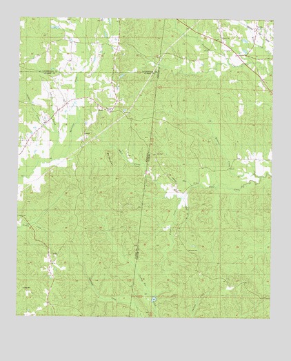
Yantley, AL USGS Topographic Map
Click on map above to begin viewing in our Map Viewer.

This topographic map contains these locations and features:
Feature Name Type Latitude Longitude GNIS ID View Map
Bethel United Methodist ChurchChurchN32.1779°W88.4217°139947View Map
Bill MountainSummitN32.1926°W88.4548°667164View Map
Bowls BranchStreamN32.1751°W88.4184°114777View Map
Concord Baptist ChurchChurchN32.2374°W88.3964°116487View Map
CyrilPopulated PlaceN32.1782°W88.4223°156245View Map
Davidson (historical)Populated PlaceN32.2015°W88.4917°709420View Map
Douglas CanalCanalN32.1821°W88.4209°117429View Map
Fuller CreekStreamN32.1751°W88.4198°118747View Map
Goddin CreekStreamN32.2024°W88.4814°670446View Map
Hog Wallow RidgeRidgeN32.1279°W88.4181°140021View Map
Hurricane CreekPopulated PlaceN32.2110°W88.4545°691953View Map
Johnnie BranchStreamN32.1901°W88.4834°671903View Map
McLendon CemeteryCemeteryN32.1535°W88.4161°122588View Map
Mount Zion Baptist ChurchChurchN32.2113°W88.4478°674353View Map
Mount Zion CemeteryCemeteryN32.2115°W88.4484°709451View Map
Mount Zion School (historical)SchoolN32.2113°W88.4486°709452View Map
Page BranchStreamN32.1796°W88.4139°140083View Map
Pleasant Grove Church (historical)ChurchN32.2154°W88.4773°687546View Map
Pleasant Hill Baptist ChurchChurchN32.2424°W88.4009°152992View Map
Reynolds School (historical)SchoolN32.1626°W88.4667°687550View Map
Reynolds Store (historical)LocaleN32.2296°W88.4531°684038View Map
Rock GapGapN32.1524°W88.4070°140106View Map
Tims CemeteryCemeteryN32.1935°W88.4331°127988View Map
Turkey Pen RidgeRidgeN32.1265°W88.4056°140165View Map
Williams CreekStreamN32.1846°W88.3803°129017View Map
YantleyPopulated PlaceN32.2460°W88.3795°154042View Map

Note: Coordinates in the location and feature list above are referenced to NAD83 datum.


Copyright (C) 2008-2025 Ryan Niemi / Sunset Dynamics ... All Rights Reserved