TopoQuest Logo
Do you find TopoQuest useful?
Help keep TopoQuest running and adding new maps/features by donating!
Bitcoin:  19c7KJd3qBynnjoSw5npx9KScwjBe4ifkT
Litecoin:  LXs6TkuXGGXo1vDsWCkWVdjQX94eUKd6ui
Home View Maps Find Maps Find Places Resources & Links


Cecil, Georgia Topographic Map

USGS Map Title: Cecil, GA
USGS Map MRC: 31083A4
DRG (GeoTIFF) Download: o31083a4.tif


Neighboring USGS Topographic Map Quads:


  Ellenton, GA  
31083B5
 

  Adel, GA  
31083B4
 

  Nashville West, GA  
31083B3
 

  Berlin East, GA  
31083A5
 

  Cecil, GA  
31083A4
 

  New Lois, GA  
31083A3
 

  Pebble Hill, GA  
30083H5
 

  Hahira West, GA  
30083H4
 

  Hahira East, GA  
30083H3


Map MRC Location:

N32°
W84°
N32°
W83°
H8 H7 H6 H5 H4 H3 H2 H1
G8 G7 G6 G5 G4 G3 G2 G1
F8 F7 F6 F5 F4 F3 F2 F1
E8 E7 E6 E5 E4 E3 E2 E1
D8 D7 D6 D5 D4 D3 D2 D1
C8 C7 C6 C5 C4 C3 C2 C1
B8 B7 B6 B5 B4 B3 B2 B1
A8 A7 A6 A5 A4 A3 A2 A1
N31°
W84°
N31°
W83°

Cecil, GA USGS 1:24K Topographic Map Preview:
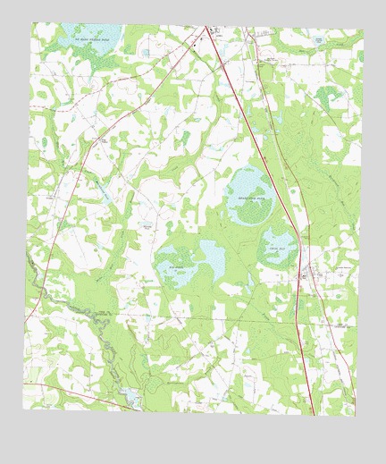
Cecil, GA USGS Topographic Map
Click on map above to begin viewing in our Map Viewer.

This topographic map contains these locations and features:
Feature Name Type Latitude Longitude GNIS ID View Map
Adel-Sparks DivisionCivilN31.1209°W83.4287°1936068View Map
Big PondLakeN31.0474°W83.4396°311404View Map
Carters Still (historical)LocaleN31.0594°W83.4827°343875View Map
CecilPopulated PlaceN31.0455°W83.3921°331347View Map
Cecil Baptist ChurchChurchN31.0469°W83.3910°343876View Map
Cecil BayLakeN31.0538°W83.4052°312443View Map
Cecil Volunteer Fire DepartmentBuildingN31.0572°W83.3943°2604319View Map
City of Adel LakeReservoirN31.1214°W83.3919°341786View Map
City of Adel Lake DamDamN31.1202°W83.3915°341785View Map
City of CecilCivilN31.0466°W83.3907°2404012View Map
Exit 8CrossingN31.0441°W83.3974°1672942View Map
Exit 9CrossingN31.1127°W83.4279°1672943View Map
Folsom BridgeBridgeN31.0010°W83.4579°346250View Map
Full Gospel ChurchChurchN31.0377°W83.3890°343885View Map
Gornto CemeteryCemeteryN31.0013°W83.4913°314727View Map
GreggsPopulated PlaceN31.0688°W83.4899°356109View Map
Greggs Baptist ChurchChurchN31.0707°W83.4896°343887View Map
Hancock PondReservoirN31.0612°W83.4550°315082View Map
Heart Pine PondLakeN31.0707°W83.4160°315287View Map
Heartpine (historical)Populated PlaceN31.1007°W83.4124°343889View Map
Jerusalem (historical)Populated PlaceN31.0546°W83.4991°343891View Map
Jerusalem CemeteryCemeteryN31.0398°W83.3915°316087View Map
Jerusalem Missionary ChurchChurchN31.0477°W83.3835°316101View Map
Meetinghouse BranchStreamN31.0074°W83.4604°318002View Map
Morrison CreekStreamN31.0613°W83.4641°318499View Map
No Mans Friend PondLakeN31.1241°W83.4774°319605View Map
Pine BluffCliffN31.0319°W83.4766°320538View Map
Pine ValleyPopulated PlaceN31.0874°W83.4732°332680View Map
Pine Valley Fire DepartmentBuildingN31.0882°W83.4732°2604297View Map
Rock Bridge (historical)BridgeN31.0496°W83.4993°343903View Map
Saint Pauls ChurchChurchN31.0460°W83.3815°322245View Map
Salem ChurchChurchN31.0230°W83.4293°322338View Map
Shiloh Volunteer Fire Department Station 6ABuildingN31.0019°W83.4061°2604870View Map
Smith LakeReservoirN31.1102°W83.4265°341745View Map
Smith Lake DamDamN31.1102°W83.4265°341744View Map
Wells Mill CreekStreamN31.0307°W83.4732°324994View Map
Whitehurst PondReservoirN31.0702°W83.4709°325211View Map
Whitehurst Pond DamDamN31.0671°W83.4682°341783View Map
Woodlawn Memorial GardensCemeteryN31.1137°W83.4091°325543View Map

Note: Coordinates in the location and feature list above are referenced to NAD83 datum.


Copyright (C) 2008-2024 Ryan Niemi / Sunset Dynamics ... All Rights Reserved