TopoQuest Logo
Do you find TopoQuest useful?
Help keep TopoQuest running and adding new maps/features by donating!
Bitcoin:  19c7KJd3qBynnjoSw5npx9KScwjBe4ifkT
Litecoin:  LXs6TkuXGGXo1vDsWCkWVdjQX94eUKd6ui
Home View Maps Find Maps Find Places Resources & Links


Cedar Run, Pennsylvania Topographic Map

USGS Map Title: Cedar Run, PA
USGS Map MRC: 41077E4
DRG (GeoTIFF) Download: o41077e4.tif


Neighboring USGS Topographic Map Quads:


  Marshlands, PA  
41077F5
 

  Tiadaghton, PA  
41077F4
 

  Antrim, PA  
41077F3
 

  Lee Fire Tower, PA  
41077E5
 

  Cedar Run, PA  
41077E4
 

  Morris, PA  
41077E3
 

  Slate Run, PA  
41077D5
 

  Cammal, PA  
41077D4
 

  English Center, PA  
41077D3


Map MRC Location:

N42°
W78°
N42°
W77°
H8 H7 H6 H5 H4 H3 H2 H1
G8 G7 G6 G5 G4 G3 G2 G1
F8 F7 F6 F5 F4 F3 F2 F1
E8 E7 E6 E5 E4 E3 E2 E1
D8 D7 D6 D5 D4 D3 D2 D1
C8 C7 C6 C5 C4 C3 C2 C1
B8 B7 B6 B5 B4 B3 B2 B1
A8 A7 A6 A5 A4 A3 A2 A1
N41°
W78°
N41°
W77°

Cedar Run, PA USGS 1:24K Topographic Map Preview:
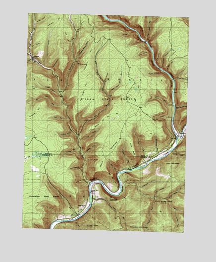
Cedar Run, PA USGS Topographic Map
Click on map above to begin viewing in our Map Viewer.

This topographic map contains these locations and features:
Feature Name Type Latitude Longitude GNIS ID View Map
Algerine Swamp BogSwampN41.5429°W77.4878°1201317View Map
Algerine Swamp Natural AreaAreaN41.5526°W77.4972°1201586View Map
Algerine TrailTrailN41.5234°W77.4866°1205765View Map
Ashworth TrailTrailN41.5403°W77.3797°1205920View Map
Babb CreekStreamN41.5537°W77.3805°1168544View Map
Bearpen HollowValleyN41.5979°W77.4620°1168971View Map
Benjamin HollowValleyN41.5952°W77.3957°1169241View Map
Big Dam Hollow TrailTrailN41.6123°W77.4830°1205930View Map
Big RunStreamN41.5473°W77.3841°1169580View Map
Black Forest TrailTrailN41.5087°W77.4969°1205760View Map
BlackwellPopulated PlaceN41.5565°W77.3791°1169778View Map
Bohen RunStreamN41.5737°W77.3847°1169944View Map
Bohen TrailTrailN41.5767°W77.4036°1205913View Map
Brace HollowValleyN41.5867°W77.4393°1170110View Map
Brown ForkStreamN41.5201°W77.3975°1170365View Map
Brown Township Volunteer Fire CompanyBuildingN41.5079°W77.4571°2653225View Map
Bull RunStreamN41.5345°W77.4250°1170645View Map
Bull Run PointCapeN41.5317°W77.4305°1170652View Map
Burnt Shanty RunStreamN41.5195°W77.3886°1170752View Map
Bushkirk TrailTrailN41.5365°W77.4761°1205922View Map
Buskirk HollowValleyN41.5356°W77.4543°1170782View Map
Callahan HillSummitN41.6203°W77.4791°1170894View Map
Callahan HollowValleyN41.5931°W77.4798°1170895View Map
Cedar MountainSummitN41.5415°W77.4280°1171390View Map
Cedar PinesPopulated PlaceN41.5095°W77.4561°1171392View Map
Cedar RunPopulated PlaceN41.5226°W77.4458°1209292View Map
Cedar RunStreamN41.5278°W77.4466°1171398View Map
Cedar Run ChurchChurchN41.5134°W77.4525°1171399View Map
Charman TrailTrailN41.5317°W77.3819°1205919View Map
Clay Mine RunStreamN41.5931°W77.3905°1171945View Map
Dam HollowValleyN41.5948°W77.4867°1172906View Map
Dillon TrailTrailN41.6034°W77.4091°1205912View Map
East Branch TrailTrailN41.5926°W77.4272°1205911View Map
East Mine Hole RunStreamN41.5781°W77.4347°1173844View Map
Elk RunStreamN41.5053°W77.4594°1174127View Map
Fahnestock HillSummitN41.5998°W77.4528°1174407View Map
Fahnestock RunStreamN41.5795°W77.4736°1174408View Map
Fall RunStreamN41.5648°W77.4658°1174583View Map
Frying Pan RunStreamN41.5987°W77.4936°1175317View Map
Gamble RunStreamN41.5076°W77.4558°1175401View Map
Gleason HillSummitN41.5820°W77.4941°1175686View Map
Gleason HollowValleyN41.5791°W77.4743°1175687View Map
Gundigut ValleyValleyN41.6166°W77.4176°1176319View Map
Hamilton HollowValleyN41.5575°W77.4633°1176421View Map
Hoyt HollowValleyN41.5204°W77.3978°1177527View Map
Huck TrailTrailN41.5695°W77.4172°1205908View Map
Huckleberry TrailTrailN41.5276°W77.4919°1205705View Map
Jacobs RunStreamN41.5184°W77.4458°1177967View Map
Jerry RunStreamN41.5667°W77.3850°1178055View Map
LeetoniaPopulated PlaceN41.5998°W77.4953°1179132View Map
Lloyd PointCapeN41.5453°W77.4141°1179734View Map
Lloyd Post Office (historical)Post OfficeN41.5559°W77.3803°1214385View Map
Lloyd RunStreamN41.5390°W77.4039°1179735View Map
Lloyd TrailTrailN41.5784°W77.4272°1205910View Map
Long BranchStreamN41.5523°W77.4566°1179846View Map
Long Branch HillSummitN41.5626°W77.4411°1179848View Map
Mill HollowValleyN41.6049°W77.4974°1181169View Map
Mine Hole RunStreamN41.5548°W77.4586°1181309View Map
Morrison HollowValleyN41.5410°W77.4519°1181584View Map
Old Mountain TrailTrailN41.5584°W77.4247°1205909View Map
Oxbow HollowValleyN41.5290°W77.4514°1183164View Map
PinePopulated PlaceN41.6103°W77.4064°1204393View Map
Pine Creek Gorge Natural AreaAreaN41.5867°W77.3880°1201585View Map
Pine Island RunStreamN41.6095°W77.4066°1183848View Map
Pine TrailTrailN41.6090°W77.4222°1205915View Map
Plantatation TrailTrailN41.5576°W77.4089°1205907View Map
Putt Hollow TrailTrailN41.5228°W77.4986°1205704View Map
Rail Island RunStreamN41.6226°W77.4289°1184599View Map
Red Rock RunStreamN41.5737°W77.4714°1193176View Map
Red Rock TrailTrailN41.5765°W77.4811°1205916View Map
Reynolds Spring BogSwampN41.5530°W77.4971°1201316View Map
Rice HollowValleyN41.5992°W77.4005°1184988View Map
Roby HollowValleyN41.6154°W77.4620°1185240View Map
Schoolhouse RunStreamN41.5465°W77.3880°1187116View Map
Sherman ForkStreamN41.5131°W77.3803°1199519View Map
Slide Island DraftValleyN41.6012°W77.4968°1193375View Map
Spinning Wheel BranchStreamN41.5981°W77.4628°1188180View Map
Spinningwheel TrailTrailN41.6062°W77.4547°1205917View Map
Steel HollowValleyN41.6039°W77.4030°1188580View Map
Steel Hollow TrailTrailN41.6034°W77.4139°1205914View Map
Stone Quarry RunStreamN41.5726°W77.3830°1188732View Map
Straight RunStreamN41.5451°W77.4553°1188844View Map
Tamarack SwampSwampN41.5431°W77.4880°1189248View Map
The NarrowsFlatN41.5281°W77.4230°1193526View Map
Trestle HollowValleyN41.6197°W77.4936°1189747View Map
Trout RunStreamN41.5267°W77.4236°1189869View Map
Tumbling RunStreamN41.5478°W77.4555°1209347View Map
Tumbling Run TrailTrailN41.5392°W77.4716°1205921View Map
Vanaimes HillSummitN41.5678°W77.4919°1190345View Map
Water Tank RunStreamN41.5890°W77.3853°1190666View Map
West HillSummitN41.5862°W77.4122°1191043View Map
West Mine Hole RunStreamN41.5781°W77.4350°1191073View Map
Wheatfield HollowValleyN41.5255°W77.4112°1191209View Map
Woodhouse RunStreamN41.5356°W77.4164°1191736View Map

Note: Coordinates in the location and feature list above are referenced to NAD83 datum.


Copyright (C) 2008-2025 Ryan Niemi / Sunset Dynamics ... All Rights Reserved