TopoQuest Logo
Do you find TopoQuest useful?
Help keep TopoQuest running and adding new maps/features by donating!
Bitcoin:  19c7KJd3qBynnjoSw5npx9KScwjBe4ifkT
Litecoin:  LXs6TkuXGGXo1vDsWCkWVdjQX94eUKd6ui
Home View Maps Find Maps Find Places Resources & Links


English Center, Pennsylvania Topographic Map

USGS Map Title: English Center, PA
USGS Map MRC: 41077D3
DRG (GeoTIFF) Download: o41077d3.tif


Neighboring USGS Topographic Map Quads:


  Cedar Run, PA  
41077E4
 

  Morris, PA  
41077E3
 

  Nauvoo, PA  
41077E2
 

  Cammal, PA  
41077D4
 

  English Center, PA  
41077D3
 

  White Pine, PA  
41077D2
 

  Jersey Mills, PA  
41077C4
 

  Waterville, PA  
41077C3
 

  Salladasburg, PA  
41077C2


Map MRC Location:

N42°
W78°
N42°
W77°
H8 H7 H6 H5 H4 H3 H2 H1
G8 G7 G6 G5 G4 G3 G2 G1
F8 F7 F6 F5 F4 F3 F2 F1
E8 E7 E6 E5 E4 E3 E2 E1
D8 D7 D6 D5 D4 D3 D2 D1
C8 C7 C6 C5 C4 C3 C2 C1
B8 B7 B6 B5 B4 B3 B2 B1
A8 A7 A6 A5 A4 A3 A2 A1
N41°
W78°
N41°
W77°

English Center, PA USGS 1:24K Topographic Map Preview:
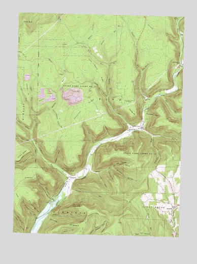
English Center, PA USGS Topographic Map
Click on map above to begin viewing in our Map Viewer.

This topographic map contains these locations and features:
Feature Name Type Latitude Longitude GNIS ID View Map
Bannan RunStreamN41.4734°W77.3053°1198354View Map
Bark Cabin RunStreamN41.4278°W77.3614°1198356View Map
Bear HollowValleyN41.4838°W77.3224°1198371View Map
Bear HollowValleyN41.3760°W77.2712°1198373View Map
Bear RunStreamN41.4551°W77.2675°1198377View Map
Blockhouse CreekStreamN41.4712°W77.2519°1198451View Map
Bonnell RunStreamN41.4476°W77.2775°1198462View Map
BrooksidePopulated PlaceN41.3912°W77.2536°1198481View Map
Buckeye RunStreamN41.4434°W77.3625°1198493View Map
Callhans RunStreamN41.4123°W77.3050°1202937View Map
Carsons RunStreamN41.4006°W77.3355°1198544View Map
CarsontownPopulated PlaceN41.4078°W77.3328°1198545View Map
Carsontown CemeteryCemeteryN41.3928°W77.3458°1198546View Map
Chestnut RidgeRidgeN41.4417°W77.3280°1198565View Map
Coal RunStreamN41.4267°W77.3144°1198581View Map
Dan Day HollowValleyN41.4135°W77.3013°1198633View Map
Dowling HillSummitN41.4456°W77.2858°1198659View Map
Dowling Hill CemeteryCemeteryN41.4515°W77.2875°1198660View Map
Dry HollowValleyN41.4120°W77.3048°1198663View Map
EnglishLocaleN41.3823°W77.2958°1205538View Map
English CenterPopulated PlaceN41.4373°W77.2797°1198711View Map
English Center Suspension BridgeBridgeN41.4347°W77.2889°2709852View Map
English RunStreamN41.4351°W77.2891°1198712View Map
Flatiron PointCapeN41.4528°W77.3653°1198743View Map
Fourmile RunStreamN41.4853°W77.2508°1198766View Map
Graveyard RunStreamN41.4442°W77.2766°1198826View Map
Hackett ForkStreamN41.4209°W77.3555°1198850View Map
Jack Cammals Camp RunStreamN41.4465°W77.3469°1198934View Map
Jake Shanty RidgeRidgeN41.4720°W77.3169°1198937View Map
Layton DraftValleyN41.4145°W77.3439°1199011View Map
Left Fork Otter RunStreamN41.4478°W77.3639°1199029View Map
Lick DraftValleyN41.4101°W77.3118°1199035View Map
Lick RunStreamN41.4362°W77.2789°1199038View Map
Little Pine Airport (historical)AirportN41.4001°W77.3247°1194228View Map
Little Pine State ParkParkN41.3792°W77.3397°1198256View Map
Long Point TrailTrailN41.4067°W77.3483°1205737View Map
Longs RidgeRidgeN41.4201°W77.3697°1199083View Map
Love Run TrailTrailN41.3831°W77.3705°1199091View Map
Lymanwood HollowValleyN41.4721°W77.3054°1199100View Map
McKees RunStreamN41.3876°W77.3480°1199137View Map
Otter RunStreamN41.4062°W77.3333°1199261View Map
OxbowSummitN41.4501°W77.3578°1199264View Map
Panther RunStreamN41.3834°W77.3564°1199272View Map
Panther Run TrailTrailN41.3937°W77.3703°1199274View Map
Pine RunStreamN41.4712°W77.3050°1199309View Map
Rank Hollow TrailTrailN41.3901°W77.3197°1205731View Map
Right Fork Otter RunStreamN41.4478°W77.3641°1199387View Map
Rock HollowValleyN41.4686°W77.2805°1199398View Map
Rogers RunStreamN41.4095°W77.3203°1199410View Map
Schoolhouse HollowValleyN41.3947°W77.3456°1199493View Map
Shadrach DraftValleyN41.4319°W77.2713°1199509View Map
Shingle Mill BranchStreamN41.4537°W77.3055°1199525View Map
Silver BranchStreamN41.4331°W77.3622°1199540View Map
Smith RunStreamN41.4981°W77.2541°1199979View Map
Stahineckers PondLakeN41.4740°W77.2522°1199590View Map
State Game Lands Number 75ParkN41.4581°W77.3269°1199604View Map
Texas CreekStreamN41.4712°W77.2519°1199673View Map
Township of PineCivilN41.4790°W77.2822°1216769View Map
Wildcat HollowValleyN41.4132°W77.3013°1200130View Map
Wolf RunStreamN41.4892°W77.2525°1199808View Map
Yutamark HollowValleyN41.4306°W77.3036°1199827View Map

Note: Coordinates in the location and feature list above are referenced to NAD83 datum.


Copyright (C) 2008-2025 Ryan Niemi / Sunset Dynamics ... All Rights Reserved