TopoQuest Logo
Do you find TopoQuest useful?
Help keep TopoQuest running and adding new maps/features by donating!
Bitcoin:  19c7KJd3qBynnjoSw5npx9KScwjBe4ifkT
Litecoin:  LXs6TkuXGGXo1vDsWCkWVdjQX94eUKd6ui
Home View Maps Find Maps Find Places Resources & Links


Slate Run, Pennsylvania Topographic Map

USGS Map Title: Slate Run, PA
USGS Map MRC: 41077D5
DRG (GeoTIFF) Download: o41077d5.tif


Neighboring USGS Topographic Map Quads:


  Oleona, PA  
41077E6
 

  Lee Fire Tower, PA  
41077E5
 

  Cedar Run, PA  
41077E4
 

  Young Womans Creek, PA  
41077D6
 

  Slate Run, PA  
41077D5
 

  Cammal, PA  
41077D4
 

  Renovo East, PA  
41077C6
 

  Glen Union, PA  
41077C5
 

  Jersey Mills, PA  
41077C4


Map MRC Location:

N42°
W78°
N42°
W77°
H8 H7 H6 H5 H4 H3 H2 H1
G8 G7 G6 G5 G4 G3 G2 G1
F8 F7 F6 F5 F4 F3 F2 F1
E8 E7 E6 E5 E4 E3 E2 E1
D8 D7 D6 D5 D4 D3 D2 D1
C8 C7 C6 C5 C4 C3 C2 C1
B8 B7 B6 B5 B4 B3 B2 B1
A8 A7 A6 A5 A4 A3 A2 A1
N41°
W78°
N41°
W77°

Slate Run, PA USGS 1:24K Topographic Map Preview:
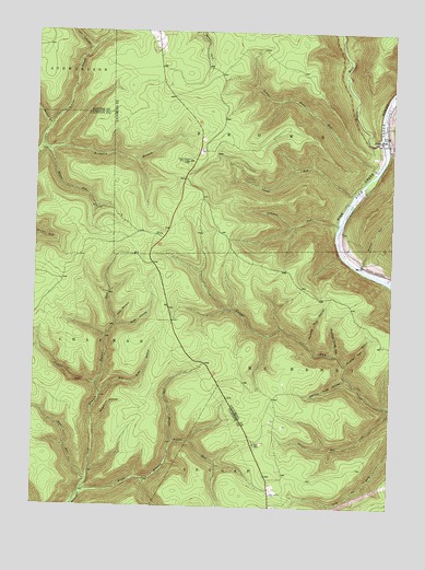
Slate Run, PA USGS Topographic Map
Click on map above to begin viewing in our Map Viewer.

This topographic map contains these locations and features:
Feature Name Type Latitude Longitude GNIS ID View Map
Abes RunStreamN41.3809°W77.6053°1198320View Map
Baldwin BranchStreamN41.4681°W77.6233°1198351View Map
Baldwin Point TrailTrailN41.4626°W77.6014°1205759View Map
Bear Trap TrailTrailN41.4137°W77.5444°1206277View Map
Benson RunStreamN41.4687°W77.6208°1198415View Map
Benson TrailTrailN41.4128°W77.5700°1206284View Map
Big Boyer TrailTrailN41.3901°W77.5550°1206275View Map
Big Slide HollowValleyN41.4041°W77.6010°1199836View Map
Black Forest Fire CompanyBuildingN41.4960°W77.5829°2652857View Map
Blackberry TrailTrailN41.4901°W77.5897°1205771View Map
Bonnell RunStreamN41.4381°W77.5105°1198461View Map
Callahan RunStreamN41.4495°W77.5186°1199843View Map
Callahan TrailTrailN41.4484°W77.5341°1205762View Map
Campbell TrailTrailN41.4092°W77.5014°1198532View Map
Cannon Hole HollowValleyN41.4089°W77.5148°1199846View Map
Cougar RunStreamN41.4070°W77.6030°1199852View Map
County Line BranchStreamN41.4681°W77.6233°1198607View Map
Dugan TrailTrailN41.4837°W77.5914°1205757View Map
Dyer BranchStreamN41.4951°W77.6064°1198681View Map
Gas Line TrailTrailN41.4709°W77.5564°1205769View Map
Golden Eagle TrailTrailN41.4481°W77.5047°1205752View Map
Harrowed TrailTrailN41.4784°W77.5689°1205767View Map
Highwood TrailTrailN41.3853°W77.5130°1205756View Map
Holt HollowValleyN41.4243°W77.5959°1199883View Map
Left Branch Hyner RunStreamN41.3801°W77.6078°1199895View Map
Little Boyer TrailTrailN41.3962°W77.5614°1206274View Map
Little Slate RunStreamN41.4637°W77.5050°1199066View Map
Little Slate Run TrailTrailN41.4806°W77.5547°1205768View Map
McClure Ridge TrailTrailN41.4012°W77.5864°1206279View Map
Mill Hollow TrailTrailN41.4237°W77.6153°1206282View Map
Muschino HollowValleyN41.3982°W77.6031°1199917View Map
Naval RunStreamN41.4573°W77.5136°1199919View Map
Number Four HollowValleyN41.4182°W77.5288°1199923View Map
Number Three HollowValleyN41.4156°W77.5185°1199924View Map
Number Two HollowValleyN41.4131°W77.5149°1199925View Map
Reeder TrailTrailN41.3856°W77.5536°1206276View Map
Refuge TrailTrailN41.4784°W77.5800°1205758View Map
Riffle RunStreamN41.4415°W77.5178°1201572View Map
Riffle TrailTrailN41.4373°W77.5258°1205764View Map
Right Branch Hyner RunStreamN41.3790°W77.6072°1199944View Map
Rock Run TrailTrailN41.4351°W77.6058°1206283View Map
Second Big ForkStreamN41.4017°W77.5003°1199502View Map
Shay TrailTrailN41.4862°W77.5730°1205770View Map
Slate RunStreamN41.4726°W77.5044°1199550View Map
Slate RunPopulated PlaceN41.4728°W77.5016°1199976View Map
Slate Run Post OfficePost OfficeN41.4723°W77.5016°2773259View Map
Slide HollowValleyN41.4227°W77.5958°1199978View Map
Slide Hollow TrailTrailN41.4784°W77.5416°1213446View Map
Slide Hollow TrailTrailN41.4240°W77.5872°1206280View Map
Spring RunStreamN41.3923°W77.5758°1199982View Map
Store Quarry TrailTrailN41.4301°W77.5347°1205763View Map
Three Ridge TrailTrailN41.4284°W77.6100°1206281View Map
Weaver TrailTrailN41.3881°W77.5644°1206278View Map
Wilcox BranchStreamN41.4748°W77.6197°1199793View Map

Note: Coordinates in the location and feature list above are referenced to NAD83 datum.


Copyright (C) 2008-2024 Ryan Niemi / Sunset Dynamics ... All Rights Reserved