TopoQuest Logo
Do you find TopoQuest useful?
Help keep TopoQuest running and adding new maps/features by donating!
Bitcoin:  19c7KJd3qBynnjoSw5npx9KScwjBe4ifkT
Litecoin:  LXs6TkuXGGXo1vDsWCkWVdjQX94eUKd6ui
Home View Maps Find Maps Find Places Resources & Links


Days Creek, Oregon Topographic Map

USGS Map Title: Days Creek, OR
USGS Map MRC: 42123H2
DRG (GeoTIFF) Download: o42123h2.tif


Neighboring USGS Topographic Map Quads:


  Myrtle Creek, OR  
43123A3
 

  Dodson Butte, OR  
43123A2
 

  White Rock, OR  
43123A1
 

  Canyonville, OR  
42123H3
 

  Days Creek, OR  
42123H2
 

  Milo, OR  
42123H1
 

  Quines Creek, OR  
42123G3
 

  Starvout Creek, OR  
42123G2
 

  Cedar Springs Mountain, OR  
42123G1


Map MRC Location:

N43°
W124°
N43°
W123°
H8 H7 H6 H5 H4 H3 H2 H1
G8 G7 G6 G5 G4 G3 G2 G1
F8 F7 F6 F5 F4 F3 F2 F1
E8 E7 E6 E5 E4 E3 E2 E1
D8 D7 D6 D5 D4 D3 D2 D1
C8 C7 C6 C5 C4 C3 C2 C1
B8 B7 B6 B5 B4 B3 B2 B1
A8 A7 A6 A5 A4 A3 A2 A1
N42°
W124°
N42°
W123°

Days Creek, OR USGS 1:24K Topographic Map Preview:
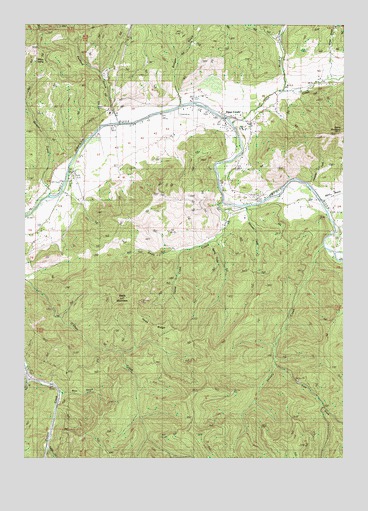
Days Creek, OR USGS Topographic Map
Click on map above to begin viewing in our Map Viewer.

This topographic map contains these locations and features:
Feature Name Type Latitude Longitude GNIS ID View Map
Beals CreekStreamN42.9487°W123.1723°1117339View Map
Beals MountainSummitN42.9212°W123.2110°1117340View Map
Bear GulchValleyN42.8937°W123.2362°1117382View Map
Beckworth CreekStreamN42.9735°W123.2040°1132235View Map
Bland BranchStreamN42.9493°W123.1342°1138251View Map
Bland Mountain CemeteryCemeteryN42.9519°W123.1298°1117804View Map
Boomer Hill Boat LaunchLocaleN42.9709°W123.2152°2668209View Map
Canyon Creek Forest State ParkParkN42.8971°W123.2428°1638187View Map
Caroline Raymond BridgeBridgeN42.9815°W123.1723°1638185View Map
Clough GulchValleyN42.9651°W123.2303°1132234View Map
Days CreekPopulated PlaceN42.9723°W123.1723°1119724View Map
Days CreekStreamN42.9712°W123.1689°1140677View Map
Days Creek Census Designated PlaceCensusN42.9705°W123.1657°2611726View Map
Days Creek Charter SchoolSchoolN42.9700°W123.1662°2417814View Map
Days Creek CutoffBendN42.9873°W123.2192°1119725View Map
Days Creek Fire DepartmentBuildingN42.9685°W123.1626°2576588View Map
Days Creek Post OfficePost OfficeN42.9709°W123.1626°1165132View Map
Dietch CreekStreamN42.9610°W123.1678°1132236View Map
East Fork Shively CreekStreamN42.9010°W123.1528°1141602View Map
GazleyPopulated PlaceN42.9535°W123.2428°1638186View Map
Gazley Post Office (historical)Post OfficeN42.9507°W123.2415°1164378View Map
Green GulchValleyN42.9901°W123.1303°1121377View Map
Hammon CreekStreamN42.9537°W123.1392°1121544View Map
Hyde RidgeRidgeN42.9132°W123.2006°1122178View Map
Kennedy CreekStreamN42.9735°W123.1637°1132237View Map
Morgan CreekStreamN42.9512°W123.2406°1124352View Map
Packard GulchValleyN42.9746°W123.2165°1125115View Map
Porter CreekStreamN42.9776°W123.1581°1132238View Map
Shively CreekStreamN42.9360°W123.1334°1126895View Map
Slimwater CreekStreamN42.9479°W123.1645°1127088View Map
Spring CreekStreamN42.9373°W123.1781°1127415View Map
Stinger GulchValleyN42.9796°W123.1903°1127611View Map
Sweat CreekStreamN42.9346°W123.1892°1127819View Map
The HeightsSlopeN42.9698°W123.1762°1638184View Map
Turkey CreekStreamN42.8790°W123.2428°1132232View Map
Weaver CreekStreamN42.9512°W123.2359°1132233View Map
Willow SpringSpringN42.9899°W123.2467°1129161View Map
Wood CreekStreamN42.9810°W123.1492°1129295View Map

Note: Coordinates in the location and feature list above are referenced to NAD83 datum.


Copyright (C) 2008-2025 Ryan Niemi / Sunset Dynamics ... All Rights Reserved