TopoQuest Logo
Do you find TopoQuest useful?
Help keep TopoQuest running and adding new maps/features by donating!
Bitcoin:  19c7KJd3qBynnjoSw5npx9KScwjBe4ifkT
Litecoin:  LXs6TkuXGGXo1vDsWCkWVdjQX94eUKd6ui
Home View Maps Find Maps Find Places Resources & Links


Center Hill, Mississippi Topographic Map

USGS Map Title: Center Hill, MS
USGS Map MRC: 32088E7
DRG (GeoTIFF) Download: o32088e7.tif


Neighboring USGS Topographic Map Quads:


  House, MS  
32088F8
 

  Moscow, MS  
32088F7
 

  Lauderdale NW, MS  
32088F6
 

  Post, MS  
32088E8
 

  Center Hill, MS  
32088E7
 

  Daleville, MS  
32088E6
 

  Duffee, MS  
32088D8
 

  Collinsville, MS  
32088D7
 

  Meridian North, MS  
32088D6


Map MRC Location:

N33°
W89°
N33°
W88°
H8 H7 H6 H5 H4 H3 H2 H1
G8 G7 G6 G5 G4 G3 G2 G1
F8 F7 F6 F5 F4 F3 F2 F1
E8 E7 E6 E5 E4 E3 E2 E1
D8 D7 D6 D5 D4 D3 D2 D1
C8 C7 C6 C5 C4 C3 C2 C1
B8 B7 B6 B5 B4 B3 B2 B1
A8 A7 A6 A5 A4 A3 A2 A1
N32°
W89°
N32°
W88°

Center Hill, MS USGS 1:24K Topographic Map Preview:
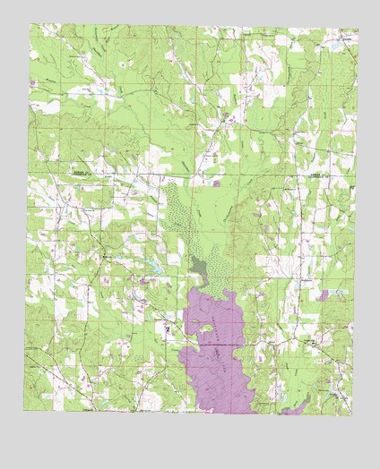
Center Hill, MS USGS Topographic Map
Click on map above to begin viewing in our Map Viewer.

This topographic map contains these locations and features:
Feature Name Type Latitude Longitude GNIS ID View Map
Bounds Pond DamDamN32.5318°W88.8300°681469View Map
Center HillPopulated PlaceN32.5224°W88.7645°668235View Map
Chickasawhay CreekStreamN32.5543°W88.8012°691553View Map
Chisholm CemeteryCemeteryN32.6146°W88.8553°668402View Map
Dripp Off School (historical)SchoolN32.5171°W88.7550°683990View Map
Duluth Snowden Pond DamDamN32.5051°W88.8417°681448View Map
E T Brown Pond DamDamN32.5518°W88.8384°681495View Map
Fellowship Baptist ChurchChurchN32.5057°W88.7559°669938View Map
Fellowship CemeteryCemeteryN32.5068°W88.7548°706377View Map
First Baptist Church of CollinsvilleChurchN32.5018°W88.8487°711377View Map
Fort Stephens (historical)MilitaryN32.5889°W88.7567°1680978View Map
Frazier Grove ChurchChurchN32.5835°W88.8078°670170View Map
Gin CreekStreamN32.5135°W88.8017°670409View Map
Hamrick CemeteryCemeteryN32.5001°W88.8270°666098View Map
Hodge BranchStreamN32.5549°W88.8137°671254View Map
Hopewell ChurchChurchN32.6224°W88.7859°671424View Map
House CreekStreamN32.5179°W88.8037°671519View Map
Houston CreekStreamN32.5993°W88.8378°671521View Map
J W Wilson Pond DamDamN32.5618°W88.7634°681506View Map
KlondikePopulated PlaceN32.6224°W88.7562°691988View Map
Klondike CemeteryCemeteryN32.6212°W88.7567°707971View Map
Litchfield (historical)LocaleN32.5463°W88.8362°684005View Map
Little Zion ChurchChurchN32.6035°W88.8517°672723View Map
Lower Store (historical)LocaleN32.5065°W88.7567°684006View Map
M C Williams Pond DamDamN32.5501°W88.8167°681492View Map
Martha Cobb Pond DamDamN32.5435°W88.8250°681484View Map
MartinPopulated PlaceN32.5496°W88.8451°692044View Map
Martin Volunteer Fire and Rescue DepartmentBuildingN32.5498°W88.8460°2668026View Map
McDonalds Store (historical)LocaleN32.5379°W88.8342°684010View Map
Mount Pleasant ChurchChurchN32.5729°W88.7773°674231View Map
Murry Rogers Catfish Ponds DamDamN32.5368°W88.7600°681475View Map
Oakdale ChurchChurchN32.5004°W88.8259°675111View Map
Okatibbee LakeReservoirN32.5010°W88.7963°684025View Map
Okatibbee State Wildlife AreaParkN32.5668°W88.8042°684026View Map
Oktibbeha (historical)Populated PlaceN32.5815°W88.8070°686702View Map
Penders CreekStreamN32.5732°W88.7937°675585View Map
Pine Forest Baptist ChurchChurchN32.5301°W88.8214°675807View Map
Pine Forest CemeteryCemeteryN32.5307°W88.8223°706393View Map
Pine Grove Baptist ChurchChurchN32.5654°W88.8534°675839View Map
Pine Grove CemeteryCemeteryN32.5660°W88.8542°706395View Map
Pleasant Grove ChurchChurchN32.5907°W88.7739°676015View Map
R E Scruggs Pond DamDamN32.5401°W88.7750°681478View Map
Rushing Store (historical)LocaleN32.5510°W88.8209°684039View Map
Russels Store (historical)LocaleN32.5029°W88.7789°684040View Map
ShucktownPopulated PlaceN32.5443°W88.7703°677758View Map
Smith Pond DamDamN32.5468°W88.7600°681489View Map
Tallachula CreekStreamN32.6132°W88.8470°691620View Map
Toles BranchStreamN32.6182°W88.8478°678798View Map
Tompeat CreekStreamN32.5029°W88.7734°678813View Map
Union Baptist ChurchChurchN32.5932°W88.8106°679058View Map
Union CemeteryCemeteryN32.5937°W88.8103°708003View Map
W O Wilkerson Pond DamDamN32.6185°W88.7600°681537View Map
White BranchStreamN32.5735°W88.7525°679569View Map

Note: Coordinates in the location and feature list above are referenced to NAD83 datum.


Copyright (C) 2008-2025 Ryan Niemi / Sunset Dynamics ... All Rights Reserved