TopoQuest Logo
Do you find TopoQuest useful?
Help keep TopoQuest running and adding new maps/features by donating!
Bitcoin:  19c7KJd3qBynnjoSw5npx9KScwjBe4ifkT
Litecoin:  LXs6TkuXGGXo1vDsWCkWVdjQX94eUKd6ui
Home View Maps Find Maps Find Places Resources & Links


Moscow, Mississippi Topographic Map

USGS Map Title: Moscow, MS
USGS Map MRC: 32088F7
DRG (GeoTIFF) Download: o32088f7.tif


Neighboring USGS Topographic Map Quads:


  Owl Creek, MS  
32088G8
 

  Lynville, MS  
32088G7
 

  De Kalb, MS  
32088G6
 

  House, MS  
32088F8
 

  Moscow, MS  
32088F7
 

  Lauderdale NW, MS  
32088F6
 

  Post, MS  
32088E8
 

  Center Hill, MS  
32088E7
 

  Daleville, MS  
32088E6


Map MRC Location:

N33°
W89°
N33°
W88°
H8 H7 H6 H5 H4 H3 H2 H1
G8 G7 G6 G5 G4 G3 G2 G1
F8 F7 F6 F5 F4 F3 F2 F1
E8 E7 E6 E5 E4 E3 E2 E1
D8 D7 D6 D5 D4 D3 D2 D1
C8 C7 C6 C5 C4 C3 C2 C1
B8 B7 B6 B5 B4 B3 B2 B1
A8 A7 A6 A5 A4 A3 A2 A1
N32°
W89°
N32°
W88°

Moscow, MS USGS 1:24K Topographic Map Preview:
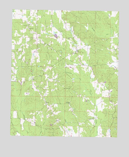
Moscow, MS USGS Topographic Map
Click on map above to begin viewing in our Map Viewer.

This topographic map contains these locations and features:
Feature Name Type Latitude Longitude GNIS ID View Map
A A Hopper Pond DamDamN32.7151°W88.8001°681596View Map
Big Oak ChurchChurchN32.6849°W88.8431°667133View Map
Bull MountainSummitN32.6599°W88.8542°707942View Map
Cedar Grove ChurchChurchN32.6729°W88.8095°668197View Map
Cole CemeteryCemeteryN32.7293°W88.8198°668670View Map
Corinth ChurchChurchN32.6412°W88.8203°668837View Map
DamascusPopulated PlaceN32.6576°W88.8339°691799View Map
Damascus CemeteryCemeteryN32.6565°W88.8334°707950View Map
Damascus Volunteer Fire DepartmentBuildingN32.6594°W88.8341°2665790View Map
Darnall (historical)Populated PlaceN32.6849°W88.8389°707951View Map
Dry CreekStreamN32.6671°W88.7812°669418View Map
East Coongetto (historical)Populated PlaceN32.7043°W88.7959°707957View Map
Hugh Thomasson Lake DamDamN32.7301°W88.7867°681609View Map
Kemper County Volunteer Fire District 3 StationBuildingN32.7208°W88.8451°2665792View Map
Lester May Lake DamDamN32.7235°W88.8234°681603View Map
LibertyPopulated PlaceN32.6612°W88.7589°692002View Map
Liberty ChurchChurchN32.6604°W88.7573°707973View Map
Linwood CemeteryCemeteryN32.6332°W88.8206°672521View Map
Little Rock SchoolSchoolN32.7343°W88.8576°672676View Map
McDonald CemeteryCemeteryN32.7162°W88.8359°673334View Map
MoscowPopulated PlaceN32.7101°W88.8001°673861View Map
Moscow Recreational Vehicle ParkLocaleN32.7278°W88.7503°2663898View Map
Mount Olive CemeteryCemeteryN32.6426°W88.7781°674108View Map
Mount Pleasant CemeteryCemeteryN32.6579°W88.8067°707977View Map
Mount Pleasant ChurchChurchN32.6585°W88.8073°674232View Map
Mount Zion ChurchChurchN32.7187°W88.8039°674365View Map
Persimmon Ridge ChurchChurchN32.6440°W88.7548°675637View Map
Shiloh CemeteryCemeteryN32.6968°W88.7773°707997View Map
Shiloh ChurchChurchN32.6960°W88.7789°677686View Map
Supervisor District 3CivilN32.6680°W88.8179°711925View Map
Talbert CemeteryCemeteryN32.6799°W88.8228°678541View Map
Unity Springs ChurchChurchN32.7315°W88.8553°679141View Map
West Kemper Baptist ChurchChurchN32.7076°W88.8042°679503View Map
West Kemper CemeteryCemeteryN32.7074°W88.8037°708006View Map

Note: Coordinates in the location and feature list above are referenced to NAD83 datum.


Copyright (C) 2008-2024 Ryan Niemi / Sunset Dynamics ... All Rights Reserved