TopoQuest Logo
Do you find TopoQuest useful?
Help keep TopoQuest running and adding new maps/features by donating!
Bitcoin:  19c7KJd3qBynnjoSw5npx9KScwjBe4ifkT
Litecoin:  LXs6TkuXGGXo1vDsWCkWVdjQX94eUKd6ui
Home View Maps Find Maps Find Places Resources & Links


Lauderdale NW, Mississippi Topographic Map

USGS Map Title: Lauderdale NW, MS
USGS Map MRC: 32088F6
DRG (GeoTIFF) Download: o32088f6.tif


Neighboring USGS Topographic Map Quads:


  Lynville, MS  
32088G7
 

  De Kalb, MS  
32088G6
 

  Townsend, MS  
32088G5
 

  Moscow, MS  
32088F7
 

  Lauderdale NW, MS  
32088F6
 

  Oak Grove, MS  
32088F5
 

  Center Hill, MS  
32088E7
 

  Daleville, MS  
32088E6
 

  Lauderdale, MS  
32088E5


Map MRC Location:

N33°
W89°
N33°
W88°
H8 H7 H6 H5 H4 H3 H2 H1
G8 G7 G6 G5 G4 G3 G2 G1
F8 F7 F6 F5 F4 F3 F2 F1
E8 E7 E6 E5 E4 E3 E2 E1
D8 D7 D6 D5 D4 D3 D2 D1
C8 C7 C6 C5 C4 C3 C2 C1
B8 B7 B6 B5 B4 B3 B2 B1
A8 A7 A6 A5 A4 A3 A2 A1
N32°
W89°
N32°
W88°

Lauderdale NW, MS USGS 1:24K Topographic Map Preview:
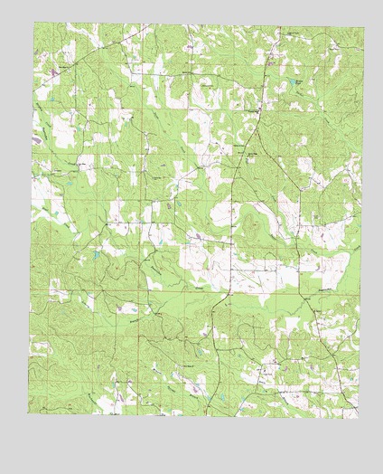
Lauderdale NW, MS USGS Topographic Map
Click on map above to begin viewing in our Map Viewer.

This topographic map contains these locations and features:
Feature Name Type Latitude Longitude GNIS ID View Map
Ayanabi (historical)Populated PlaceN32.6946°W88.7423°707933View Map
Beulah ChurchChurchN32.7349°W88.6903°667046View Map
Brown Ridge ChurchChurchN32.7085°W88.6681°667631View Map
Bruton PondSwampN32.7322°W88.6516°667707View Map
Church of GodChurchN32.7115°W88.6692°668462View Map
Delphia CreekStreamN32.7104°W88.7434°669214View Map
East Yazo Skatane (historical)Populated PlaceN32.6849°W88.6348°707959View Map
Flat CreekStreamN32.6804°W88.6495°670022View Map
H C Jenkins Pond DamDamN32.6751°W88.7250°681575View Map
Haanka Ullah (historical)Populated PlaceN32.6849°W88.7292°707964View Map
Hampton CemeteryCemeteryN32.7307°W88.6859°670870View Map
James Barnhanm Pond DamDamN32.7135°W88.7467°681595View Map
KiplingPopulated PlaceN32.6724°W88.6484°686700View Map
Liberty BranchStreamN32.6665°W88.6903°672436View Map
Mount NeboPopulated PlaceN32.7029°W88.7070°686701View Map
New Hope CemeteryCemeteryN32.7051°W88.7328°707979View Map
New Hope CemeteryCemeteryN32.7346°W88.7362°707980View Map
New Hope ChurchChurchN32.6412°W88.6917°674699View Map
New Hope ChurchChurchN32.7051°W88.7328°674702View Map
New Hope ChurchChurchN32.7351°W88.7364°674703View Map
Pawticfaw Baptist Church (historical)ChurchN32.7015°W88.7042°707984View Map
Pawticfaw CemeteryCemeteryN32.7010°W88.7039°675514View Map
Pleasant Ridge ChurchChurchN32.7229°W88.6642°676112View Map
Rush CemeteryCemeteryN32.6892°W88.6409°676958View Map
Steel CreekStreamN32.6862°W88.7214°678259View Map
Supervisor District 5CivilN32.7437°W88.6702°711927View Map
Yazoo CreekStreamN32.6776°W88.6284°679923View Map

Note: Coordinates in the location and feature list above are referenced to NAD83 datum.


Copyright (C) 2008-2025 Ryan Niemi / Sunset Dynamics ... All Rights Reserved