TopoQuest Logo
Do you find TopoQuest useful?
Help keep TopoQuest running and adding new maps/features by donating!
Bitcoin:  19c7KJd3qBynnjoSw5npx9KScwjBe4ifkT
Litecoin:  LXs6TkuXGGXo1vDsWCkWVdjQX94eUKd6ui
Home View Maps Find Maps Find Places Resources & Links


Centreville East, Alabama Topographic Map

USGS Map Title: Centreville East, AL
USGS Map MRC: 32087H1
DRG (GeoTIFF) Download: o32087h1.tif


Neighboring USGS Topographic Map Quads:


  West Blocton West, AL  
33087A2
 

  West Blocton East, AL  
33087A1
 

  Aldrich, AL  
33086A8
 

  Centreville West, AL  
32087H2
 

  Centreville East, AL  
32087H1
 

  Randolph, AL  
32086H8
 

  Harrisburg, AL  
32087G2
 

  Oakmulgee, AL  
32087G1
 

  Maplesville West, AL  
32086G8


Map MRC Location:

N33°
W88°
N33°
W87°
H8 H7 H6 H5 H4 H3 H2 H1
G8 G7 G6 G5 G4 G3 G2 G1
F8 F7 F6 F5 F4 F3 F2 F1
E8 E7 E6 E5 E4 E3 E2 E1
D8 D7 D6 D5 D4 D3 D2 D1
C8 C7 C6 C5 C4 C3 C2 C1
B8 B7 B6 B5 B4 B3 B2 B1
A8 A7 A6 A5 A4 A3 A2 A1
N32°
W88°
N32°
W87°

Centreville East, AL USGS 1:24K Topographic Map Preview:
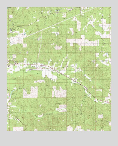
Centreville East, AL USGS Topographic Map
Click on map above to begin viewing in our Map Viewer.

This topographic map contains these locations and features:
Feature Name Type Latitude Longitude GNIS ID View Map
Bibb County AirportAirportN32.9374°W87.0879°161278View Map
Bibb County Training School (historical)SchoolN32.9429°W87.1144°1952336View Map
Big BranchStreamN32.9068°W87.0189°1952337View Map
Blue HoleLakeN32.9155°W87.1020°159211View Map
Cahaba AcademySchoolN32.9771°W87.1208°159293View Map
Centreville Elementary SchoolSchoolN32.9429°W87.1153°161892View Map
Centreville Police DepartmentBuildingN32.9430°W87.1150°2751940View Map
Centreville Work CenterLocaleN32.9398°W87.1244°163093View Map
Crockett McKinney CemeteryCemeteryN32.9809°W87.1080°159463View Map
Enon CemeteryCemeteryN32.9890°W87.0780°150983View Map
Enon Missionary Baptist ChurchChurchN32.9893°W87.0786°159572View Map
Gary SpringsPopulated PlaceN32.9676°W87.0880°159654View Map
Goodhope Baptist ChurchChurchN32.9071°W87.1156°159682View Map
Lightseys Mill Pond DamDamN32.9101°W87.1233°161330View Map
Lightseys PondReservoirN32.9098°W87.1226°159944View Map
Little CreekStreamN32.9123°W87.0280°159962View Map
Mount Zion CemeteryCemeteryN32.9051°W87.1186°150984View Map
Mount Zion Missionary Baptist ChurchChurchN32.9043°W87.1186°160186View Map
Pineland Memorial ParkCemeteryN32.9423°W87.0892°160384View Map
Rising Star Baptist ChurchChurchN32.9773°W87.1150°160493View Map
Ross F Gray Memorial ParkParkN32.9404°W87.0905°160535View Map
Sandy CemeteryCemeteryN32.9185°W87.1100°160563View Map
Sandy Chapel CemeteryCemeteryN32.9415°W87.0794°162364View Map
Sandy Chapel United Methodist ChurchChurchN32.9418°W87.0803°160564View Map
Soap HillSummitN32.9548°W87.0242°161912View Map
Southern Methodist ChurchChurchN32.9412°W87.1231°162363View Map
TrioPopulated PlaceN32.9123°W87.0247°160757View Map
VickPopulated PlaceN32.9410°W87.0833°160786View Map
Wheeler MountainSummitN32.8890°W87.1061°1952341View Map

Note: Coordinates in the location and feature list above are referenced to NAD83 datum.


Copyright (C) 2008-2025 Ryan Niemi / Sunset Dynamics ... All Rights Reserved