TopoQuest Logo
Do you find TopoQuest useful?
Help keep TopoQuest running and adding new maps/features by donating!
Bitcoin:  19c7KJd3qBynnjoSw5npx9KScwjBe4ifkT
Litecoin:  LXs6TkuXGGXo1vDsWCkWVdjQX94eUKd6ui
Home View Maps Find Maps Find Places Resources & Links


Chapin, Michigan Topographic Map

USGS Map Title: Chapin, MI
USGS Map MRC: 43084B3
DRG (GeoTIFF) Download: o43084b3.tif


Neighboring USGS Topographic Map Quads:


  Rathbone, MI  
43084C4
 

  Lakefield, MI  
43084C3
 

  Saint Charles, MI  
43084C2
 

  Ashley, MI  
43084B4
 

  Chapin, MI  
43084B3
 

  Chesaning West, MI  
43084B2
 

  Ovid West, MI  
43084A4
 

  Ovid East, MI  
43084A3
 

  Owosso North, MI  
43084A2


Map MRC Location:

N44°
W85°
N44°
W84°
H8 H7 H6 H5 H4 H3 H2 H1
G8 G7 G6 G5 G4 G3 G2 G1
F8 F7 F6 F5 F4 F3 F2 F1
E8 E7 E6 E5 E4 E3 E2 E1
D8 D7 D6 D5 D4 D3 D2 D1
C8 C7 C6 C5 C4 C3 C2 C1
B8 B7 B6 B5 B4 B3 B2 B1
A8 A7 A6 A5 A4 A3 A2 A1
N43°
W85°
N43°
W84°

Chapin, MI USGS 1:24K Topographic Map Preview:
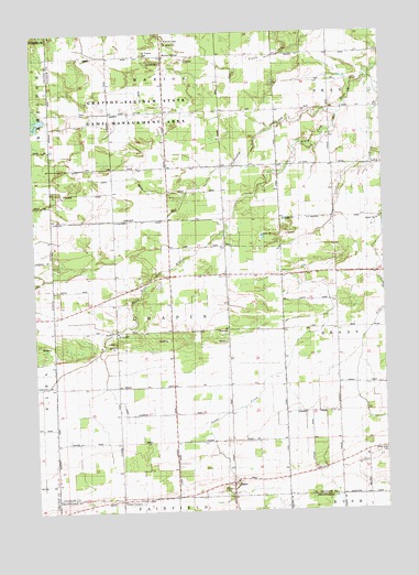
Chapin, MI USGS Topographic Map
Click on map above to begin viewing in our Map Viewer.

This topographic map contains these locations and features:
Feature Name Type Latitude Longitude GNIS ID View Map
Amman FarmLocaleN43.2069°W84.3322°2725285View Map
Bibrietz DrainCanalN43.2295°W84.3369°621276View Map
ChapinPopulated PlaceN43.1322°W84.3047°623091View Map
Chapin Post Office (historical)Post OfficeN43.1322°W84.3047°2558580View Map
Chapin United Methodist ChurchChurchN43.1322°W84.3044°2572317View Map
Coon DrainCanalN43.1367°W84.3244°623776View Map
FenmorePopulated PlaceN43.1728°W84.3453°1617555View Map
Fenmore Post Office (historical)Post OfficeN43.1728°W84.3453°2558497View Map
Gratiot - Saginaw State Game Management AreaParkN43.2347°W84.3250°627231View Map
Griffus CreekStreamN43.2192°W84.2530°627434View Map
Lamb CreekStreamN43.2381°W84.2536°630084View Map
Limbocker CreekStreamN43.2286°W84.2647°630415View Map
Limbocker DrainCanalN43.2017°W84.3447°630416View Map
Marion SpringsPopulated PlaceN43.2445°W84.3272°1617701View Map
Marion Springs Post Office (historical)Post OfficeN43.2444°W84.3272°2558483View Map
Marion Township CemeteryCemeteryN43.2480°W84.3275°2558990View Map
North Branch Limbocker DrainCanalN43.2117°W84.3405°633519View Map
Olney CornersPopulated PlaceN43.1281°W84.3447°1617760View Map
Olney DrainCanalN43.1486°W84.3380°634041View Map
RacyPopulated PlaceN43.1950°W84.3061°1617807View Map
Racy ChurchChurchN43.1864°W84.3061°635589View Map
Racy Post Office (historical)Post OfficeN43.1950°W84.3061°2558479View Map
Saint John's Lutheran ChurchChurchN43.2422°W84.3281°2558956View Map
Saint Johns CemeteryCemeteryN43.2475°W84.3266°636723View Map
Saint Johns SchoolSchoolN43.2425°W84.3275°636756View Map
Saint Theresa CemeteryCemeteryN43.2445°W84.3341°637067View Map
Township of ChapinCivilN43.1717°W84.3272°1626058View Map

Note: Coordinates in the location and feature list above are referenced to NAD83 datum.


Copyright (C) 2008-2025 Ryan Niemi / Sunset Dynamics ... All Rights Reserved