TopoQuest Logo
Do you find TopoQuest useful?
Help keep TopoQuest running and adding new maps/features by donating!
Bitcoin:  19c7KJd3qBynnjoSw5npx9KScwjBe4ifkT
Litecoin:  LXs6TkuXGGXo1vDsWCkWVdjQX94eUKd6ui
Home View Maps Find Maps Find Places Resources & Links


Chesaning West, Michigan Topographic Map

USGS Map Title: Chesaning West, MI
USGS Map MRC: 43084B2
DRG (GeoTIFF) Download: o43084b2.tif


Neighboring USGS Topographic Map Quads:


  Lakefield, MI  
43084C3
 

  Saint Charles, MI  
43084C2
 

  Alicia, MI  
43084C1
 

  Chapin, MI  
43084B3
 

  Chesaning West, MI  
43084B2
 

  Chesaning East, MI  
43084B1
 

  Ovid East, MI  
43084A3
 

  Owosso North, MI  
43084A2
 

  Easton, MI  
43084A1


Map MRC Location:

N44°
W85°
N44°
W84°
H8 H7 H6 H5 H4 H3 H2 H1
G8 G7 G6 G5 G4 G3 G2 G1
F8 F7 F6 F5 F4 F3 F2 F1
E8 E7 E6 E5 E4 E3 E2 E1
D8 D7 D6 D5 D4 D3 D2 D1
C8 C7 C6 C5 C4 C3 C2 C1
B8 B7 B6 B5 B4 B3 B2 B1
A8 A7 A6 A5 A4 A3 A2 A1
N43°
W85°
N43°
W84°

Chesaning West, MI USGS 1:24K Topographic Map Preview:
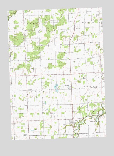
Chesaning West, MI USGS Topographic Map
Click on map above to begin viewing in our Map Viewer.

This topographic map contains these locations and features:
Feature Name Type Latitude Longitude GNIS ID View Map
Brady CenterPopulated PlaceN43.1725°W84.2272°1617458View Map
Brady Center Wesleyan ChurchChurchN43.1719°W84.2269°2558895View Map
Brady Elementary SchoolSchoolN43.1686°W84.2267°2558896View Map
Brady Post Office (historical)Post OfficeN43.1722°W84.2278°2558583View Map
Brown Fickies DrainCanalN43.2128°W84.1586°622081View Map
Chesaning Brady Fire DepartmentBuildingN43.1881°W84.1360°2558914View Map
Chesaning Middle SchoolSchoolN43.1900°W84.1306°2558911View Map
Chesaning Police DepartmentBuildingN43.1865°W84.1274°2558913View Map
Chesaning Union High SchoolSchoolN43.1931°W84.1281°2558910View Map
Christ ChurchChurchN43.1864°W84.2278°623239View Map
Dygert DrainCanalN43.2372°W84.1697°625062View Map
Francis DrainCanalN43.2086°W84.2075°626394View Map
Greens DrainCanalN43.1795°W84.1775°627363View Map
Griffus CemeteryCemeteryN43.1981°W84.2375°627433View Map
GrovetonPopulated PlaceN43.2425°W84.1291°1617599View Map
Howard Nixon Memorial AirportAirportN43.1809°W84.1313°1623835View Map
Kingdom HallChurchN43.1294°W84.1442°2558707View Map
Leutz Post Office (historical)Post OfficeN43.2303°W84.2492°2558485View Map
Mickles CreekStreamN43.1392°W84.1605°632220View Map
Oak Grove CemeteryCemeteryN43.1384°W84.1772°633824View Map
OakleyPopulated PlaceN43.1397°W84.1680°633890View Map
Oakley Community ChurchChurchN43.1403°W84.1672°2558720View Map
Oakley Post OfficePost OfficeN43.1422°W84.1681°2558718View Map
Oakley StationLocaleN43.1411°W84.1694°2558716View Map
Oakley Village HallBuildingN43.1422°W84.1669°2558717View Map
ParshallburgPopulated PlaceN43.1464°W84.1361°634430View Map
Pine Grove County ParkParkN43.1275°W84.1703°634936View Map
Ridge Road CemeteryCemeteryN43.1414°W84.2478°635906View Map
Saginaw County FairgroundsLocaleN43.1756°W84.1361°2558856View Map
Saint John's Lutheran CemeteryCemeteryN43.2408°W84.1614°2558989View Map
Saint Michael ChurchChurchN43.1389°W84.1667°2558719View Map
Saint Michael's Catholic CemeteryCemeteryN43.1394°W84.1656°2558984View Map
Stoddard Mobile CourtPopulated PlaceN43.1736°W84.1694°2558912View Map
Township of BradyCivilN43.1709°W84.2248°1625968View Map
Trinity United Methodist ChurchChurchN43.1867°W84.1361°2558909View Map
Twin Brook Golf CourseLocaleN43.1975°W84.1361°2558917View Map
Village of OakleyCivilN43.1434°W84.1686°2399543View Map
Wildwood CemeteryCemeteryN43.1581°W84.1280°1616464View Map

Note: Coordinates in the location and feature list above are referenced to NAD83 datum.


Copyright (C) 2008-2025 Ryan Niemi / Sunset Dynamics ... All Rights Reserved