TopoQuest Logo
Do you find TopoQuest useful?
Help keep TopoQuest running and adding new maps/features by donating!
Bitcoin:  19c7KJd3qBynnjoSw5npx9KScwjBe4ifkT
Litecoin:  LXs6TkuXGGXo1vDsWCkWVdjQX94eUKd6ui
Home View Maps Find Maps Find Places Resources & Links


Chassahowitzka, Florida Topographic Map

USGS Map Title: Chassahowitzka, FL
USGS Map MRC: 28082F5
DRG (GeoTIFF) Download: o28082f5.tif


Neighboring USGS Topographic Map Quads:


  Ozello, FL  
28082G6
 

  Homosassa, FL  
28082G5
 

  Lecanto, FL  
28082G4
 

  Chassahowitzka Bay, FL  
28082F6
 

  Chassahowitzka, FL  
28082F5
 

  Brooksville NW, FL  
28082F4
 

  Bayport, FL  
28082E6
 

  Weeki Wachee Spring, FL  
28082E5
 

  Brooksville, FL  
28082E4


Map MRC Location:

N29°
W83°
N29°
W82°
H8 H7 H6 H5 H4 H3 H2 H1
G8 G7 G6 G5 G4 G3 G2 G1
F8 F7 F6 F5 F4 F3 F2 F1
E8 E7 E6 E5 E4 E3 E2 E1
D8 D7 D6 D5 D4 D3 D2 D1
C8 C7 C6 C5 C4 C3 C2 C1
B8 B7 B6 B5 B4 B3 B2 B1
A8 A7 A6 A5 A4 A3 A2 A1
N28°
W83°
N28°
W82°

Chassahowitzka, FL USGS 1:24K Topographic Map Preview:
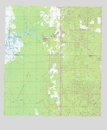
Chassahowitzka, FL USGS Topographic Map
Click on map above to begin viewing in our Map Viewer.

This topographic map contains these locations and features:
Feature Name Type Latitude Longitude GNIS ID View Map
Baird CreekStreamN28.7144°W82.5837°278043View Map
ChassahowitzkaPopulated PlaceN28.7130°W82.5743°280337View Map
Chassahowitzka National Wildlife Refuge HeadquartersBuildingN28.7492°W82.5562°304701View Map
Chassahowitzka SwampSwampN28.6582°W82.6116°280342View Map
Citrus County Fire Rescue Station 18BuildingN28.7233°W82.5161°2644271View Map
Citrus County Fire Rescue Station 4BuildingN28.7122°W82.5676°2376252View Map
Crawford CreekStreamN28.7047°W82.6145°281012View Map
E. Brittle PlaygroundParkN28.7153°W82.5686°2376250View Map
First Baptist Church of ChassahowitzkaChurchN28.7153°W82.5678°2376249View Map
First Christian Church of ChassahowitzkaChurchN28.6981°W82.5639°2376251View Map
Garden IslandIslandN28.7019°W82.6179°282925View Map
Johnson CreekStreamN28.7108°W82.6115°284866View Map
Little Gator CreekBayN28.7061°W82.6215°285690View Map
Potter CreekStreamN28.7217°W82.5973°289265View Map
Ryle CreekStreamN28.7036°W82.6190°290097View Map
Salt CreekStreamN28.7208°W82.5937°290424View Map
Stevenson CreekStreamN28.7167°W82.6126°291688View Map
Sugarmill WoodsPopulated PlaceN28.7322°W82.5062°1867212View Map

Note: Coordinates in the location and feature list above are referenced to NAD83 datum.


Copyright (C) 2008-2024 Ryan Niemi / Sunset Dynamics ... All Rights Reserved