TopoQuest Logo
Do you find TopoQuest useful?
Help keep TopoQuest running and adding new maps/features by donating!
Bitcoin:  19c7KJd3qBynnjoSw5npx9KScwjBe4ifkT
Litecoin:  LXs6TkuXGGXo1vDsWCkWVdjQX94eUKd6ui
Home View Maps Find Maps Find Places Resources & Links


Chatterton, Indiana Topographic Map

USGS Map Title: Chatterton, IN
USGS Map MRC: 40087D2
DRG (GeoTIFF) Download: o40087d2.tif


Neighboring USGS Topographic Map Quads:


  Fowler, IN  
40087E3
 

  Templeton, IN  
40087E2
 

  Round Grove, IN  
40087E1
 

  Pine Village, IN  
40087D3
 

  Chatterton, IN  
40087D2
 

  Otterbein, IN  
40087D1
 

  Williamsport, IN  
40087C3
 

  Attica, IN  
40087C2
 

  Westpoint, IN  
40087C1


Map MRC Location:

N41°
W88°
N41°
W87°
H8 H7 H6 H5 H4 H3 H2 H1
G8 G7 G6 G5 G4 G3 G2 G1
F8 F7 F6 F5 F4 F3 F2 F1
E8 E7 E6 E5 E4 E3 E2 E1
D8 D7 D6 D5 D4 D3 D2 D1
C8 C7 C6 C5 C4 C3 C2 C1
B8 B7 B6 B5 B4 B3 B2 B1
A8 A7 A6 A5 A4 A3 A2 A1
N40°
W88°
N40°
W87°

Chatterton, IN USGS 1:24K Topographic Map Preview:
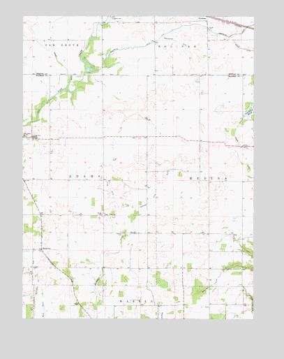
Chatterton, IN USGS Topographic Map
Click on map above to begin viewing in our Map Viewer.

This topographic map contains these locations and features:
Feature Name Type Latitude Longitude GNIS ID View Map
Bartondale DitchCanalN40.4895°W87.1667°430551View Map
ChattertonPopulated PlaceN40.4036°W87.2397°432436View Map
Cottingham AirportAirportN40.3990°W87.2209°2676893View Map
ForesmanPopulated PlaceN40.4998°W87.1506°434644View Map
Griffin CemeteryCemeteryN40.4989°W87.2011°435496View Map
Harman CemeteryCemeteryN40.4103°W87.1963°435742View Map
Harrington DitchCanalN40.4956°W87.1503°435775View Map
Holder DitchCanalN40.4553°W87.1336°436310View Map
James CemeteryCemeteryN40.3813°W87.2195°436920View Map
Little Blind DitchCanalN40.4250°W87.2008°437991View Map
Moore DitchCanalN40.4859°W87.1256°439397View Map
Mound CemeteryCemeteryN40.4178°W87.2062°439511View Map
Peterson DitchCanalN40.3956°W87.1389°441060View Map
Pine Village Elementary SchoolSchoolN40.4506°W87.2492°441165View Map
Quaker CemeteryCemeteryN40.3962°W87.2441°441684View Map
Smith Brothers Airport (historical)AirportN40.3870°W87.2153°449098View Map
Township of AdamsCivilN40.4324°W87.2208°453082View Map
Township of MedinaCivilN40.4321°W87.1354°453617View Map
WAZY-FM (Lafayette)TowerN40.3839°W87.1320°449027View Map
Woodham DitchCanalN40.4286°W87.1772°446285View Map

Note: Coordinates in the location and feature list above are referenced to NAD83 datum.


Copyright (C) 2008-2025 Ryan Niemi / Sunset Dynamics ... All Rights Reserved