TopoQuest Logo
Do you find TopoQuest useful?
Help keep TopoQuest running and adding new maps/features by donating!
Bitcoin:  19c7KJd3qBynnjoSw5npx9KScwjBe4ifkT
Litecoin:  LXs6TkuXGGXo1vDsWCkWVdjQX94eUKd6ui
Home View Maps Find Maps Find Places Resources & Links


Chewalla, Tennessee Topographic Map

USGS Map Title: Chewalla, TN
USGS Map MRC: 35088A6
DRG (GeoTIFF) Download: o35088a6.tif


Neighboring USGS Topographic Map Quads:


  Hornsby, TN  
35088B7
 

  Rose Creek, TN  
35088B6
 

  Purdy, TN  
35088B5
 

  Pocahontas, TN  
35088A7
 

  Chewalla, TN  
35088A6
 

  Guys, TN  
35088A5
 

  Chalybeate, MS  
34088H7
 

  Kossuth North, MS  
34088H6
 

  Corinth, MS  
34088H5


Map MRC Location:

N36°
W89°
N36°
W88°
H8 H7 H6 H5 H4 H3 H2 H1
G8 G7 G6 G5 G4 G3 G2 G1
F8 F7 F6 F5 F4 F3 F2 F1
E8 E7 E6 E5 E4 E3 E2 E1
D8 D7 D6 D5 D4 D3 D2 D1
C8 C7 C6 C5 C4 C3 C2 C1
B8 B7 B6 B5 B4 B3 B2 B1
A8 A7 A6 A5 A4 A3 A2 A1
N35°
W89°
N35°
W88°

Chewalla, TN USGS 1:24K Topographic Map Preview:
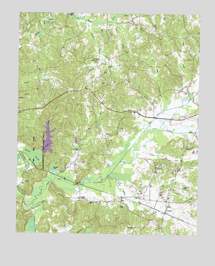
Chewalla, TN USGS Topographic Map
Click on map above to begin viewing in our Map Viewer.

This topographic map contains these locations and features:
Feature Name Type Latitude Longitude GNIS ID View Map
Allen BranchStreamN35.0184°W88.6531°1275573View Map
Antioch ChurchChurchN35.0695°W88.6698°1275795View Map
Big Hill PondLakeN35.0345°W88.7249°1277313View Map
Big Hill Pond LakeReservoirN35.0525°W88.7290°1301507View Map
Big Hill Pond Lake DamDamN35.0468°W88.7334°1301506View Map
Big Hill Pond State ParkAreaN35.0459°W88.7348°1308637View Map
Boles BranchStreamN35.0312°W88.7239°1277901View Map
Butlers ChapelChurchN35.0204°W88.7056°1305571View Map
Caney CreekStreamN35.0418°W88.6784°1279562View Map
Carr CemeteryCemeteryN35.0965°W88.6917°1279716View Map
ChewallaPopulated PlaceN35.0134°W88.6464°1280430View Map
Chewalla Baptist ChurchChurchN35.0156°W88.6453°1320087View Map
Chewalla Post OfficePost OfficeN35.0123°W88.6469°1649718View Map
Chewalla School (historical)SchoolN35.0162°W88.6431°1320088View Map
Coleman CemeteryCemeteryN35.0951°W88.6873°1280938View Map
Commissioner District 5CivilN35.0556°W88.6538°2464470View Map
CypressPopulated PlaceN35.0281°W88.7081°1314925View Map
Cypress CreekStreamN35.0162°W88.7401°1281922View Map
Cypress Creek DitchCanalN35.0645°W88.6564°1281940View Map
Dismal BranchStreamN35.0465°W88.7331°1282490View Map
Dismal SwampSwampN35.0440°W88.7392°1282495View Map
Dry BranchStreamN35.1109°W88.7439°1282875View Map
Friendship Baptist ChurchChurchN35.1001°W88.6300°1320091View Map
Friendship CemeteryCemeteryN35.0998°W88.6298°1284923View Map
Hurley SchoolSchoolN35.0373°W88.6534°1288773View Map
Indian CreekStreamN35.0323°W88.6870°1288955View Map
Indian Creek CemeteryCemeteryN35.0265°W88.6342°1288969View Map
Jimmies BranchStreamN35.1204°W88.6862°1289439View Map
Kings Mountain SchoolSchoolN35.0181°W88.6995°1290246View Map
Little Indian CreekStreamN35.0151°W88.6620°1328728View Map
McNairy County Fire Department Station 31 Chewalla Fire DepartmentBuildingN35.0185°W88.6491°2654000View Map
McNairy County Fire Department Station 33 Big Hill Pond Fire DepartmentBuildingN35.0747°W88.7276°2654193View Map
Muddy CreekStreamN35.0590°W88.6620°1295040View Map
Neatherly BranchStreamN35.1193°W88.6992°1295288View Map
Neatherly CemeteryCemeteryN35.0979°W88.6964°1295289View Map
Otterville ChurchChurchN35.0990°W88.6953°1296523View Map
Ramer BranchStreamN35.0734°W88.6359°1298873View Map
Reed SchoolSchoolN35.0034°W88.6695°1299152View Map
Reedy BranchStreamN35.0695°W88.6509°1299163View Map
Tan Yard BendBendN35.0423°W88.7476°1272072View Map
Turner CemeteryCemeteryN35.0187°W88.6778°1273063View Map
Turner LakeReservoirN35.0154°W88.6756°1273086View Map
Tuscumbia River CanalCanalN35.0058°W88.7376°1273109View Map
Union Chapel SchoolSchoolN35.0473°W88.7081°1273198View Map
White Oak CemeteryCemeteryN35.0565°W88.6859°1274390View Map
Wooten CemeteryCemeteryN35.0290°W88.7445°1275117View Map

Note: Coordinates in the location and feature list above are referenced to NAD83 datum.


Copyright (C) 2008-2024 Ryan Niemi / Sunset Dynamics ... All Rights Reserved