TopoQuest Logo
Do you find TopoQuest useful?
Help keep TopoQuest running and adding new maps/features by donating!
Bitcoin:  19c7KJd3qBynnjoSw5npx9KScwjBe4ifkT
Litecoin:  LXs6TkuXGGXo1vDsWCkWVdjQX94eUKd6ui
Home View Maps Find Maps Find Places Resources & Links


Bearbones Mountain, Oregon Topographic Map

USGS Map Title: Bearbones Mountain, OR
USGS Map MRC: 43122E5
DRG (GeoTIFF) Download: o43122e5.tif


Neighboring USGS Topographic Map Quads:


  Rose Hill, OR  
43122F6
 

  Holland Point, OR  
43122F5
 

  Oakridge, OR  
43122F4
 

  Fairview Peak, OR  
43122E6
 

  Bearbones Mountain, OR  
43122E5
 

  Warner Mountain, OR  
43122E4
 

  Chilcoot Mountain, OR  
43122D6
 

  Reynolds Ridge, OR  
43122D5
 

  Staley Ridge, OR  
43122D4


Map MRC Location:

N44°
W123°
N44°
W122°
H8 H7 H6 H5 H4 H3 H2 H1
G8 G7 G6 G5 G4 G3 G2 G1
F8 F7 F6 F5 F4 F3 F2 F1
E8 E7 E6 E5 E4 E3 E2 E1
D8 D7 D6 D5 D4 D3 D2 D1
C8 C7 C6 C5 C4 C3 C2 C1
B8 B7 B6 B5 B4 B3 B2 B1
A8 A7 A6 A5 A4 A3 A2 A1
N43°
W123°
N43°
W122°

Bearbones Mountain, OR USGS 1:24K Topographic Map Preview:
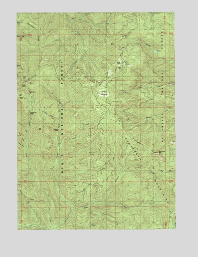
Bearbones Mountain, OR USGS Topographic Map
Click on map above to begin viewing in our Map Viewer.

This topographic map contains these locations and features:
Feature Name Type Latitude Longitude GNIS ID View Map
Annie CreekStreamN43.5551°W122.6181°1158106View Map
Bearbones MountainSummitN43.5438°W122.5146°1137780View Map
Calapooya WayTrailN43.5265°W122.5406°1139150View Map
Champion Post Office (historical)Post OfficeN43.5832°W122.6220°1165033View Map
Colorado MineMineN43.5554°W122.6206°1153339View Map
East Fork Steamboat CreekStreamN43.5151°W122.5584°1141606View Map
Frog RockPillarN43.5577°W122.6069°1155382View Map
Gertrude LakeLakeN43.5950°W122.5409°1142622View Map
Gertrude ShelterLocaleN43.5954°W122.5445°1134686View Map
Grass CreekStreamN43.6029°W122.5701°1142951View Map
Grass MountainSummitN43.5921°W122.5436°1142955View Map
Grizzly MountainSummitN43.5864°W122.6206°1143107View Map
Grouse MountainSummitN43.5795°W122.6221°1143130View Map
Grouse Mountain FallsFallsN43.5671°W122.6152°1143133View Map
Helena MineMineN43.5832°W122.6131°1143456View Map
Helena SaddleGapN43.5826°W122.6220°1153349View Map
Hobart CreekStreamN43.5637°W122.5928°1155383View Map
Horse Heaven CreekStreamN43.5112°W122.5826°1143763View Map
Johnson MeadowsFlatN43.5779°W122.5573°1144358View Map
Johnson Meadows TrailTrailN43.5740°W122.5031°1144359View Map
Knott CreekStreamN43.5721°W122.6153°1134685View Map
Knott SpringSpringN43.5763°W122.6213°1155384View Map
Mayflower MineMineN43.5704°W122.5939°1145896View Map
Mayflower TrailTrailN43.5743°W122.5942°1145897View Map
Noonday MineMineN43.5782°W122.6156°1146873View Map
Noonday RidgeRidgeN43.6157°W122.6081°1146874View Map
Prospect CreekStreamN43.5123°W122.5701°1148016View Map
Rocky PointSummitN43.6062°W122.5488°1148668View Map
Saint Peter CreekStreamN43.5471°W122.6189°1148951View Map
Skeeter CampLocaleN43.5118°W122.5814°1149581View Map
Skeeter Camp TrailTrailN43.5398°W122.5589°1149582View Map
Steamboat TrailTrailN43.5623°W122.6206°1150381View Map
Windfall LakeLakeN43.6024°W122.5164°1802965View Map
Windy CreekStreamN43.5473°W122.5923°1152505View Map

Note: Coordinates in the location and feature list above are referenced to NAD83 datum.


Copyright (C) 2008-2025 Ryan Niemi / Sunset Dynamics ... All Rights Reserved