TopoQuest Logo
Do you find TopoQuest useful?
Help keep TopoQuest running and adding new maps/features by donating!
Bitcoin:  19c7KJd3qBynnjoSw5npx9KScwjBe4ifkT
Litecoin:  LXs6TkuXGGXo1vDsWCkWVdjQX94eUKd6ui
Home View Maps Find Maps Find Places Resources & Links


Chilli Creek, Mississippi Topographic Map

USGS Map Title: Chilli Creek, MS
USGS Map MRC: 34089F2
DRG (GeoTIFF) Download: o34089f2.tif


Neighboring USGS Topographic Map Quads:


  Holly Springs SE, MS  
34089G3
 

  Ashland, MS  
34089G2
 

  Whitten Town, MS  
34089G1
 

  Potts Camp, MS  
34089F3
 

  Chilli Creek, MS  
34089F2
 

  Blue Mountain, MS  
34089F1
 

  Bethlehem, MS  
34089E3
 

  Hickory Flat, MS  
34089E2
 

  Myrtle, MS  
34089E1


Map MRC Location:

N35°
W90°
N35°
W89°
H8 H7 H6 H5 H4 H3 H2 H1
G8 G7 G6 G5 G4 G3 G2 G1
F8 F7 F6 F5 F4 F3 F2 F1
E8 E7 E6 E5 E4 E3 E2 E1
D8 D7 D6 D5 D4 D3 D2 D1
C8 C7 C6 C5 C4 C3 C2 C1
B8 B7 B6 B5 B4 B3 B2 B1
A8 A7 A6 A5 A4 A3 A2 A1
N34°
W90°
N34°
W89°

Chilli Creek, MS USGS 1:24K Topographic Map Preview:
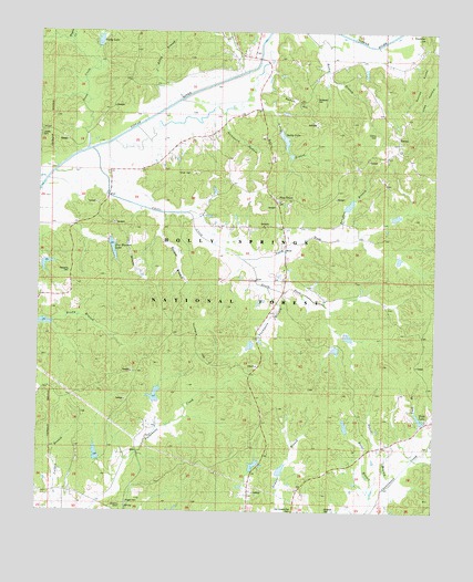
Chilli Creek, MS USGS Topographic Map
Click on map above to begin viewing in our Map Viewer.

This topographic map contains these locations and features:
Feature Name Type Latitude Longitude GNIS ID View Map
Austerlitz (historical)LocaleN34.6851°W89.2404°705869View Map
Autry BranchStreamN34.7209°W89.2267°692428View Map
Autry LakeReservoirN34.7222°W89.1729°704498View Map
Barlow BranchStreamN34.7034°W89.2117°692458View Map
Baugham BranchStreamN34.6954°W89.1581°692473View Map
Baugham LakeReservoirN34.7051°W89.1521°711480View Map
Beldorah CemeteryCemeteryN34.6259°W89.1584°692529View Map
BethelPopulated PlaceN34.7229°W89.1359°692551View Map
Bethel CemeteryCemeteryN34.7212°W89.1362°705872View Map
Bethel Methodist ChurchChurchN34.7220°W89.1365°705873View Map
Brady LakeReservoirN34.6740°W89.2494°711482View Map
Buck Rucker LakeReservoirN34.6400°W89.2315°711484View Map
Butler BranchStreamN34.6290°W89.1437°692782View Map
Cannon Lake DamDamN34.7418°W89.1451°695675View Map
Chilli CreekStreamN34.7173°W89.2367°692892View Map
Chilli LakeReservoirN34.6904°W89.1350°711485View Map
Clemmer HillSummitN34.7490°W89.1278°692935View Map
Collins CemeteryCemeteryN34.7231°W89.1431°692946View Map
Curtis CreekStreamN34.7470°W89.1417°693023View Map
Daniel BranchStreamN34.6320°W89.1398°693048View Map
Elliott CemeteryCemeteryN34.7123°W89.1956°693168View Map
Fox Hunters LakeReservoirN34.6937°W89.2265°693260View Map
Hudspeth CemeteryCemeteryN34.7326°W89.1623°693555View Map
Hunters HillSummitN34.6657°W89.1998°693561View Map
J Autry BranchStreamN34.7326°W89.2056°693593View Map
Johnson CemeteryCemeteryN34.6265°W89.2237°704518View Map
Lonoke CemeteryCemeteryN34.7229°W89.2495°704520View Map
LT 7-8 DamDamN34.7201°W89.1701°695663View Map
LT 8-7 DamDamN34.6918°W89.1367°695654View Map
LT 8-8 DamDamN34.7011°W89.1385°695661View Map
LT 8-9 DamDamN34.6868°W89.1517°695652View Map
LT 8-9 LakeReservoirN34.6868°W89.1517°695651View Map
Massengill Lake DamDamN34.6484°W89.1284°695633View Map
Maxey (historical)LocaleN34.7465°W89.1806°704522View Map
Mount Vista (historical)LocaleN34.6501°W89.1487°704526View Map
North Chilli LakeReservoirN34.7020°W89.1374°711492View Map
North Fork Chilli CreekStreamN34.6909°W89.1856°694207View Map
Oaklimeter Watershed LT 8-14 DamDamN34.6334°W89.1734°695625View Map
Oaklimeter Watershed LT 8-16 DamDamN34.6551°W89.2117°695635View Map
Oaklimeter Watershed LT 8-4DamN34.6668°W89.1834°695642View Map
Oaklimeter Watershed LT 8-5 DamDamN34.6651°W89.1551°695640View Map
Oaklimeter Watershed LT 8-6 DamDamN34.6701°W89.1501°695643View Map
Old Hickory Flat CemeteryCemeteryN34.6254°W89.1687°694261View Map
Palestine CemeteryCemeteryN34.6868°W89.2409°694295View Map
Palestine School (historical)SchoolN34.6865°W89.2404°705892View Map
Parks LakeReservoirN34.7475°W89.2313°694318View Map
Parks Lake DamDamN34.7468°W89.2301°695676View Map
Pine GrovePopulated PlaceN34.7059°W89.1748°694375View Map
Pine Grove Baptist ChurchChurchN34.7059°W89.1751°705893View Map
Pine Grove CemeteryCemeteryN34.7065°W89.1756°705894View Map
Pisgah CemeteryCemeteryN34.6270°W89.2215°704531View Map
Pisgah ChurchChurchN34.6265°W89.2215°694410View Map
Renick HillSummitN34.7323°W89.1681°704534View Map
Richmond HollowValleyN34.7271°W89.1920°694558View Map
Rocky BranchStreamN34.7465°W89.1626°676778View Map
Snow CreekStreamN34.7195°W89.2345°694834View Map
South Chilli LakeReservoirN34.6706°W89.1522°711494View Map
South Fork Chilli CreekStreamN34.6909°W89.1859°694843View Map
Supervisor District 4CivilN34.7476°W89.2215°711782View Map
Supervisor District 5CivilN34.6506°W89.1773°711783View Map
Suttles RocksSummitN34.7343°W89.1306°694910View Map
Thompson BranchStreamN34.6829°W89.1770°694967View Map
Tippah River Watershed LT 7-17 DamDamN34.6918°W89.2301°695655View Map
Tippah River Watershed LT 7-18 DamDamN34.6784°W89.2384°695647View Map
Tippah River Watershed LT 7-9 DamDamN34.6718°W89.2467°695644View Map
Todd (historical)LocaleN34.7001°W89.2376°704542View Map
Todd LakeReservoirN34.6496°W89.1295°694989View Map
United States Forest Service Lake DamDamN34.6334°W89.1834°695626View Map
United States Forest Service Lake DamDamN34.6468°W89.1501°695632View Map
Upper Pechahallee LakeReservoirN34.6553°W89.2130°711495View Map
Wagner CreekStreamN34.7470°W89.2404°695077View Map
Yellow Rabbit CreekStreamN34.7484°W89.1498°695227View Map

Note: Coordinates in the location and feature list above are referenced to NAD83 datum.


Copyright (C) 2008-2024 Ryan Niemi / Sunset Dynamics ... All Rights Reserved