TopoQuest Logo
Do you find TopoQuest useful?
Help keep TopoQuest running and adding new maps/features by donating!
Bitcoin:  19c7KJd3qBynnjoSw5npx9KScwjBe4ifkT
Litecoin:  LXs6TkuXGGXo1vDsWCkWVdjQX94eUKd6ui
Home View Maps Find Maps Find Places Resources & Links


Hickory Flat, Mississippi Topographic Map

USGS Map Title: Hickory Flat, MS
USGS Map MRC: 34089E2
DRG (GeoTIFF) Download: o34089e2.tif


Neighboring USGS Topographic Map Quads:


  Potts Camp, MS  
34089F3
 

  Chilli Creek, MS  
34089F2
 

  Blue Mountain, MS  
34089F1
 

  Bethlehem, MS  
34089E3
 

  Hickory Flat, MS  
34089E2
 

  Myrtle, MS  
34089E1
 

  Puskus Lake, MS  
34089D3
 

  Etta, MS  
34089D2
 

  New Albany West, MS  
34089D1


Map MRC Location:

N35°
W90°
N35°
W89°
H8 H7 H6 H5 H4 H3 H2 H1
G8 G7 G6 G5 G4 G3 G2 G1
F8 F7 F6 F5 F4 F3 F2 F1
E8 E7 E6 E5 E4 E3 E2 E1
D8 D7 D6 D5 D4 D3 D2 D1
C8 C7 C6 C5 C4 C3 C2 C1
B8 B7 B6 B5 B4 B3 B2 B1
A8 A7 A6 A5 A4 A3 A2 A1
N34°
W90°
N34°
W89°

Hickory Flat, MS USGS 1:24K Topographic Map Preview:
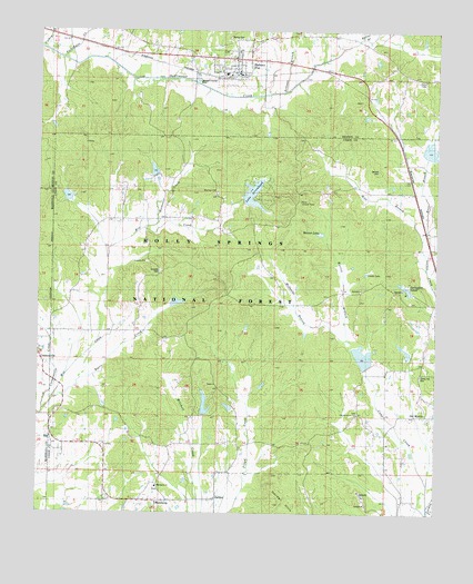
Hickory Flat, MS USGS Topographic Map
Click on map above to begin viewing in our Map Viewer.

This topographic map contains these locations and features:
Feature Name Type Latitude Longitude GNIS ID View Map
Amaziah CemeteryCemeteryN34.5598°W89.2120°704706View Map
Amaziah ChurchChurchN34.5648°W89.2165°692392View Map
Armour BranchStreamN34.6095°W89.1742°692411View Map
Arrowhead Lake DamDamN34.5784°W89.1884°695606View Map
Baird Lake DamDamN34.5251°W89.1984°695594View Map
Ballard Pond DamDamN34.5834°W89.2151°695609View Map
Barnes LakeLakeN34.5726°W89.1617°692461View Map
Barnett CemeteryCemeteryN34.5887°W89.1437°692462View Map
Byers CreekStreamN34.5345°W89.2359°692787View Map
Candy Hill CemeteryCemeteryN34.5357°W89.1298°704708View Map
Cane CreekStreamN34.5018°W89.1270°692830View Map
Cathey BranchStreamN34.6207°W89.2487°692858View Map
Community ChurchChurchN34.6151°W89.1370°692952View Map
Cornersville CreekStreamN34.5268°W89.2481°692979View Map
DardenPopulated PlaceN34.5032°W89.1937°693051View Map
Darden HillsSummitN34.5054°W89.1762°693052View Map
East Branch Lockes CreekStreamN34.5695°W89.1292°693146View Map
Ebenezer CemeteryCemeteryN34.5831°W89.1937°706095View Map
Ebenezer ChurchChurchN34.5832°W89.1948°693159View Map
Hickory FlatPopulated PlaceN34.6159°W89.1884°693465View Map
Hickory Flat Post OfficePost OfficeN34.6184°W89.1837°2768767View Map
Hickory Flat SchoolSchoolN34.6140°W89.1917°705882View Map
Hickory Flat Volunteer Fire DepartmentBuildingN34.6141°W89.1877°2666040View Map
Lake ArrowheadReservoirN34.5830°W89.1828°692840View Map
Locks Watershed LT-9a-1 DamDamN34.5951°W89.1267°695616View Map
Locks Watershed LT-9a-3 DamDamN34.5368°W89.1467°695595View Map
LT 8-17 DamDamN34.6218°W89.2284°695622View Map
LT 8-17 LakeReservoirN34.6218°W89.2284°695621View Map
MacedoniaPopulated PlaceN34.5029°W89.2087°693854View Map
Macedonia CemeteryCemeteryN34.5062°W89.2126°706104View Map
Macedonia ChurchChurchN34.5070°W89.2123°704715View Map
Martin BranchStreamN34.5448°W89.1520°693877View Map
McDaniel BranchStreamN34.5448°W89.1520°673328View Map
McKay CemeteryCemeteryN34.6226°W89.1909°693923View Map
Mill LakeReservoirN34.5819°W89.2411°711507View Map
Mill Watershed LT-14b-1 DamDamN34.5534°W89.2034°695599View Map
Mill Watershed LT-14b-2 DamDamN34.5784°W89.2384°695607View Map
Mill Watershed LT-14b-5 DamDamN34.5867°W89.2126°695611View Map
Myrtle Lookout TowerTowerN34.5809°W89.1681°711279View Map
New Oak Grove CemeteryCemeteryN34.5251°W89.1270°706113View Map
New Oak Grove ChurchChurchN34.5243°W89.1270°694182View Map
Oco (historical)LocaleN34.5568°W89.1906°704717View Map
Old Oak Grove CemeteryCemeteryN34.5259°W89.1492°706114View Map
Old Oak Grove ChurchChurchN34.5254°W89.1498°694266View Map
Pechahalee CreekStreamN34.6165°W89.2415°694332View Map
Rochester CreekStreamN34.5743°W89.2173°694587View Map
Smith LakeLakeN34.5628°W89.1464°694827View Map
Spencer Lake DamDamN34.5401°W89.1351°695598View Map
Springdale Lake DamDamN34.5551°W89.1334°695600View Map
Springdale LakesLakeN34.5578°W89.1337°694876View Map
Supervisor District 1CivilN34.5464°W89.1386°712110View Map
Town of Hickory FlatCivilN34.6159°W89.1914°2405823View Map
Turkland (historical)LocaleN34.5034°W89.1631°704719View Map
West Branch Lockes CreekStreamN34.5693°W89.1290°695126View Map

Note: Coordinates in the location and feature list above are referenced to NAD83 datum.


Copyright (C) 2008-2025 Ryan Niemi / Sunset Dynamics ... All Rights Reserved