TopoQuest Logo
Do you find TopoQuest useful?
Help keep TopoQuest running and adding new maps/features by donating!
Bitcoin:  19c7KJd3qBynnjoSw5npx9KScwjBe4ifkT
Litecoin:  LXs6TkuXGGXo1vDsWCkWVdjQX94eUKd6ui
Home View Maps Find Maps Find Places Resources & Links


Circle Mesa, New Mexico Topographic Map

USGS Map Title: Circle Mesa, NM
USGS Map MRC: 32108G4
DRG (GeoTIFF) Download: o32108g4.tif


Neighboring USGS Topographic Map Quads:


  Cliff, NM  
32108H5
 

  Dorsey Ranch, NM  
32108H4
 

  Reading Mountain, NM  
32108H3
 

  Mangas Springs, NM  
32108G5
 

  Circle Mesa, NM  
32108G4
 

  Silver City, NM  
32108G3
 

  Bullard Peak, NM  
32108F5
 

  Wind Mountain, NM  
32108F4
 

  Tyrone, NM  
32108F3


Map MRC Location:

N33°
W109°
N33°
W108°
H8 H7 H6 H5 H4 H3 H2 H1
G8 G7 G6 G5 G4 G3 G2 G1
F8 F7 F6 F5 F4 F3 F2 F1
E8 E7 E6 E5 E4 E3 E2 E1
D8 D7 D6 D5 D4 D3 D2 D1
C8 C7 C6 C5 C4 C3 C2 C1
B8 B7 B6 B5 B4 B3 B2 B1
A8 A7 A6 A5 A4 A3 A2 A1
N32°
W109°
N32°
W108°

Circle Mesa, NM USGS 1:24K Topographic Map Preview:
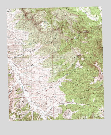
Circle Mesa, NM USGS Topographic Map
Click on map above to begin viewing in our Map Viewer.

This topographic map contains these locations and features:
Feature Name Type Latitude Longitude GNIS ID View Map
Agua Alto TankReservoirN32.7593°W108.4939°900199View Map
Alice MineMineN32.8309°W108.4117°914941View Map
Alies Seep CanyonValleyN32.7962°W108.4287°903089View Map
Allison RanchLocaleN32.8717°W108.4942°903110View Map
Ash SpringSpringN32.8207°W108.4079°903441View Map
Ash Spring CanyonValleyN32.7967°W108.4839°903442View Map
Barney Kerr CanyonValleyN32.8084°W108.4945°903573View Map
Box CanyonValleyN32.7640°W108.4634°904035View Map
Cane SpringSpringN32.8434°W108.4276°900204View Map
Cane Spring CanyonValleyN32.8070°W108.4864°904497View Map
Circle MesaSummitN32.8559°W108.4528°905168View Map
Cottonwood CanyonValleyN32.8190°W108.4964°905396View Map
Dorsey MineMineN32.8323°W108.4006°921057View Map
Dud TankReservoirN32.8352°W108.4696°905898View Map
E McMillen RanchLocaleN32.7690°W108.4684°905923View Map
Fleming CanyonValleyN32.7809°W108.4748°906304View Map
Franks 5 Water WellWellN32.7509°W108.3750°918828View Map
Haystack CanyonValleyN32.7701°W108.4714°906890View Map
J McMillen RanchLocaleN32.7781°W108.4409°908540View Map
McKeefer CanyonValleyN32.7598°W108.4576°908527View Map
New EnglandMineN32.7904°W108.3762°914973View Map
Old Man MineMineN32.7931°W108.3823°914976View Map
Old Woman MineMineN32.7917°W108.3789°914977View Map
Pauline MineMineN32.8012°W108.3762°914632View Map
Saddle Rock CanyonValleyN32.7945°W108.4884°910510View Map
Sherman RanchLocaleN32.7856°W108.3848°911011View Map
Treasure MountainSummitN32.7995°W108.3787°911797View Map
Wake-Up-Charlie MineMineN32.8312°W108.4617°915508View Map
White RanchLocaleN32.8484°W108.3909°912320View Map

Note: Coordinates in the location and feature list above are referenced to NAD83 datum.


Copyright (C) 2008-2025 Ryan Niemi / Sunset Dynamics ... All Rights Reserved