TopoQuest Logo
Do you find TopoQuest useful?
Help keep TopoQuest running and adding new maps/features by donating!
Bitcoin:  19c7KJd3qBynnjoSw5npx9KScwjBe4ifkT
Litecoin:  LXs6TkuXGGXo1vDsWCkWVdjQX94eUKd6ui
Home View Maps Find Maps Find Places Resources & Links


Dorsey Ranch, New Mexico Topographic Map

USGS Map Title: Dorsey Ranch, NM
USGS Map MRC: 32108H4
DRG (GeoTIFF) Download: o32108h4.tif


Neighboring USGS Topographic Map Quads:


  Canteen Canyon, NM  
33108A5
 

  Canyon Hill, NM  
33108A4
 

  Granny Mountain, NM  
33108A3
 

  Cliff, NM  
32108H5
 

  Dorsey Ranch, NM  
32108H4
 

  Reading Mountain, NM  
32108H3
 

  Mangas Springs, NM  
32108G5
 

  Circle Mesa, NM  
32108G4
 

  Silver City, NM  
32108G3


Map MRC Location:

N33°
W109°
N33°
W108°
H8 H7 H6 H5 H4 H3 H2 H1
G8 G7 G6 G5 G4 G3 G2 G1
F8 F7 F6 F5 F4 F3 F2 F1
E8 E7 E6 E5 E4 E3 E2 E1
D8 D7 D6 D5 D4 D3 D2 D1
C8 C7 C6 C5 C4 C3 C2 C1
B8 B7 B6 B5 B4 B3 B2 B1
A8 A7 A6 A5 A4 A3 A2 A1
N32°
W109°
N32°
W108°

Dorsey Ranch, NM USGS 1:24K Topographic Map Preview:
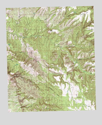
Dorsey Ranch, NM USGS Topographic Map
Click on map above to begin viewing in our Map Viewer.

This topographic map contains these locations and features:
Feature Name Type Latitude Longitude GNIS ID View Map
Avery RanchLocaleN32.9306°W108.3981°903466View Map
Brushy CanyonValleyN32.9656°W108.4770°904109View Map
Dorsey CampLocaleN32.9973°W108.3817°905820View Map
Dorsey CanyonValleyN32.9670°W108.4562°905821View Map
Dorsey Hole SpringSpringN32.9931°W108.4008°905822View Map
Dorsey MesaSummitN32.9912°W108.3901°905823View Map
Dorsey RanchLocaleN32.9190°W108.3834°905824View Map
Dorsey SpringSpringN32.9187°W108.3817°905825View Map
H W RanchLocaleN32.9528°W108.4248°904231View Map
Hells Half AcreAreaN32.9442°W108.4662°906916View Map
Holman CanyonValleyN32.9337°W108.4023°907033View Map
Lee SpringSpringN32.9928°W108.4591°907926View Map
McClure MountainSummitN32.9717°W108.4389°908497View Map
Medina TankReservoirN32.9320°W108.4880°900247View Map
Mikes TankReservoirN32.9561°W108.4981°908734View Map
Reading CanyonValleyN32.9540°W108.4031°910034View Map
Redding Mesa DamDamN32.9695°W108.3792°912695View Map
Second ValleyValleyN32.9462°W108.4731°910909View Map
Seep Springs CanyonValleyN32.9842°W108.4634°910927View Map
Slick Rock CanyonValleyN32.9867°W108.4176°911139View Map
Steamboat CanyonValleyN32.9509°W108.4220°911399View Map
Stone CanyonValleyN32.9690°W108.4876°911431View Map
Taylor TankReservoirN32.8792°W108.3868°912696View Map
Windmill CanyonValleyN32.9506°W108.4234°912456View Map
Y L CanyonValleyN32.9634°W108.4776°912514View Map

Note: Coordinates in the location and feature list above are referenced to NAD83 datum.


Copyright (C) 2008-2025 Ryan Niemi / Sunset Dynamics ... All Rights Reserved