TopoQuest Logo
Do you find TopoQuest useful?
Help keep TopoQuest running and adding new maps/features by donating!
Bitcoin:  19c7KJd3qBynnjoSw5npx9KScwjBe4ifkT
Litecoin:  LXs6TkuXGGXo1vDsWCkWVdjQX94eUKd6ui
Home View Maps Find Maps Find Places Resources & Links


Citronelle West, Alabama Topographic Map

USGS Map Title: Citronelle West, AL
USGS Map MRC: 31088A3
DRG (GeoTIFF) Download: o31088a3.tif


Neighboring USGS Topographic Map Quads:


  Rounsaville, MS  
31088B4
 

  Deer Park, AL  
31088B3
 

  Sims Chapel, AL  
31088B2
 

  Brown Town, MS  
31088A4
 

  Citronelle West, AL  
31088A3
 

  Citronelle East, AL  
31088A2
 

  Earlville, AL  
30088H4
 

  Georgetown, AL  
30088H3
 

  Chunchula, AL  
30088H2


Map MRC Location:

N32°
W89°
N32°
W88°
H8 H7 H6 H5 H4 H3 H2 H1
G8 G7 G6 G5 G4 G3 G2 G1
F8 F7 F6 F5 F4 F3 F2 F1
E8 E7 E6 E5 E4 E3 E2 E1
D8 D7 D6 D5 D4 D3 D2 D1
C8 C7 C6 C5 C4 C3 C2 C1
B8 B7 B6 B5 B4 B3 B2 B1
A8 A7 A6 A5 A4 A3 A2 A1
N31°
W89°
N31°
W88°

Citronelle West, AL USGS 1:24K Topographic Map Preview:
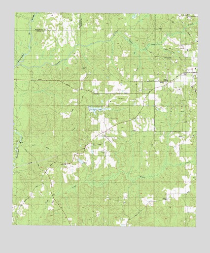
Citronelle West, AL USGS Topographic Map
Click on map above to begin viewing in our Map Viewer.

This topographic map contains these locations and features:
Feature Name Type Latitude Longitude GNIS ID View Map
Baxter Will CemeteryCemeteryN31.0927°W88.3286°2579289View Map
Beaver Pond BranchStreamN31.1149°W88.3042°113745View Map
Bennett CreekStreamN31.0941°W88.3731°113924View Map
Bethel ChurchChurchN31.0360°W88.3395°114028View Map
Brannon CemeteryCemeteryN31.0441°W88.3119°114833View Map
Citronelle DivisionCivilN31.0304°W88.2665°165892View Map
Citronelle LakeReservoirN31.0686°W88.3181°143247View Map
Citronelle Municipal Park Lake DamDamN31.0668°W88.3167°129629View Map
Citronelle Volunteer Fire DepartmentBuildingN31.0708°W88.2871°2330966View Map
Lotts Mill CreekStreamN31.0493°W88.3706°122043View Map
Mill BranchStreamN31.1041°W88.2933°122736View Map
Mill Creek Golf CourseLocaleN31.0749°W88.3059°2579610View Map
New Home ChurchChurchN31.0532°W88.3128°123763View Map
New Hope CemeteryCemeteryN31.0927°W88.3286°143595View Map
New Hope ChurchChurchN31.0855°W88.2792°143596View Map
Nobodies CreekStreamN31.0455°W88.3733°123960View Map
Oil City SpeedwayLocaleN31.0846°W88.2714°143617View Map
Okwakee CreekStreamN31.1199°W88.3647°152764View Map
Rascoe Farm PondReservoirN31.0918°W88.3033°129648View Map
Rascoe Farm Pond DamDamN31.0918°W88.3033°129647View Map
Sandy Ford BranchStreamN31.1074°W88.2770°126382View Map
Silver Hill ChurchChurchN31.0857°W88.2836°126853View Map
Walker SchoolSchoolN31.0855°W88.2972°128526View Map
Whatley ChurchChurchN31.0163°W88.2689°128822View Map
Whatley Holiness CemeteryCemeteryN31.0160°W88.2700°1730048View Map

Note: Coordinates in the location and feature list above are referenced to NAD83 datum.


Copyright (C) 2008-2025 Ryan Niemi / Sunset Dynamics ... All Rights Reserved