TopoQuest Logo
Do you find TopoQuest useful?
Help keep TopoQuest running and adding new maps/features by donating!
Bitcoin:  19c7KJd3qBynnjoSw5npx9KScwjBe4ifkT
Litecoin:  LXs6TkuXGGXo1vDsWCkWVdjQX94eUKd6ui
Home View Maps Find Maps Find Places Resources & Links


Georgetown, Alabama Topographic Map

USGS Map Title: Georgetown, AL
USGS Map MRC: 30088H3
DRG (GeoTIFF) Download: o30088h3.tif


Neighboring USGS Topographic Map Quads:


  Brown Town, MS  
31088A4
 

  Citronelle West, AL  
31088A3
 

  Citronelle East, AL  
31088A2
 

  Earlville, AL  
30088H4
 

  Georgetown, AL  
30088H3
 

  Chunchula, AL  
30088H2
 

  Howell, MS  
30088G4
 

  Semmes, AL  
30088G3
 

  Kushla, AL  
30088G2


Map MRC Location:

N31°
W89°
N31°
W88°
H8 H7 H6 H5 H4 H3 H2 H1
G8 G7 G6 G5 G4 G3 G2 G1
F8 F7 F6 F5 F4 F3 F2 F1
E8 E7 E6 E5 E4 E3 E2 E1
D8 D7 D6 D5 D4 D3 D2 D1
C8 C7 C6 C5 C4 C3 C2 C1
B8 B7 B6 B5 B4 B3 B2 B1
A8 A7 A6 A5 A4 A3 A2 A1
N30°
W89°
N30°
W88°

Georgetown, AL USGS 1:24K Topographic Map Preview:
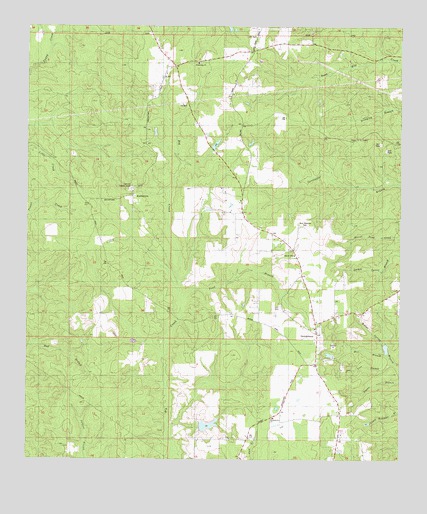
Georgetown, AL USGS Topographic Map
Click on map above to begin viewing in our Map Viewer.

This topographic map contains these locations and features:
Feature Name Type Latitude Longitude GNIS ID View Map
Adams BranchStreamN30.8974°W88.2508°112915View Map
Bad BranchStreamN30.9141°W88.3542°163765View Map
Bee Tree BranchStreamN30.9027°W88.2520°113805View Map
BoothetownPopulated PlaceN30.9513°W88.3395°143159View Map
Byrd Memorial CemeteryCemeteryN30.9427°W88.2806°143174View Map
Fellowship Baptist Church CemeteryCemeteryN30.9897°W88.3177°2579287View Map
Fellowship ChurchChurchN30.9896°W88.3206°118239View Map
Garrison Lookout TowerTowerN30.9549°W88.3425°164331View Map
GeorgetownPopulated PlaceN30.8885°W88.2703°118906View Map
Georgetown Baptist ChurchChurchN30.9132°W88.2784°118909View Map
Georgetown ChurchChurchN30.8871°W88.2920°120227View Map
Georgetown Fellowship Volunteer Fire Department Station 1BuildingN30.9245°W88.2807°2331001View Map
Georgetown Fellowship Volunteer Fire Department Station 2BuildingN30.9831°W88.3247°2691138View Map
Lott CemeteryCemeteryN30.9202°W88.2922°118908View Map
Lott CemeteryCemeteryN30.9974°W88.2986°143499View Map
Mill BranchStreamN30.9057°W88.2550°122735View Map
Old Providence CemeteryCemeteryN30.9910°W88.2597°1730015View Map
Pond BranchStreamN30.9216°W88.3247°125110View Map
R L Lambert DamDamN30.8885°W88.3133°129587View Map

Note: Coordinates in the location and feature list above are referenced to NAD83 datum.


Copyright (C) 2008-2025 Ryan Niemi / Sunset Dynamics ... All Rights Reserved