TopoQuest Logo
Do you find TopoQuest useful?
Help keep TopoQuest running and adding new maps/features by donating!
Bitcoin:  19c7KJd3qBynnjoSw5npx9KScwjBe4ifkT
Litecoin:  LXs6TkuXGGXo1vDsWCkWVdjQX94eUKd6ui
Home View Maps Find Maps Find Places Resources & Links


Amity, Pennsylvania Topographic Map

USGS Map Title: Amity, PA
USGS Map MRC: 40080A2
DRG (GeoTIFF) Download: o40080a2.tif


Neighboring USGS Topographic Map Quads:


  Washington West, PA  
40080B3
 

  Washington East, PA  
40080B2
 

  Hackett, PA  
40080B1
 

  Prosperity, PA  
40080A3
 

  Amity, PA  
40080A2
 

  Ellsworth, PA  
40080A1
 

  Rogersville, PA  
39080H3
 

  Waynesburg, PA  
39080H2
 

  Mather, PA  
39080H1


Map MRC Location:

N41°
W81°
N41°
W80°
H8 H7 H6 H5 H4 H3 H2 H1
G8 G7 G6 G5 G4 G3 G2 G1
F8 F7 F6 F5 F4 F3 F2 F1
E8 E7 E6 E5 E4 E3 E2 E1
D8 D7 D6 D5 D4 D3 D2 D1
C8 C7 C6 C5 C4 C3 C2 C1
B8 B7 B6 B5 B4 B3 B2 B1
A8 A7 A6 A5 A4 A3 A2 A1
N40°
W81°
N40°
W80°

Amity, PA USGS 1:24K Topographic Map Preview:
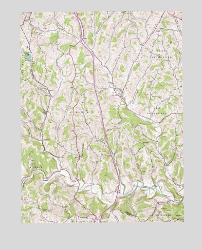
Amity, PA USGS Topographic Map
Click on map above to begin viewing in our Map Viewer.

This topographic map contains these locations and features:
Feature Name Type Latitude Longitude GNIS ID View Map
AmityPopulated PlaceN40.0395°W80.2051°1168264View Map
Amity Post OfficePost OfficeN40.0371°W80.2052°2779677View Map
Amity SchoolSchoolN40.0542°W80.2092°1168268View Map
Amwell Township Volunteer Fire Department Station 34BuildingN40.0375°W80.2047°2645394View Map
Bailey Covered BridgeBridgeN40.0206°W80.1956°2740673View Map
Baker StationPopulated PlaceN40.0753°W80.2262°1168610View Map
BakersPopulated PlaceN40.0479°W80.1612°1201650View Map
Bane CreekStreamN40.0298°W80.2206°1168682View Map
BanetownPopulated PlaceN40.0784°W80.2281°1203016View Map
Bethlehem ChurchChurchN40.1134°W80.1423°1169431View Map
BissellPopulated PlaceN40.0134°W80.1273°1201675View Map
Brush RunStreamN40.0659°W80.1651°1170449View Map
ChambersLocaleN40.0948°W80.2401°1206200View Map
Chambers DamDamN40.0962°W80.2417°1171538View Map
Chambers MillPopulated PlaceN40.0995°W80.2434°1171540View Map
Condit CrossingPopulated PlaceN40.0656°W80.2301°1172295View Map
CongerPopulated PlaceN40.0273°W80.2481°1203323View Map
Dunns StationLocaleN40.0134°W80.2484°1192386View Map
Fork of Bane CreekStreamN40.0545°W80.2348°1174989View Map
Franklin CemeteryCemeteryN40.0217°W80.1251°1175143View Map
HackneyPopulated PlaceN40.0317°W80.2178°1176350View Map
Hainers RunStreamN40.0595°W80.1506°1176366View Map
Harts MillLocaleN40.1095°W80.2014°1201648View Map
Horne RunStreamN40.0381°W80.2240°1177425View Map
Hufford RunStreamN40.0117°W80.1314°1177560View Map
Kathys Day Care CenterBuildingN40.0982°W80.2099°2430115View Map
Liberty ChurchChurchN40.1201°W80.2417°1179258View Map
Little Tenmile CreekStreamN40.0148°W80.1253°1179694View Map
Lone PinePopulated PlaceN40.0742°W80.1723°1179839View Map
Lone Pine SchoolSchoolN40.0826°W80.1789°1179840View Map
Lone Pine Volunteer Fire Department Station 50BuildingN40.0796°W80.1809°2645420View Map
Long PinePopulated PlaceN40.1101°W80.1748°1202276View Map
Luellen StationLocaleN40.0556°W80.2342°1212730View Map
McCrackenPopulated PlaceN40.0701°W80.2381°1201649View Map
Miller CemeteryCemeteryN40.0409°W80.1814°1181209View Map
Montgomery RunStreamN40.0229°W80.1726°1181463View Map
Moore ShaftMineN40.0109°W80.1445°1181509View Map
Mount HermanPopulated PlaceN40.0490°W80.2337°1181696View Map
Nolton StationLocaleN40.0651°W80.2298°1212729View Map
North Tenmile ChurchChurchN40.0470°W80.1559°1182642View Map
Pine RunStreamN40.0659°W80.1651°1183872View Map
Pleasant Hill ChurchChurchN40.0217°W80.1478°1184039View Map
Pleasant Valley RunStreamN40.0481°W80.2337°1184078View Map
Potato RunStreamN40.0865°W80.1820°1184327View Map
Redd RunStreamN40.1015°W80.1959°1184803View Map
RinglandsPopulated PlaceN40.0265°W80.2306°1204513View Map
Shipe RunStreamN40.0923°W80.1870°1187550View Map
Smith RunStreamN40.0237°W80.1570°1187885View Map
Sowers SchoolSchoolN40.0604°W80.1498°1188140View Map
Strabane Post Office (historical)Post OfficeN40.1117°W80.1598°1214500View Map
Ten MilePopulated PlaceN40.0206°W80.1564°1189362View Map
Township of AmwellCivilN40.0755°W80.1934°1217181View Map
Union Sunday SchoolSchoolN40.0787°W80.2289°1190178View Map
VankirkPopulated PlaceN40.1209°W80.2428°1204867View Map
West AmityPopulated PlaceN40.0395°W80.2220°1204920View Map

Note: Coordinates in the location and feature list above are referenced to NAD83 datum.


Copyright (C) 2008-2024 Ryan Niemi / Sunset Dynamics ... All Rights Reserved